
York
River Ouse, York , England


York (YO) Postcode Area
York: Historic walled city, medieval architecture, iconic York Minster, cobbled streets, and surrounded by ancient city walls. A city steeped in history and charm, with a vibrant cultural scene and picturesque surroundings in North Yorkshire.
York Postcode Area includes:
York, Thirsk, Selby, Scarborough, Filey, Bridlington, Malton, Pickering, Whitby, Driffield.
Discover everything you need to know about York with PostcodeArea. Scroll down to uncover demographics, property prices, crime stats, amenities and more.
Most Desirable Postcodes
Here are the top 10 most desirable postcode areas in York (YO), based on a unique scoring system that weighs key factors like safety, schools, diversity, and affordability.
Whether you're a renter, homebuyer, or property investor, this tool lets you customise the score to focus on what matters most to you, helping you make smarter, data-driven decisions.
How are Desirability Scores calculated?
Our custom algorithm calculates a unique "Desirability Score" for any UK postcode by analysing a range of factors - including Census 2021 data, third-party insights, and socio-economic knowledge, to provide a tailored rating.
Explain more
Primary Industries
Get to know the backbone of the York postcode area with these top four industries, highlighting the key sectors that fuel the local economy.
Agriculture, Forestry & Fishing
The prevalance of agricultural industries (including forestry and fishing) in York suggests this is a lively and creative postcode sector. These kinds of businesses tend to pop up in areas that are known for their cultural scene, where people value things like theatres, galleries, music venues, and independent cinemas. It could mean the area attracts a mix of creatives, young professionals, and tourists, making it a vibrant and potentially trendy spot. This could also be a sign of a more laid-back, community-focused vibe, with lots of local events and activities in and around York. It might push property prices up if the area becomes particularly popular, but it's also a good indicator of a strong local identity and a thriving social scene.
Professional & Scientific
York has a large proportion of professional and scientific businesses, which makes it a hub for specialised industries like law firms, consulting agencies, tech companies, or research labs. This suggests a high level of expertise and innovation, attracting professionals such as engineers, scientists, lawyers, and consultants. The York area might have a more polished, business-focused atmosphere, with modern offices and co-working spaces. It's often well-connected, with good transport links and amenities to support a skilled workforce. Property prices could be higher, as these areas tend to attract well-paid professionals. It might not be the most vibrant or social place, but it will have a reputation for being smart, efficient, and future-focused.
Construction
York has a strong presence of construction businesses, which usually means there's a lot of building going on - whether it's new homes, commercial spaces, or infrastructure. This can be a good sign that the York area is growing and attracting investment. It could also mean there's a strong local economy, with plenty of work available for builders and tradespeople. On the flip side, it might suggest there's a fair bit of property in need of repair or updating. Either way, it tells you the York area is pretty active and could be on the up.
Accommodation & Food
When postcode areas have a lot of accommodation and food businesses, areas like York are a popular spot for visitors or tourists, or it could be a bustling community with a strong local hospitality scene. You'd expect to find hotels, B&Bs, restaurants, cafes, and maybe a few pubs or bars, creating a vibrant atmosphere, especially during peak seasons or weekends. It's the kind of area where people come to relax, socialise, or enjoy a good meal out, making it feel welcoming and lively. This could boost property demand if it's a desirable place to live or visit, but it might also mean the area gets busier, especially if York is a tourist hotspot. It gives the impression of a friendly, service-oriented place where people come to enjoy themselves.
Data showing the activity, size and location is from the Inter Departmental Business Register 2024, produced by the ONS.
Key Statistics
York YO, part of the ceremonial county of North Yorkshire in England, presents a substantial geographical area with 29 outward codes (the first half of a postcode, e.g. YO 1AA). Its population stands at 582,897 individuals, reflecting a density of 1,369 people per square kilometre. The average household income here is £42,956 , which is 22.7% higher than the average UK median household income (£35,000), indicating a stable economic profile within the region.
Postcode Area
York
Total Outward Codes
Postcodes
Population
People
Population Density
People/km2
Average Income
Per household
What's York like to live and work in?

River Ouse, York , England
Adobe Stock
York, located in North Yorkshire, England, is a historic city with a population of approximately 210,000. Renowned for its rich heritage and well-preserved medieval architecture, York offers a unique blend of history and modern living.
The city boasts excellent transport links, including the A1(M) motorway and York railway station, providing direct services to London, Edinburgh, and Manchester. York's community is diverse, with a mix of families, professionals, students from the University of York and York St John University, and retirees.
Housing in York ranges from contemporary apartments and new builds to charming Georgian and Victorian homes.
The city offers a variety of amenities, including the bustling Shambles market, a wide array of restaurants, and cultural attractions like York Minster, the National Railway Museum, and the Jorvik Viking Centre. York also features beautiful green spaces such as the Museum Gardens and Rowntree Park.
This page contains a list of postcode districts for York area. Select a postcode to see the map location, demographics, house prices, local information, tourist guides and statistics:
York (YO) Postcode Districts
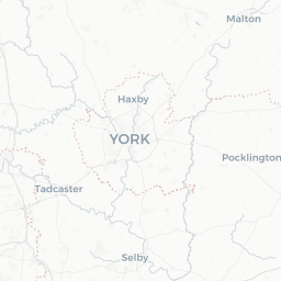
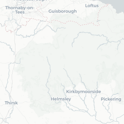
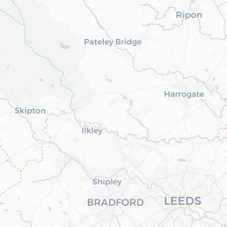
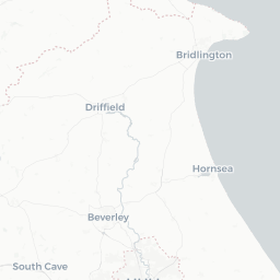


York YO postcode area contains 29 postcode districts within its boundary.
Click on an outward postal code (the first half of a postcode, i.e. YO*) to explore information about the area.
House Prices in York
How are property price trends?
The ONS (Office for National Statistics) regularly tracks and records average house prices and rents in this area (E06000014). Note that these estimates are based on local authority rather than postcode area. For more information about current house prices, choose an individual postcode below.
North Yorkshire
The wider county
Spanning over 3,300 square miles, North Yorkshire is the largest ceremonial county in England, boasting a variety of picturesque towns, bustling cities, and tranquil countryside. The county is divided into several districts, each with its unique character and charm. From the historic city of York with its ancient walls and magnificent Minster, to the rolling hills and quaint villages of the Yorkshire Dales, there's a postcode here that tells a very rich story.
When it comes to postcodes, North Yorkshire is covered by several postcode areas including YO (York), DL (Darlington), TS (Teesside), and HG (Harrogate). Each area offers a unique glimpse into the region's diverse geography and community. For instance, the YO postcode area encompasses the vibrant city of York as well as surrounding towns and rural areas, reflecting a mix of urban and country living. Meanwhile, the HG postcode area is centreed around Harrogate, a beautiful spa town known for its stunning gardens and elegant architecture.
Read more about North Yorkshire
Local Transport
Transport in the YO Postal Area
The YO postal area offers a range of transport options that make commuting and travel convenient. For rail travel, you'll find well-connected stations in York, Selby, and Malton, providing regular services to major cities such as Leeds, Manchester, and London. York station is particularly noteworthy, given its strategic location on the East Coast Main Line.
When it comes to air travel, Leeds Bradford Airport and Doncaster Sheffield Airport are both within reasonable driving distance, offering flights to various domestic and international destinations. For more comprehensive flight options, Manchester Airport is also accessible by train or car.
Commuting by car is facilitated by major road networks, including the A1(M), A64, and A19, which provide straightforward access to neighbouring cities and towns. The picturesque countryside drives are an added bonus!
Bus services are extensive around York, with several operators providing local and regional routes. This ensures that even without a car, residents can navigate the area with ease. the YO postal area is well-equipped to meet a variety of transport needs.
Train Stations
The following railway stations are within the YO postcode region:
Bempton Railway Station

Bridlington Railway Station
Castleton Moor Railway Station
Cattal Railway Station
Commondale Railway Station
Danby Railway Station
Driffield Railway Station
Egton Railway Station
Filey Railway Station
Glaisdale Railway Station
Grosmont Railway Station
Hammerton Railway Station
Hunmanby Railway Station
Hutton Cranswick Railway Station
Kildale Railway Station
Lealholm Railway Station
Malton Railway Station

Nafferton Railway Station
Poppleton Railway Station
Ruswarp Railway Station
Scarborough Railway Station
Seamer Railway Station
Selby Railway Station
Sleights Railway Station
Thirsk Railway Station
Whitby Railway Station
Wressle Railway Station
York Railway Station

Local Authorities
YO Postcode area
Local Authorities are government organisations responsible for providing local services and facilities such as education, housing, and social services within a specific area. The YO postcode area includes the following local authorities:
East Riding of Yorkshire
East Riding of Yorkshire Council is committed to fostering economic development and enhancing community welfare through comprehensive public services and strategic urban and rural planning.
Hambleton
Hambleton District Council supports sustainable development and community welfare through effective governance and the delivery of high-quality public services.
Harrogate
Harrogate Borough Council focuses on enhancing the quality of life for its residents by promoting sustainable development and providing high-quality public services aimed at improving residents' quality of life.
GDP (Gross Domestic Product)
Economic Output
GDP (Gross Domestic Product) measures the total economic output of a country, region, or Local Authority. It tells us how much money is being made within a particular area. This includes everything from a business selling cars or consumers getting their hair cut.
This list of the Local Authorities within the York (YO) postcode town gives us a snapshot of how much money is being generated at current market prices, based on what people are spending and earning. It's an important way to understand the economic health and activity levels across the UK.
For comparison purposes, we've included the top and bottom two local authorities across the UK in terms of GDP.
Local Authority
GDP (£)
GDP trends over time
The graph below shows the total GDP values for all Local Authorities within the York (YO) area:
When we talk about GDP at current market prices, we're looking at the total value of all goods and services produced in an area, but the key bit here is "current market prices." This means it includes the value of goods and services as they're bought and sold right now, without adjusting for inflation or changes in prices over time.
So, for example a figure of £2,511 GDP means that, on average, each person within an area contributes this amount to the UK economy each year.
Republished from the ONS regional gross domestic product: local authorities under the Open Government Licence v3.0. Latest available data: April 2022.
Education
Highest Rated Schools in YO
As rated by Ofsted
- Archbishop Holgate's School, A Church of England Academy
Hull Road, York, YO10 5ZA
Secondary School (11-18)Outstanding - Ryedale School
Gale Lane, York, YO62 7SL
Secondary School (11-16)Outstanding - Huntington School
Huntington Road, York, YO32 9WT
Secondary School (11-18)Outstanding - Market Weighton Infant School
Princess Road, Market Weighton, YO43 3EY
Primary School (3-7)Outstanding - Springhead School
Barry's Lane, Scarborough, YO12 4HA
Secondary School (2-19)Outstanding - Ralph Butterfield Primary School
Station Road, York, YO32 3LS
Primary School (4-11)Outstanding - Warter Church of England Primary School
Addlekel, York, YO42 1XR
Primary School (3-11)Outstanding - Dishforth Airfield Community Primary School
Short Road, Thirsk, YO7 3DL
Primary School (3-11)Outstanding - Acomb Primary School
West Bank, York, YO24 4ES
Primary School (4-11)Outstanding - Knavesmire Primary School
Trafalgar Street, York, YO23 1HY
Primary School (3-11)Outstanding

Unlock the full power of postcode insights.
Data is meaningless without context. Reveal the stories behind a neighbourhood, and make smarter decisions with data you can trust. Gain unlimited access to detailed statistics, exclusive reports, and essential tools.
PostcodeArea is grateful to our sponsors for their support.


