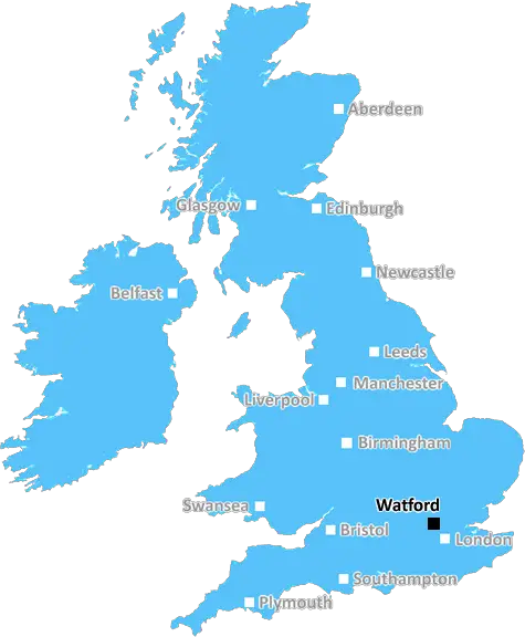
Watford High Street, © Google Street View
Watford: Suburban town, historic market, green spaces, diverse community, and convenient transport links to London. A town with a mix of heritage, culture, and modern amenities in Hertfordshire.
Rickmansworth, Kings Langley, Abbots Langley, Borehamwood, Radlett, Watford, Bushey.
Discover everything you need to know about Watford with PostcodeArea. Scroll down to uncover demographics, property prices, crime stats, amenities and more.
Here are the top 10 most desirable postcode areas in Watford (WD), based on a unique scoring system that weighs key factors like safety, schools, diversity, and affordability.
Whether you're a renter, homebuyer, or property investor, this tool lets you customise the score to focus on what matters most to you, helping you make smarter, data-driven decisions.
Our custom algorithm calculates a unique "Desirability Score" for any UK postcode by analysing a range of factors - including Census 2021 data, third-party insights, and socio-economic knowledge, to provide a tailored rating.
Explain more
Wondering what businesses thrive in Watford? Check out the top four industries, giving you an insight into the key sectors keeping the local area buzzing.
Watford has a large proportion of professional and scientific businesses, which makes it a hub for specialised industries like law firms, consulting agencies, tech companies, or research labs. This suggests a high level of expertise and innovation, attracting professionals such as engineers, scientists, lawyers, and consultants. The Watford area might have a more polished, business-focused atmosphere, with modern offices and co-working spaces. It's often well-connected, with good transport links and amenities to support a skilled workforce. Property prices could be higher, as these areas tend to attract well-paid professionals. It might not be the most vibrant or social place, but it will have a reputation for being smart, efficient, and future-focused.
Watford has a strong presence of construction businesses, which usually means there's a lot of building going on - whether it's new homes, commercial spaces, or infrastructure. This can be a good sign that the Watford area is growing and attracting investment. It could also mean there's a strong local economy, with plenty of work available for builders and tradespeople. On the flip side, it might suggest there's a fair bit of property in need of repair or updating. Either way, it tells you the Watford area is pretty active and could be on the up.
Watford has a large percentage of Information & Communication businesses, making it a tech-savvy, modern, and highly connected place. These industries include IT services, telecommunications, media, and software development companies, so the area might have a strong digital infrastructure and attract tech professionals, creatives, and innovators. It suggests the Watford area is dynamic and forward-thinking, often with a mix of startups and established firms working in cutting-edge fields like software, digital marketing, or broadcasting. You'll likely find a lot of modern office spaces, co-working hubs, and good transport links to support these businesses. The vibe could feel energetic and entrepreneurial, but also professional, with a focus on innovation and staying connected.
If a postcode area such as WD has a lot of business administration services, such as accounting firms, HR consultancies, and management services, it's likely a centre for corporate and operational support. These businesses help other companies run smoothly, so the area might be more business-centric, attracting professionals like administrators, accountants, and consultants. The local economy could be quite strong, driven by a steady demand for services that keep companies ticking over. It's not necessarily the most exciting or creative environment, but it would be efficient, organised, and perhaps well-connected with reliable transport links. You'd expect to see a lot of office spaces in Watford and maybe even shared workspaces catering to small and medium-sized businesses. The area could feel more formal and professional, with less of a residential or leisure focus.
Data showing the activity, size and location is from the Inter Departmental Business Register 2024, produced by the ONS.
Watford WD, part of the ceremonial county of Greater London in England, presents a substantial geographical area with 13 outward codes (the first half of a postcode, e.g. WD 1AA). Its population stands at 282,979 individuals, reflecting a density of 2,677 people per square kilometre. The average household income here is £57,798 , which is 65.1% higher than the average UK median household income (£35,000), indicating a stable economic profile within the region.
Watford
Postcodes
People
People/km2
Per household
Watford High Street, © Google Street View
Adobe Stock
Watford, located in Hertfordshire, England, has a population of around 96,000 and is known for its excellent connectivity and vibrant town center.
The town benefits from strong transport links, including the M1 and M25 motorways, and Watford Junction railway station offering direct services to London Euston.
Watford features a diverse community, with a mix of families, professionals, and young people. Housing options in Watford are varied, from modern apartments and new developments to Victorian and Edwardian houses.
The town offers a range of amenities, including the intu Watford shopping centre, numerous restaurants, and entertainment venues like the Watford Colosseum and Watford Palace Theatre.
Green spaces such as Cassiobury Park provide recreational opportunities.
This page contains a list of postcode districts for Watford area. Select a postcode to see the map location, demographics, house prices, local information, tourist guides and statistics:
The ONS (Office for National Statistics) regularly tracks and records average house prices and rents in this area (E07000103). Note that these estimates are based on local authority rather than postcode area. For more information about current house prices, choose an individual postcode below.
Though known as probably the most famous city in the world, most people don't realize that Greater London is actually classed as a county, and includes the City of London, the City of Westminster and the 32 surrounding London Boroughs.
It takes in a large number of villages, towns and open countryside and borders the home counties of Berkshire, Buckinghamshire, Surrey and Kent in the south east, as well as Essex and Hertfordshire in the East. It has more history within its boundaries than many entire countries around the world, stretching back more than 2000 years, and is Britain's most visited area.
Read more about Greater LondonConsidering a move to the WD postal area? You'll be pleased to know it offers a variety of transport options to suit different lifestyles and commuting needs.
The WD area benefits from excellent rail links. Key stations like Watford Junction provide fast trains to London Euston, taking roughly 20 minutes. Other local stations connect you to major cities and towns, making commuting or leisure trips convenient.
For international travel, London Heathrow and Luton Airports are both easily accessible by car or public transport. Regular coach services and train connections ensure that catching a flight is hassle-free.
If you prefer driving, the WD area is well-served by the M25, M1, and A41, facilitating smooth commutes to London and other destinations. Ample parking facilities and well-maintained roads add to the convenience.
Comprehensive bus networks cover the WD area, providing reliable services for local and regional travel. Whether you're heading to work, school, or a shopping trip, buses offer an efficient and eco-friendly option.
The following railway stations are within the WD postcode region:
Local Authorities are government organisations responsible for providing local services and facilities such as education, housing, and social services within a specific area. The WD postcode area includes the following local authorities:
Barnet offers a blend of urban and suburban lifestyles with plentiful parks and reputable schools, making it a favored choice for families seeking accessibility and tranquility in North London.
Chiltern, known for its picturesque landscapes and historic villages, provides a quiet rural retreat with strong community ties, nestled in the heart of Buckinghamshire.
Dacorum includes the bustling town of Hemel Hempstead and historic Berkhamsted, offering residents a mix of modern amenities and rich heritage within the Hertfordshire county.
GDP (Gross Domestic Product) measures the total economic output of a country, region, or Local Authority. It tells us how much money is being made within a particular area. This includes everything from a business selling cars or consumers getting their hair cut.
This list of the Local Authorities within the Watford (WD) postcode town gives us a snapshot of how much money is being generated at current market prices, based on what people are spending and earning. It's an important way to understand the economic health and activity levels across the UK.
For comparison purposes, we've included the top and bottom two local authorities across the UK in terms of GDP.
The graph below shows the total GDP values for all Local Authorities within the Watford (WD) area:
When we talk about GDP at current market prices, we're looking at the total value of all goods and services produced in an area, but the key bit here is "current market prices." This means it includes the value of goods and services as they're bought and sold right now, without adjusting for inflation or changes in prices over time.
So, for example a figure of £2,819 GDP means that, on average, each person within an area contributes this amount to the UK economy each year.
Republished from the ONS regional gross domestic product: local authorities under the Open Government Licence v3.0. Latest available data: April 2022.
As rated by Ofsted
Nascot Wood Road, Watford, WD17 4YS
Primary School (7-11)
High Elms Lane, Watford, WD25 0SS
Secondary School (11-18)
The Common, Rickmansworth, WD3 5SG
Primary School (3-11)
The Rutts, Bushey, WD23 1SP
Primary School (3-11)
School Lane, Bushey, WD23 1ST
Primary School (3-7)
Stag Lane, Rickmansworth, WD3 5HR
Primary School (3-11)
Ainsdale Road, Watford, WD19 7DW
Primary School (3-11)
Harvey Road, Rickmansworth, WD3 3BN
Primary School (3-11)
Malvern Way, Rickmansworth, WD3 3QQ
Primary School (3-7)
Addiscombe Road, Watford, WD18 0WN
Primary School (7-11)
Data is meaningless without context. Reveal the stories behind a neighbourhood, and make smarter decisions with data you can trust. Gain unlimited access to detailed statistics, exclusive reports, and essential tools.
PostcodeArea is grateful to our sponsors for their support.