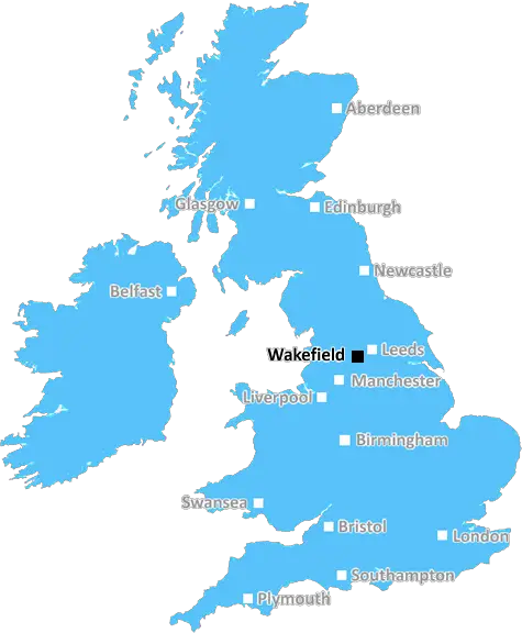
Wakefield

Aerial photo of the village centre of Castleford in Wakefield, West Yorkshire, England showing the main street along side the River Aire

UK Map

Wakefield (WF) Postcode Area

Wakefield: Historic cathedral city, medieval architecture, scenic riverside, vibrant arts scene, and a strong community spirit. A city with a rich cultural heritage and picturesque surroundings in West Yorkshire.

Wakefield Postcode Area includes:

Wakefield, Ossett, Normanton, Pontefract, Castleford, Knottingley, Dewsbury, Mirfield, Liversedge, Heckmondwike, Batley.


Discover everything you need to know about Wakefield with PostcodeArea. Scroll down to uncover demographics, property prices, crime stats, amenities and more.

Most Desirable Postcodes

Here are the top 10 most desirable postcode areas in Wakefield (WF), based on a unique scoring system that weighs key factors like safety, schools, diversity, and affordability.

Whether you're a renter, homebuyer, or property investor, this tool lets you customise the score to focus on what matters most to you, helping you make smarter, data-driven decisions.

How are Desirability Scores calculated?

Our custom algorithm calculates a unique "Desirability Score" for any UK postcode by analysing a range of factors - including Census 2021 data, third-party insights, and socio-economic knowledge, to provide a tailored rating.
Explain more

Top Postcodes in "WF"

Postcode Score
WF17 6AA
9.0
WF12 0AA
8.8
WF4 1AA
8.4
WF9 3AA
8.2
WF4 4AA
8.0
WF3 2AA
8.0
WF13 3AA
8.0
WF17 5AA
7.8
WF1 5AB
7.8
WF3 1AA
7.8

Bottom Postcodes in "WF"

Postcode Score
WF10 4AA
6.6
WF7 5AA
6.6
WF13 2AA
6.5
WF17 1FN
6.5
WF8 9AB
6.4
WF2 0AA
6.4
WF11 0AA
6.4
WF2 8AA
6.4
WF8 4AA
6.4
WF8 1AA
6.4

Primary Industries

The local economy at a glance! Here are the four most common industries in Wakefield, revealing what fuels growth and opportunity in the postcode area.

Construction

Construction

Wakefield has a strong presence of construction businesses, which usually means there's a lot of building going on - whether it's new homes, commercial spaces, or infrastructure. This can be a good sign that the Wakefield area is growing and attracting investment. It could also mean there's a strong local economy, with plenty of work available for builders and tradespeople. On the flip side, it might suggest there's a fair bit of property in need of repair or updating. Either way, it tells you the Wakefield area is pretty active and could be on the up.

Professional

Professional & Scientific

Wakefield has a large proportion of professional and scientific businesses, which makes it a hub for specialised industries like law firms, consulting agencies, tech companies, or research labs. This suggests a high level of expertise and innovation, attracting professionals such as engineers, scientists, lawyers, and consultants. The Wakefield area might have a more polished, business-focused atmosphere, with modern offices and co-working spaces. It's often well-connected, with good transport links and amenities to support a skilled workforce. Property prices could be higher, as these areas tend to attract well-paid professionals. It might not be the most vibrant or social place, but it will have a reputation for being smart, efficient, and future-focused.

Retail

Retail

Wakefield area has a large quantity of retail businesses, making it a busy, commercial hub where people go to shop and socialise. High streets, shopping centres, and independent boutiques often thrive in these areas, making it a convenient place for residents and visitors alike. The presence of retail businesses can indicate that the local economy is fairly strong, with plenty of footfall and a demand for goods and services. This kind of area tends to have good transport links and a lively atmosphere, but it can also mean a bit more hustle and bustle, especially during weekends and sales events. If you're living in Wakefield, it's handy for convenience, but it could also bring a lot of traffic and noise during peak shopping hours.

Business

Business Administration

If a postcode area such as WF has a lot of business administration services, such as accounting firms, HR consultancies, and management services, it's likely a centre for corporate and operational support. These businesses help other companies run smoothly, so the area might be more business-centric, attracting professionals like administrators, accountants, and consultants. The local economy could be quite strong, driven by a steady demand for services that keep companies ticking over. It's not necessarily the most exciting or creative environment, but it would be efficient, organised, and perhaps well-connected with reliable transport links. You'd expect to see a lot of office spaces in Wakefield and maybe even shared workspaces catering to small and medium-sized businesses. The area could feel more formal and professional, with less of a residential or leisure focus.


Data showing the activity, size and location is from the Inter Departmental Business Register 2024, produced by the ONS.

Key Statistics

Wakefield WF, part of the ceremonial county of West Yorkshire in England, presents a substantial geographical area with 17 outward codes (the first half of a postcode, e.g. WF 1AA). Its population stands at 549,488 individuals, reflecting a density of 1,911 people per square kilometre. The average household income here is £39,603 , which is 13.2% higher than the average UK median household income (£35,000), indicating a stable economic profile within the region.

Wakefield WF - Postcode

Postcode Area

WF

Wakefield

Wakefield WF - Outward Codes

Total Outward Codes

17

Postcodes

Wakefield WF - Population

Population

549,488

People

Wakefield WF - Population Density

Population Density

1,911

People/km2

Wakefield WF - Income

Average Income

£39,603

Per household

What's Wakefield like to live and work in?

Wakefield WF Photograph

Aerial photo of the village centre of Castleford in Wakefield, West Yorkshire, England showing the main street along side the River Aire

Adobe Stock

Wakefield, situated in West Yorkshire, England, has a population of approximately 100,000 and is known for its historical significance and vibrant cultural scene. The city benefits from good transport links, including the M1 and M62 motorways and Wakefield Westgate railway station, offering direct services to London and other major cities.

Wakefield's community includes a mix of families, professionals, and retirees. Housing in Wakefield ranges from modern apartments and new developments to traditional terraced and detached homes.

The city offers a variety of amenities, including the Ridings and Trinity Walk shopping centres, a wide range of restaurants, and cultural venues like The Hepworth Wakefield gallery and Wakefield Theatre Royal.

This page contains a list of postcode districts for Wakefield area. Select a postcode to see the map location, demographics, house prices, local information, tourist guides and statistics:

Wakefield (WF) Postcode Districts

Wakefield WF postcode area contains 17 postcode districts within its boundary.

Click on an outward postal code (the first half of a postcode, i.e. WF*) to explore information about the area.

House Prices in Wakefield

How are property price trends?

The ONS (Office for National Statistics) regularly tracks and records average house prices and rents in this area (E08000036). Note that these estimates are based on local authority rather than postcode area. For more information about current house prices, choose an individual postcode below.

West Yorkshire

The wider county

Read more about West Yorkshire
West Yorkshire Photo

Local Transport

Transport in the WF Postal Area

Thinking of moving to the WF postal area? Great choice! Nestled in West Yorkshire, WF is well-connected and offers a variety of transport options to make your commute easy and convenient.

Rail

WF is served by several railway stations, including Wakefield Westgate and Wakefield Kirkgate. These stations offer frequent services to major cities like Leeds, London, and Manchester. Whether you're commuting for work or planning a weekend getaway, the rail network has you covered.

Air

For air travel, Leeds Bradford Airport is the closest, roughly a 40-minute drive from central WF. Offering flights to a range of domestic and international destinations, it makes both business and leisure trips straightforward.

Commuting by Car

The area benefits from excellent road links, with the M1 and M62 motorways providing quick access to major cities like Leeds, Sheffield, and Manchester. Perfect for those who prefer the flexibility of commuting by car.

Buses

Public bus services are robust, operated mainly by Arriva and First West Yorkshire. With routes covering both urban and rural areas, buses offer a reliable way to get around without the need for a car.

Train Stations

The following railway stations are within the WF postcode region:

Primary Destinations
Approx Journey Times

Batley Railway Station

Northern Rail
Batley
Leeds
25 mins
Dewsbury
5 mins
Huddersfield
15 mins
Manchester
1 hr 30 mins

Castleford Railway Station

Northern Rail
Leeds
25 mins
Wakefield Westgate
10 mins
Nottingham
1 hr 45 mins

Dewsbury Railway Station

First TransPennine Express
Leeds
20 mins
Dewsbury
30 mins
Huddersfield
40 mins
Manchester
1 hr
London
2 hrs.

Featherstone Railway Station

Northern Rail
Wakefield Westgate
12 mins
Leeds
30 mins
Pontefract Monkhill
5 mins
Knottingley
10 mins
Goole
25 mins

Fitzwilliam Railway Station

Northern Rail
London Kings Cross
1hr
Peterborough
50mins
Leeds
2hrs
Edinburgh
4hrs

Glasshoughton Railway Station

Northern Rail
Glasshoughton Train Station
Castleford Train Station
5 mins
Leeds Train Station
25 mins
Wakefield Westgate Train Station
10 mins
Knottingley Train Station
7 mins

Knottingley Railway Station

Northern Rail
Knottingley Train Station
Snaith Train Station
13 mins
Doncaster Train Station
32 mins
Sheffield Train Station
1 hr 6 mins
Derby Train Station
1 hr 58 mins
Birmingham New Street Train Station
2 hrs 53 mins

Mirfield Railway Station

Northern Rail
Leeds
17 mins
Dewsbury
6 mins
Huddersfield
17 mins

Moorthorpe Railway Station

Northern Rail
Wakefield Westgate
18 mins
Moorthorpe
7 mins
Sheffield
1 hr 15 mins
Meadowhall
1 hr 10 mins
Doncaster
50 mins
Leeds
35 mins.

Normanton Railway Station

Northern Rail
York
25 mins
Wakefield
45 mins
Leeds
1 hr
Bradford
1 hr 10 mins
Halifax
1 hr 20 mins
Huddersfield
1 hr 30 mins
Manchester
1 hr 45 mins

Outwood Railway Station

Northern Rail
Outwood
Wakefield Westgate
10 mins
Leeds
25 mins
York
1 hr
Newcastle
2 hrs
Edinburgh
3 hrs

Pontefract Baghill Railway Station

Northern Rail
Pontefract Baghill Train Station
Wakefield Kirkgate Train Station
10 mins
Leeds Train Station
25 mins
Manchester Victoria Train Station
1 hr 30 mins

Pontefract Monkhill Railway Station

Northern Rail
Pontefract Knottingley
10 mins
Pontefract Tanshelf
5 mins
Glasshoughton
3 mins
Castleford
8 mins
Wakefield Westgate
14 mins
Leeds
25 mins
York
1 hr 10 mins

Pontefract Tanshelf Railway Station

Northern Rail
Pontefract Tanshelf Train Station
Pontefract Monkhill Train Station
2 mins
Glasshoughton Train Station
5 mins
Castleford Train Station
10 mins
Leeds Train Station
30 mins

Ravensthorpe Railway Station

Northern Rail
London Kings Cross
2 hrs
Peterborough
1 hr 15 mins
Grantham
45 mins
Newark Northgate
30 mins
Retford
15 mins
Doncaster
45 mins
Wakefield Westgate
1 hr
Leeds
1 hr 15 mins

Sandal And Agbrigg Railway Station

Northern Rail
Outwood
5 mins
Wakefield Westgate
10 mins
Sandal And Agbrigg
15 mins
Fitzwilliam
30 mins
Doncaster
50 mins
Sheffield
1 hr 20 mins

South Elmsall Railway Station

Northern Rail
South Elmsall
to Manchester
1hr 30mins)
Wakefield Westgate
to London
2hrs)
Leeds
to Edinburgh
2hrs 30mins)
Doncaster
to Birmingham
1hr 30mins)
Sheffield
to Manchester
50mins)

Streethouse Railway Station

Northern Rail
Streethouse Train Station
0 mins
Horbury Train Station
5 mins
Wakefield Westgate Train Station
10 mins
Leeds Train Station
30 mins

Wakefield Kirkgate Railway Station

Northern Rail
Leeds
20 mins
Dewsbury
10 mins
Huddersfield
25 mins
Manchester
1 hr 10 mins

Wakefield Westgate Railway Station

East Coast
Wakefield Westgate
0 mins
Outwood
5 mins
Leeds
15 mins
Huddersfield
25 mins
Manchester Piccadilly
1 hr
Liverpool Lime Street
1 hr 30 mins

Local Authorities

WF Postcode area

Local Authorities are government organisations responsible for providing local services and facilities such as education, housing, and social services within a specific area. The WF postcode area includes the following local authorities:

Barnsley

Barnsley Metropolitan Borough Council is committed to promoting economic growth and community well-being through strategic planning and the provision of high-quality public services.

Barnsley Metropolitan Borough Council Website

Calderdale

Calderdale Council focuses on fostering sustainable development and community welfare, delivering essential public services to enhance the quality of life for its residents.

Calderdale Council Website

Doncaster

Doncaster Council focuses on urban regeneration, economic development, and delivering high-quality public services to enhance community welfare and residents' quality of life.

Doncaster Council Website

+ 4 more

Doncaster

Kirklees

Leeds

Selby

Wakefield

View all Local Authorities

GDP (Gross Domestic Product)

Economic Output

GDP (Gross Domestic Product) measures the total economic output of a country, region, or Local Authority. It tells us how much money is being made within a particular area. This includes everything from a business selling cars or consumers getting their hair cut.

This list of the Local Authorities within the Wakefield (WF) postcode town gives us a snapshot of how much money is being generated at current market prices, based on what people are spending and earning. It's an important way to understand the economic health and activity levels across the UK.

For comparison purposes, we've included the top and bottom two local authorities across the UK in terms of GDP.

Local Authority

GDP (£)

City of London
£99,277
Westminster
£92,008
Doncaster
£7,766
Calderdale
£6,274
Barnsley
£5,459
Na h Eileanan Siar
£674
Isles of Scilly
£86

GDP trends over time

The graph below shows the total GDP values for all Local Authorities within the Wakefield (WF) area:

When we talk about GDP at current market prices, we're looking at the total value of all goods and services produced in an area, but the key bit here is "current market prices." This means it includes the value of goods and services as they're bought and sold right now, without adjusting for inflation or changes in prices over time.

So, for example a figure of £1,477 GDP means that, on average, each person within an area contributes this amount to the UK economy each year.

Republished from the ONS regional gross domestic product: local authorities under the Open Government Licence v3.0. Latest available data: April 2022.

Education

Highest Rated Schools in WF

As rated by Ofsted

Mortgage Calculator

This tool helps you quickly understand your potential mortgage payments, making it easier to plan your finances.

To use the mortgage calculator, simply enter the loan amount you wish to borrow in pounds (£), the annual interest rate as a percentage (%), and the loan term in years. Click the "Calculate" button to see your estimated monthly payment.

PostcodeArea Screenshots of Data

Unlock the full power of postcode insights.

Data is meaningless without context. Reveal the stories behind a neighbourhood, and make smarter decisions with data you can trust. Gain unlimited access to detailed statistics, exclusive reports, and essential tools.

PostcodeArea is grateful to our sponsors for their support.

  • Greens Water Systems
  • Alamin Media
  • Takeaway Tree
  • Yark Beds
  • Soccerbox
  • Gamechanger Consultancy

Share this page