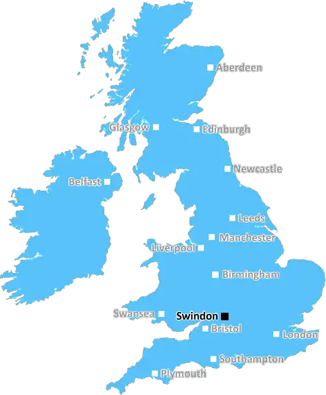
Swindon

Aerial view of the old town area in Swindon

UK Map

Swindon (SN) Postcode Area

Swindon: Historic market town, railway heritage, green spaces, vibrant cultural scene, and convenient access to the Cotswolds. A town blending industrial history with modern amenities in Wiltshire.

Swindon Postcode Area includes:

Swindon, Faringdon, Marlborough, Pewsey, Devizes, Calne, Melksham, Corsham, Chippenham, Malmesbury.


Discover everything you need to know about Swindon with PostcodeArea. Scroll down to uncover demographics, property prices, crime stats, amenities and more.

Most Desirable Postcodes

Here are the top 10 most desirable postcode areas in Swindon (SN), based on a unique scoring system that weighs key factors like safety, schools, diversity, and affordability.

Whether you're a renter, homebuyer, or property investor, this tool lets you customise the score to focus on what matters most to you, helping you make smarter, data-driven decisions.

How are Desirability Scores calculated?

Our custom algorithm calculates a unique "Desirability Score" for any UK postcode by analysing a range of factors - including Census 2021 data, third-party insights, and socio-economic knowledge, to provide a tailored rating.
Explain more

Top Postcodes in "SN"

Postcode Score
SN5 1ES
8.8
SN5 8AA
8.5
SN3 4AA
8.2
SN5 5AA
8.1
SN1 2AA
8.1
SN17 3ZZ
8.0
SN5 0AA
8.0
SN17 6ZZ
8.0
SN17 5ST
8.0
SN17 4YE
8.0

Bottom Postcodes in "SN"

Postcode Score
SN25 4AA
6.1
SN10 2AA
5.8
SN10 1AB
5.8
SN26 7AB
5.8
SN25 5AE
5.5
SN17 7AR
0.0
SN13 7AF
0.0
SN42 7YR
0.0
SN86 6DE
0.0
SN17 9ZZ
0.0

Primary Industries

From local jobs to economic growth, these four industries lead the way in the Swindon postcode area. Find out what's driving business in this region.

Professional

Professional & Scientific

Swindon has a large proportion of professional and scientific businesses, which makes it a hub for specialised industries like law firms, consulting agencies, tech companies, or research labs. This suggests a high level of expertise and innovation, attracting professionals such as engineers, scientists, lawyers, and consultants. The Swindon area might have a more polished, business-focused atmosphere, with modern offices and co-working spaces. It's often well-connected, with good transport links and amenities to support a skilled workforce. Property prices could be higher, as these areas tend to attract well-paid professionals. It might not be the most vibrant or social place, but it will have a reputation for being smart, efficient, and future-focused.

Construction

Construction

Swindon has a strong presence of construction businesses, which usually means there's a lot of building going on - whether it's new homes, commercial spaces, or infrastructure. This can be a good sign that the Swindon area is growing and attracting investment. It could also mean there's a strong local economy, with plenty of work available for builders and tradespeople. On the flip side, it might suggest there's a fair bit of property in need of repair or updating. Either way, it tells you the Swindon area is pretty active and could be on the up.

Business

Business Administration

If a postcode area such as SN has a lot of business administration services, such as accounting firms, HR consultancies, and management services, it's likely a centre for corporate and operational support. These businesses help other companies run smoothly, so the area might be more business-centric, attracting professionals like administrators, accountants, and consultants. The local economy could be quite strong, driven by a steady demand for services that keep companies ticking over. It's not necessarily the most exciting or creative environment, but it would be efficient, organised, and perhaps well-connected with reliable transport links. You'd expect to see a lot of office spaces in Swindon and maybe even shared workspaces catering to small and medium-sized businesses. The area could feel more formal and professional, with less of a residential or leisure focus.

Information

Information & Communication

Swindon has a large percentage of Information & Communication businesses, making it a tech-savvy, modern, and highly connected place. These industries include IT services, telecommunications, media, and software development companies, so the area might have a strong digital infrastructure and attract tech professionals, creatives, and innovators. It suggests the Swindon area is dynamic and forward-thinking, often with a mix of startups and established firms working in cutting-edge fields like software, digital marketing, or broadcasting. You'll likely find a lot of modern office spaces, co-working hubs, and good transport links to support these businesses. The vibe could feel energetic and entrepreneurial, but also professional, with a focus on innovation and staying connected.


Major Employers

Major employers and businesses in the SN postcode area include:

Dyson

Technology & Engineering, Malmesbury

Known for innovative engineering, Dyson is a major employer in the South West, with a focus on R&D and product development.

Postcode Location: SN16

Dyson

Technology & Engineering, Malmesbury

Known for its innovative engineering, Dyson has a significant presence near Bristol.

Postcode Location: SN16

Show more employers

Data showing the activity, size and location is from the Inter Departmental Business Register 2024, produced by the ONS.

Key Statistics

Swindon SN, part of the ceremonial county of Wiltshire in England, presents a substantial geographical area with 18 outward codes (the first half of a postcode, e.g. SN 1AA). Its population stands at 503,724 individuals, reflecting a density of 2,193 people per square kilometre. The average household income here is £50,588 , which is 44.5% higher than the average UK median household income (£35,000), indicating a stable economic profile within the region.

Swindon SN - Postcode

Postcode Area

SN

Swindon

Swindon SN - Outward Codes

Total Outward Codes

18

Postcodes

Swindon SN - Population

Population

503,724

People

Swindon SN - Population Density

Population Density

2,193

People/km2

Swindon SN - Income

Average Income

£50,588

Per household

What's Swindon like to live and work in?

Swindon SN Photograph

Aerial view of the old town area in Swindon

Adobe Stock

Swindon, located in Wiltshire, England, has a population of approximately 222,000 and is known for its strong economy, diverse community, and convenient location. The town benefits from excellent transport links, including the M4 motorway, direct train services to London Paddington and Bristol, and proximity to major airports like Heathrow and Bristol.

Swindon has a varied demographic profile, featuring a mix of families, professionals, and a growing number of young people.

The town is home to several business parks and headquarters, including notable companies such as Intel and Nationwide Building Society. Swindon offers a wide range of amenities, including shopping centers like the McArthurGlen Designer Outlet, numerous schools, parks, and leisure facilities.

This page contains a list of postcode districts for Swindon area. Select a postcode to see the map location, demographics, house prices, local information, tourist guides and statistics:

Swindon (SN) Postcode Districts

Swindon SN postcode area contains 18 postcode districts within its boundary.

Click on an outward postal code (the first half of a postcode, i.e. SN*) to explore information about the area.

House Prices in Swindon

How are property price trends?

The ONS (Office for National Statistics) regularly tracks and records average house prices and rents in this area (E06000030). Note that these estimates are based on local authority rather than postcode area. For more information about current house prices, choose an individual postcode below.

Wiltshire

The wider county

Home to Britain's most famous ancient monuments Wiltshire is a county that is defined by its place in English history. Unlike other counties however, it is the history of thousands of years ago that makes Wiltshire most famous. For amongst Wiltshire's wide-open plains and green hills are hundreds upon hundreds of burial mounds, chalk figures and stone circles (as well as more and more dubious crop circles.)

A good place to start is with the hugely impressive Iron Age Hillfort of Old Sarum, on the site of the original Salisbury City. This fort was used by everyone from the Romans to the Saxons to the Normans and then grew out to become one of the busiest and most successful settlements in the medieval era.

Read more about Wiltshire
Wiltshire Photo

Local Transport

Rail

The postal area of SN benefits from a strong rail network, connecting you to major cities like London, Bristol, and Bath. Swindon is the main hub, offering frequent and fast services, making commuting a breeze. Smaller towns also have convenient local stations.

Air

For international and domestic flights, Bristol Airport and Heathrow Airport are both within a reasonable driving distance. Whether you're jetting off for a holiday or a business trip, you have options nearby.

Commuting by Car

The SN area is well-connected by major roads, including the M4 motorway, which offers excellent links to London, South Wales, and beyond. Driving around the area is generally smooth, with ample parking available in most towns and cities.

Buses

Public bus services in the SN area are reliable and extensive. You can easily travel within towns and to neighbouring areas without a car. Many routes offer frequent services, ensuring you’re well-connected at all times.

Train Stations

The following railway stations are within the SN postcode region:

Primary Destinations
Approx Journey Times

Bedwyn Railway Station

First Great Western
Bedwyn
terminus
Hungerford
5 mins
Kintbury
10 mins
Newbury
20 mins
Thatcham
25 mins
Reading
45 mins

Chippenham Railway Station

First Great Western
Chippenham
to Bath Spa - 15mins
to Bristol Temple Meads - 30mins)
Swindon
to London Paddington - 1hr
Reading
to London Paddington - 30mins
London Paddington
to Oxford - 1hr

Melksham Railway Station

First Great Western
London Paddington
1hr 30mins
Reading
1hr
Swindon
30mins
Chippenham
10mins
Bath Spa
30mins
Bristol Temple Meads
1hr

Pewsey Railway Station

First Great Western
Reading
Newbury
45 mins
Hungerford
1hr
Bedwyn
1hr 15 mins
Pewsey
1hr 30 mins

Swindon Railway Station

First Great Western
London Paddington
1hr
Reading
25mins
Bristol Temple Meads
1hr 10mins
Cardiff Central
1hr 40mins

Local Authorities

SN Postcode area

Local Authorities are government organisations responsible for providing local services and facilities such as education, housing, and social services within a specific area. The SN postcode area includes the following local authorities:

Cotswold

Cotswold District Council is committed to preserving its historic charm and natural beauty while promoting sustainable development and providing high-quality public services to enhance community welfare.

Cotswold District Council Website

South Gloucestershire

South Gloucestershire Council focuses on driving economic growth and enhancing the quality of life through strategic planning and effective public service delivery in both urban and rural communities.

South Gloucestershire Council Website

Swindon

Swindon Borough Council promotes robust urban development and economic prosperity, offering comprehensive services to meet the needs of its diverse population and foster community well-being.

Swindon Borough Council Website

+ 3 more

Swindon

Vale of White Horse

West Berkshire

Wiltshire

View all Local Authorities

GDP (Gross Domestic Product)

Economic Output

GDP (Gross Domestic Product) measures the total economic output of a country, region, or Local Authority. It tells us how much money is being made within a particular area. This includes everything from a business selling cars or consumers getting their hair cut.

This list of the Local Authorities within the Swindon (SN) postcode town gives us a snapshot of how much money is being generated at current market prices, based on what people are spending and earning. It's an important way to understand the economic health and activity levels across the UK.

For comparison purposes, we've included the top and bottom two local authorities across the UK in terms of GDP.

Local Authority

GDP (£)

City of London
£99,277
Westminster
£92,008
South Gloucestershire
£16,387
Swindon
£12,457
Cotswold
£4,491
Na h Eileanan Siar
£674
Isles of Scilly
£86

GDP trends over time

The graph below shows the total GDP values for all Local Authorities within the Swindon (SN) area:

When we talk about GDP at current market prices, we're looking at the total value of all goods and services produced in an area, but the key bit here is "current market prices." This means it includes the value of goods and services as they're bought and sold right now, without adjusting for inflation or changes in prices over time.

So, for example a figure of £1,788 GDP means that, on average, each person within an area contributes this amount to the UK economy each year.

Republished from the ONS regional gross domestic product: local authorities under the Open Government Licence v3.0. Latest available data: April 2022.

Mortgage Calculator

This tool helps you quickly understand your potential mortgage payments, making it easier to plan your finances.

To use the mortgage calculator, simply enter the loan amount you wish to borrow in pounds (£), the annual interest rate as a percentage (%), and the loan term in years. Click the "Calculate" button to see your estimated monthly payment.

PostcodeArea Screenshots of Data

Unlock the full power of postcode insights.

Data is meaningless without context. Reveal the stories behind a neighbourhood, and make smarter decisions with data you can trust. Gain unlimited access to detailed statistics, exclusive reports, and essential tools.

PostcodeArea is grateful to our sponsors for their support.

  • Greens Water Systems
  • Alamin Media
  • Takeaway Tree
  • Yark Beds
  • Soccerbox
  • Gamechanger Consultancy

Share this page