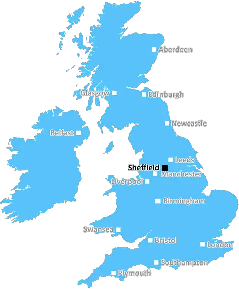
View of Kelham island museum in Sheffield, industry and steelmaking history museum with interactive galleries and on-site craftsmen
Sheffield: Industrial heritage, vibrant cultural scene, stunning Peak District views, friendly community spirit, and a hub for outdoor enthusiasts and arts aficionados alike. A city where innovation meets natural beauty in South Yorkshire.
Sheffield, Dronfield, Hope Valley, Chesterfield, Rotherham, Mexborough, Barnsley, Worksop.
Discover everything you need to know about Sheffield with PostcodeArea. Scroll down to uncover demographics, property prices, crime stats, amenities and more.
Here are the top 10 most desirable postcode areas in Sheffield (S), based on a unique scoring system that weighs key factors like safety, schools, diversity, and affordability.
Whether you're a renter, homebuyer, or property investor, this tool lets you customise the score to focus on what matters most to you, helping you make smarter, data-driven decisions.
Our custom algorithm calculates a unique "Desirability Score" for any UK postcode by analysing a range of factors - including Census 2021 data, third-party insights, and socio-economic knowledge, to provide a tailored rating.
Explain more
Wondering what businesses thrive in Sheffield? Check out the top four industries, giving you an insight into the key sectors keeping the local area buzzing.
Sheffield has a large proportion of professional and scientific businesses, which makes it a hub for specialised industries like law firms, consulting agencies, tech companies, or research labs. This suggests a high level of expertise and innovation, attracting professionals such as engineers, scientists, lawyers, and consultants. The Sheffield area might have a more polished, business-focused atmosphere, with modern offices and co-working spaces. It's often well-connected, with good transport links and amenities to support a skilled workforce. Property prices could be higher, as these areas tend to attract well-paid professionals. It might not be the most vibrant or social place, but it will have a reputation for being smart, efficient, and future-focused.
Sheffield has a strong presence of construction businesses, which usually means there's a lot of building going on - whether it's new homes, commercial spaces, or infrastructure. This can be a good sign that the Sheffield area is growing and attracting investment. It could also mean there's a strong local economy, with plenty of work available for builders and tradespeople. On the flip side, it might suggest there's a fair bit of property in need of repair or updating. Either way, it tells you the Sheffield area is pretty active and could be on the up.
If a postcode area such as S has a lot of business administration services, such as accounting firms, HR consultancies, and management services, it's likely a centre for corporate and operational support. These businesses help other companies run smoothly, so the area might be more business-centric, attracting professionals like administrators, accountants, and consultants. The local economy could be quite strong, driven by a steady demand for services that keep companies ticking over. It's not necessarily the most exciting or creative environment, but it would be efficient, organised, and perhaps well-connected with reliable transport links. You'd expect to see a lot of office spaces in Sheffield and maybe even shared workspaces catering to small and medium-sized businesses. The area could feel more formal and professional, with less of a residential or leisure focus.
Sheffield has a large percentage of Information & Communication businesses, making it a tech-savvy, modern, and highly connected place. These industries include IT services, telecommunications, media, and software development companies, so the area might have a strong digital infrastructure and attract tech professionals, creatives, and innovators. It suggests the Sheffield area is dynamic and forward-thinking, often with a mix of startups and established firms working in cutting-edge fields like software, digital marketing, or broadcasting. You'll likely find a lot of modern office spaces, co-working hubs, and good transport links to support these businesses. The vibe could feel energetic and entrepreneurial, but also professional, with a focus on innovation and staying connected.
Major employers and businesses in the S postcode area include:
Technology & Engineering, Malmesbury
Known for innovative engineering, Dyson is a major employer in the South West, with a focus on R&D and product development.
Postcode Location: SN16
Technology & Engineering, Malmesbury
Known for its innovative engineering, Dyson has a significant presence near Bristol.
Postcode Location: SN16
Insurance, Eastleigh (near Bournemouth)
A leading provider of car, home, and travel insurance with a large office near Bournemouth.
Postcode Location: SO53
Manufacturing & Engineering, Sunderland (near Durham)
A manufacturer of port cranes, offshore cranes, and heavy equipment, with a major facility near Durham.
Postcode Location: SR5
Engineering & Technology, Peterlee
A global engineering and technology company, providing automation solutions for various industries.
Postcode Location: SR8
Engineering, Stoke-on-Trent
Specialises in casting and machining, employing skilled workers in engineering and manufacturing.
Postcode Location: ST1
Data showing the activity, size and location is from the Inter Departmental Business Register 2024, produced by the ONS.
Sheffield S, part of the ceremonial county of South Yorkshire in England, presents a substantial geographical area with 45 outward codes (the first half of a postcode, e.g. S 1AA). Its population stands at 1,389,622 individuals, reflecting a density of 2,390 people per square kilometre. The average household income here is £38,330 , a difference of 9.5%, which is in line with the average median UK household income of £35,000.
Sheffield
Postcodes
People
People/km2
Per household
View of Kelham island museum in Sheffield, industry and steelmaking history museum with interactive galleries and on-site craftsmen
Adobe Stock
Sheffield, located in South Yorkshire, England, is a vibrant city with a population of approximately 584,000. Known for its industrial heritage and green spaces, Sheffield offers a blend of urban and rural living.
The city boasts excellent transport links, including direct train services to London, Manchester, and Leeds, and access to the M1 motorway. Sheffield's diverse demographics reflect a rich cultural mix, with a significant student population due to its two universities, the University of Sheffield and Sheffield Hallam University.
The city is renowned for its cultural scene, including theatres, museums, and music venues, as well as outdoor activities in the nearby Peak District. Residents benefit from a range of amenities, including shopping centers, restaurants, and sports facilities.
This page contains a list of postcode districts for Sheffield area. Select a postcode to see the map location, demographics, house prices, local information, tourist guides and statistics:
Sheffield S postcode area contains 45 postcode districts within its boundary.
Click on an outward postal code (the first half of a postcode, i.e. S*) to explore information about the area.
The ONS (Office for National Statistics) regularly tracks and records average house prices and rents in this area (E08000019). Note that these estimates are based on local authority rather than postcode area. For more information about current house prices, choose an individual postcode below.
The 'S' postcode area is well-connected by rail, offering frequent services to major cities like Sheffield, Chesterfield, and Doncaster. The key stations in this region are Sheffield Station and Chesterfield Station, which provide excellent links to London, Manchester, and Leeds. Rail travel is a convenient option for both daily commuters and occasional travellers.
For international and domestic flights, residents can easily reach Doncaster Sheffield Airport, which is approximately a 30-minute drive from central parts of the 'S' area. Manchester Airport is another viable option, an hour's drive away, featuring a broader range of destinations.
The area benefits from a comprehensive road network, including major roads such as the M1 motorway, providing direct routes to Leeds, London, and the Midlands. Driving in the 'S' postcode is generally convenient, with ample parking options and manageable traffic, especially outside peak hours.
Bus transport in the 'S' postcode area is reliable and efficient, with numerous routes operating through local towns and cities. Services are frequent, making it easy to get around without a car. The main bus operators include Stagecoach and First South Yorkshire, ensuring comprehensive coverage and regular schedules.
The following railway stations are within the S postcode region:
Local Authorities are government organisations responsible for providing local services and facilities such as education, housing, and social services within a specific area. The S postcode area includes the following local authorities:
Amber Valley Borough Council supports its communities by focusing on economic development, improving public services, and enhancing the quality of life across its diverse areas.
Barnsley Metropolitan Borough Council is committed to promoting economic growth and community well-being through strategic planning and the provision of high-quality public services.
Bassetlaw District Council serves the district of Bassetlaw, emphasising urban development, economic growth, and delivering extensive public services to foster community well-being and enhance residents' quality of life.
GDP (Gross Domestic Product) measures the total economic output of a country, region, or Local Authority. It tells us how much money is being made within a particular area. This includes everything from a business selling cars or consumers getting their hair cut.
This list of the Local Authorities within the Sheffield (S) postcode town gives us a snapshot of how much money is being generated at current market prices, based on what people are spending and earning. It's an important way to understand the economic health and activity levels across the UK.
For comparison purposes, we've included the top and bottom two local authorities across the UK in terms of GDP.
The graph below shows the total GDP values for all Local Authorities within the Sheffield (S) area:
When we talk about GDP at current market prices, we're looking at the total value of all goods and services produced in an area, but the key bit here is "current market prices." This means it includes the value of goods and services as they're bought and sold right now, without adjusting for inflation or changes in prices over time.
So, for example a figure of £1,065 GDP means that, on average, each person within an area contributes this amount to the UK economy each year.
Republished from the ONS regional gross domestic product: local authorities under the Open Government Licence v3.0. Latest available data: April 2022.
As rated by Ofsted
Church Road, Thundersley, SS7 3HG
Primary School (4-11)
Cambrian Way, Stoke on Trent, ST2 8PQ
Secondary School (6-19)
Sandygate Road, Marlow, SL7 3AZ
Primary School (5-7)
214b Kennington Road, London, SE11 6AU
Secondary School (5-17)
Mollison Drive, Wallington, SM6 9JW
Secondary School (11-18)
Stuart Drive, Hitchin, SG4 9QB
Primary School (4-11)
Ascupart Street, Southampton, SO14 1LU
Primary School (3-11)
Christchurch Road, London, SW2 3ES
Primary School (4-11)
Lilleshall Road, Morden, SM4 6DU
Secondary School (11-18)
Daniel Gardens, London, SE15 6ER
Secondary School (11-19)
Data is meaningless without context. Reveal the stories behind a neighbourhood, and make smarter decisions with data you can trust. Gain unlimited access to detailed statistics, exclusive reports, and essential tools.
PostcodeArea is grateful to our sponsors for their support.