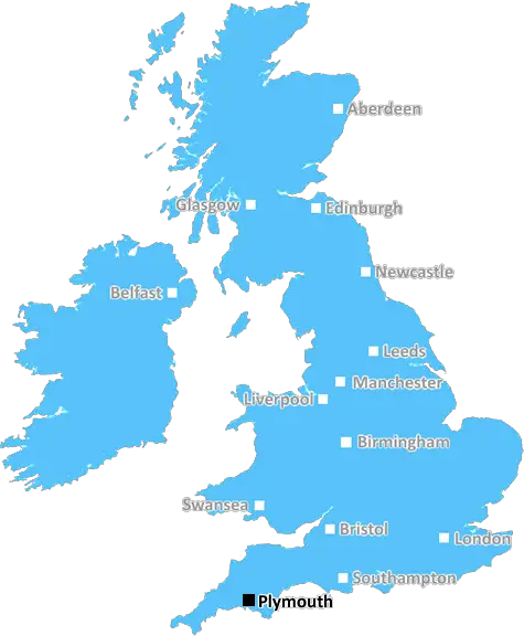
Tinside pool at Plymouth Hoe, Devon, UK
Plymouth: Historic maritime city, scenic waterfront, iconic Hoe, vibrant arts scene, and gateway to Dartmoor National Park. A city of naval heritage and natural beauty on the south coast of Devon.
Plymouth, Torpoint, Saltash, Looe, Liskeard, Launceston, Lifton, Callington, Calstock, Gunnislake, Tavistock, Yelverton, Ivybridge, Lostwithiel, Fowey, Par, St. Austell, Wadebridge, Padstow, Port Isaac, Bodmin, Camelford, Delabole, Tintagel, Boscastle.
Discover everything you need to know about Plymouth with PostcodeArea. Scroll down to uncover demographics, property prices, crime stats, amenities and more.
Here are the top 10 most desirable postcode areas in Plymouth (PL), based on a unique scoring system that weighs key factors like safety, schools, diversity, and affordability.
Whether you're a renter, homebuyer, or property investor, this tool lets you customise the score to focus on what matters most to you, helping you make smarter, data-driven decisions.
Our custom algorithm calculates a unique "Desirability Score" for any UK postcode by analysing a range of factors - including Census 2021 data, third-party insights, and socio-economic knowledge, to provide a tailored rating.
Explain more
Ever wondered which industries are the biggest players in Plymouth? Here's a look at the top four that shape the postcode's economy.
Plymouth has a strong presence of construction businesses, which usually means there's a lot of building going on - whether it's new homes, commercial spaces, or infrastructure. This can be a good sign that the Plymouth area is growing and attracting investment. It could also mean there's a strong local economy, with plenty of work available for builders and tradespeople. On the flip side, it might suggest there's a fair bit of property in need of repair or updating. Either way, it tells you the Plymouth area is pretty active and could be on the up.
The prevalance of agricultural industries (including forestry and fishing) in Plymouth suggests this is a lively and creative postcode sector. These kinds of businesses tend to pop up in areas that are known for their cultural scene, where people value things like theatres, galleries, music venues, and independent cinemas. It could mean the area attracts a mix of creatives, young professionals, and tourists, making it a vibrant and potentially trendy spot. This could also be a sign of a more laid-back, community-focused vibe, with lots of local events and activities in and around Plymouth. It might push property prices up if the area becomes particularly popular, but it's also a good indicator of a strong local identity and a thriving social scene.
Plymouth has a large proportion of professional and scientific businesses, which makes it a hub for specialised industries like law firms, consulting agencies, tech companies, or research labs. This suggests a high level of expertise and innovation, attracting professionals such as engineers, scientists, lawyers, and consultants. The Plymouth area might have a more polished, business-focused atmosphere, with modern offices and co-working spaces. It's often well-connected, with good transport links and amenities to support a skilled workforce. Property prices could be higher, as these areas tend to attract well-paid professionals. It might not be the most vibrant or social place, but it will have a reputation for being smart, efficient, and future-focused.
When postcode areas have a lot of accommodation and food businesses, areas like Plymouth are a popular spot for visitors or tourists, or it could be a bustling community with a strong local hospitality scene. You'd expect to find hotels, B&Bs, restaurants, cafes, and maybe a few pubs or bars, creating a vibrant atmosphere, especially during peak seasons or weekends. It's the kind of area where people come to relax, socialise, or enjoy a good meal out, making it feel welcoming and lively. This could boost property demand if it's a desirable place to live or visit, but it might also mean the area gets busier, especially if Plymouth is a tourist hotspot. It gives the impression of a friendly, service-oriented place where people come to enjoy themselves.
Data showing the activity, size and location is from the Inter Departmental Business Register 2024, produced by the ONS.
Plymouth PL, part of the ceremonial county of Cornwall in England, presents a substantial geographical area with 35 outward codes (the first half of a postcode, e.g. PL 1AA). Its population stands at 566,418 individuals, reflecting a density of 2,159 people per square kilometre. The average household income here is £42,595 , which is 21.7% higher than the average UK median household income (£35,000), indicating a stable economic profile within the region.
Plymouth
Postcodes
People
People/km2
Per household
Tinside pool at Plymouth Hoe, Devon, UK
Adobe Stock
Plymouth, a port city in Devon, has a population of approximately 262,000. It offers excellent transport links, including direct trains to London Paddington and easy access to the A38, connecting to the M5 motorway.
The city's demographics are diverse, with a mix of families, young professionals, and students, partly due to the presence of the University of Plymouth. Plymouth boasts a range of amenities, including shopping centres, restaurants, and cultural attractions such as the historic Barbican, Plymouth Hoe, and the National Marine Aquarium.
The city has several well-regarded schools and healthcare facilities, making it family-friendly. Green spaces like Central Park and Dartmoor National Park nearby provide ample opportunities for outdoor activities.
This page contains a list of postcode districts for Plymouth area. Select a postcode to see the map location, demographics, house prices, local information, tourist guides and statistics:
Plymouth PL postcode area contains 35 postcode districts within its boundary.
Click on an outward postal code (the first half of a postcode, i.e. PL*) to explore information about the area.
The ONS (Office for National Statistics) regularly tracks and records average house prices and rents in this area (E06000026). Note that these estimates are based on local authority rather than postcode area. For more information about current house prices, choose an individual postcode below.
Cornwall sits right in the corner of Great Britain's South West peninsula and is bordered by Devon to the east, the English Channel to the south and the Atlantic to the west. It covers over 3500 square kilometers, includes the Isles of Scilly and is blessed with some of the finest coastal scenery in all of Britain.
Serving up the longest continuous stretch of beaches and coastline in the UK Cornwall is a county of coves and caves, north coast cliffs and small fishing ports, pilchard boats and schooners, tree lined creeks and granite breakwaters on the southern coast and a growing surfing scene. It is a county that manages to preserve the past whilst being innovative with the future, with futuristic biomes set in prehistoric landscapes and world famous galleries in medieval market towns.
Read more about CornwallThe PL postcode area benefits from several rail connections, with Plymouth as a key hub. Regular services run to major cities including London, Bristol, and Exeter, making commuting and leisure travel convenient and efficient.
For international and domestic flights, Exeter Airport and Bristol Airport are the nearest options. Both airports offer a wide range of destinations, ensuring residents have access to global travel with relative ease.
Travelling by car in the PL area is facilitated by the A38 and A30, which provide direct routes to the rest of Devon and Cornwall. The region is well-connected, making it easy for commuters to navigate to work or explore the beautiful surrounding countryside.
Local bus services are plentiful, with reliable routes operated by companies such as Stagecoach and Plymouth Citybus. These services cover key locations within the PL area and offer a practical option for daily commuting or shopping trips.
The following railway stations are within the PL postcode region:
Local Authorities are government organisations responsible for providing local services and facilities such as education, housing, and social services within a specific area. The PL postcode area includes the following local authorities:
Cornwall Council, along with the Isles of Scilly, focuses on supporting sustainable development and enhancing public services across its unique and picturesque landscapes, aiming to improve the quality of life for residents and visitors alike.
Plymouth City Council drives forward with urban regeneration and robust economic strategies, providing top-tier public services to foster a vibrant community and dynamic growth within the city.
South Hams District Council prioritises the enhancement of its beautiful natural environments while promoting sustainable local economic growth and ensuring the provision of essential public services to its communities.
GDP (Gross Domestic Product) measures the total economic output of a country, region, or Local Authority. It tells us how much money is being made within a particular area. This includes everything from a business selling cars or consumers getting their hair cut.
This list of the Local Authorities within the Plymouth (PL) postcode town gives us a snapshot of how much money is being generated at current market prices, based on what people are spending and earning. It's an important way to understand the economic health and activity levels across the UK.
For comparison purposes, we've included the top and bottom two local authorities across the UK in terms of GDP.
The graph below shows the total GDP values for all Local Authorities within the Plymouth (PL) area:
When we talk about GDP at current market prices, we're looking at the total value of all goods and services produced in an area, but the key bit here is "current market prices." This means it includes the value of goods and services as they're bought and sold right now, without adjusting for inflation or changes in prices over time.
So, for example a figure of £1,084 GDP means that, on average, each person within an area contributes this amount to the UK economy each year.
Republished from the ONS regional gross domestic product: local authorities under the Open Government Licence v3.0. Latest available data: April 2022.
As rated by Ofsted
Sandy Hill, St Austell, PL25 3AT
Primary School (3-11)
2 Torridge Way, Plymouth, PL3 6JQ
Primary School (3-11)
School Road, Saltash, PL12 5EA
Primary School (4-11)
, St Austell, PL26 6LH
Primary School (4-11)
Bodmin Road, Plymouth, PL5 4DZ
Secondary School (11-16)
Loveny Road, Liskeard, PL14 6NL
Primary School (4-11)
Albion Road, Torpoint, PL11 2LU
Primary School (3-7)
Newton Ferrers, Newton Ferrers Plymouth, PL8 1AS
Primary School (2-11)
Haye Road South, Plymouth, PL9 8HJ
Primary School (2-11)
Trevithick Road, Plymouth, PL5 2AF
Primary School (2-11)
Data is meaningless without context. Reveal the stories behind a neighbourhood, and make smarter decisions with data you can trust. Gain unlimited access to detailed statistics, exclusive reports, and essential tools.
PostcodeArea is grateful to our sponsors for their support.