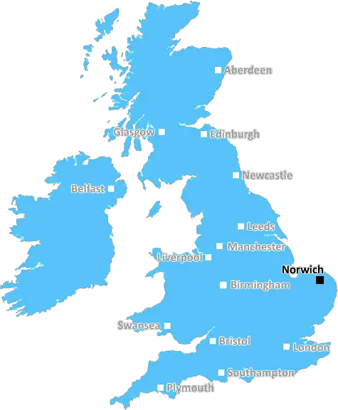
Norwich

Norwich Cathedral, Shot At Night with a Long Exposure from the Jarrold Foot Bridge, Norfolk, England

UK Map

Norwich (NR) Postcode Area

Norwich: Historic cathedral city, medieval streets, vibrant market, cultural festivals, and surrounded by the scenic Norfolk Broads. A city of heritage and creativity in the heart of East Anglia.

Norwich Postcode Area includes:

Norwich, Attleborough, Wymondham, Dereham, Fakenham, Walsingham, Wells Next The Sea, Melton Constable, Holt, Sheringham, Cromer, North Walsham, Great Yarmouth, Lowestoft, Beccles, Bungay.


Discover everything you need to know about Norwich with PostcodeArea. Scroll down to uncover demographics, property prices, crime stats, amenities and more.

Most Desirable Postcodes

Here are the top 10 most desirable postcode areas in Norwich (NR), based on a unique scoring system that weighs key factors like safety, schools, diversity, and affordability.

Whether you're a renter, homebuyer, or property investor, this tool lets you customise the score to focus on what matters most to you, helping you make smarter, data-driven decisions.

How are Desirability Scores calculated?

Our custom algorithm calculates a unique "Desirability Score" for any UK postcode by analysing a range of factors - including Census 2021 data, third-party insights, and socio-economic knowledge, to provide a tailored rating.
Explain more

Top Postcodes in "NR"

Postcode Score
NR8 7AL
8.2
NR17 1AA
8.2
NR14 8AA
8.0
NR7 0AA
8.0
NR6 7AA
8.0
NR31 9AA
8.0
NR8 6AA
8.0
NR1 3AA
7.8
NR21 9AA
7.8
NR10 5AA
7.8

Bottom Postcodes in "NR"

Postcode Score
NR30 4AA
6.2
NR19 2AA
6.2
NR19 9AA
6.2
NR1 4AA
6.2
NR31 7AA
6.2
NR21 0AA
6.0
NR24 2AA
6.0
NR4 7AA
5.6
NR2 4AB
3.2
NR2 1AB
3.1

Primary Industries

What's behind the hustle and bustle in the Norwich postcode ara? Here are the top four industries that power the local economy and shape the community.

Construction

Construction

Norwich has a strong presence of construction businesses, which usually means there's a lot of building going on - whether it's new homes, commercial spaces, or infrastructure. This can be a good sign that the Norwich area is growing and attracting investment. It could also mean there's a strong local economy, with plenty of work available for builders and tradespeople. On the flip side, it might suggest there's a fair bit of property in need of repair or updating. Either way, it tells you the Norwich area is pretty active and could be on the up.

Professional

Professional & Scientific

Norwich has a large proportion of professional and scientific businesses, which makes it a hub for specialised industries like law firms, consulting agencies, tech companies, or research labs. This suggests a high level of expertise and innovation, attracting professionals such as engineers, scientists, lawyers, and consultants. The Norwich area might have a more polished, business-focused atmosphere, with modern offices and co-working spaces. It's often well-connected, with good transport links and amenities to support a skilled workforce. Property prices could be higher, as these areas tend to attract well-paid professionals. It might not be the most vibrant or social place, but it will have a reputation for being smart, efficient, and future-focused.

Agriculture

Agriculture, Forestry & Fishing

The prevalance of agricultural industries (including forestry and fishing) in Norwich suggests this is a lively and creative postcode sector. These kinds of businesses tend to pop up in areas that are known for their cultural scene, where people value things like theatres, galleries, music venues, and independent cinemas. It could mean the area attracts a mix of creatives, young professionals, and tourists, making it a vibrant and potentially trendy spot. This could also be a sign of a more laid-back, community-focused vibe, with lots of local events and activities in and around Norwich. It might push property prices up if the area becomes particularly popular, but it's also a good indicator of a strong local identity and a thriving social scene.

Retail

Retail

Norwich area has a large quantity of retail businesses, making it a busy, commercial hub where people go to shop and socialise. High streets, shopping centres, and independent boutiques often thrive in these areas, making it a convenient place for residents and visitors alike. The presence of retail businesses can indicate that the local economy is fairly strong, with plenty of footfall and a demand for goods and services. This kind of area tends to have good transport links and a lively atmosphere, but it can also mean a bit more hustle and bustle, especially during weekends and sales events. If you're living in Norwich, it's handy for convenience, but it could also bring a lot of traffic and noise during peak shopping hours.


Data showing the activity, size and location is from the Inter Departmental Business Register 2024, produced by the ONS.

Key Statistics

Norwich NR, part of the ceremonial county of Norfolk in England, presents a substantial geographical area with 34 outward codes (the first half of a postcode, e.g. NR 1AA). Its population stands at 766,553 individuals, reflecting a density of 1,487 people per square kilometre. The average household income here is £41,365 , which is 18.2% higher than the average UK median household income (£35,000), indicating a stable economic profile within the region.

Norwich NR - Postcode

Postcode Area

NR

Norwich

Norwich NR - Outward Codes

Total Outward Codes

34

Postcodes

Norwich NR - Population

Population

766,553

People

Norwich NR - Population Density

Population Density

1,487

People/km2

Norwich NR - Income

Average Income

£41,365

Per household

What's Norwich like to live and work in?

Norwich NR Photograph

Norwich Cathedral, Shot At Night with a Long Exposure from the Jarrold Foot Bridge, Norfolk, England

Adobe Stock

Norwich, the county town of Norfolk, has a population of around 140,000. It boasts good transport links, including direct trains to London Liverpool Street in about two hours and easy access to the A47 and A11 roads.

Norwich International Airport also offers flights to various destinations. The city's demographics are diverse, with a mix of students, young professionals, families, and retirees.

Norwich offers a range of amenities, including two universities, extensive shopping areas, and cultural attractions such as Norwich Cathedral, Norwich Castle, and a vibrant arts scene.

The city has several well-regarded schools and healthcare facilities. Green spaces like Eaton Park and Mousehold Heath provide ample opportunities for outdoor activities.

This page contains a list of postcode districts for Norwich area. Select a postcode to see the map location, demographics, house prices, local information, tourist guides and statistics:

Norwich (NR) Postcode Districts

Norwich NR postcode area contains 34 postcode districts within its boundary.

Click on an outward postal code (the first half of a postcode, i.e. NR*) to explore information about the area.

House Prices in Norwich

How are property price trends?

The ONS (Office for National Statistics) regularly tracks and records average house prices and rents in this area (E07000148). Note that these estimates are based on local authority rather than postcode area. For more information about current house prices, choose an individual postcode below.

Norfolk

The wider county

Norfolk is a piece of land that is all about water. Casting a net over a wide coastal corner of eastern England, Norfolk is a county of rivers, streams, lakes and waterways as well as, of course, the famous Norfolk Broads. Holidaymakers come in their thousands and yet it still remains one of the most peaceful and tranquil regions of the UK. Perhaps this is because the holidaymakers that come to Norfolk do so for quiet pursuits such as boating holidays or canoeing, bird watching or hiking, none of which are very noisy activities.

Norfolk has been inhabited for thousands of years, from the Icenie tribe in the first century BC to the Roman invasion of 47AD to Boudica's rebellion in 60AD and back to the Romans. The Romans, always useful invaders, laid down roads and ports throughout the county as well as forts and to this day there are some fantastic ancient sites worth visiting. Norfolk also went on to become the independent kingdom of East Anglia. It is packed full of historic buildings and some of the best can be found in the monuments and crooked streets of the historic city of Norwich.

Read more about Norfolk
Norfolk Photo

Local Transport

Rail

The NR postal area, mainly centred around Norwich, offers excellent rail connections. Norwich railway station is a hub, providing direct services to London Liverpool Street, Cambridge, and regional destinations. Regular trains ensure swift and convenient commutes, whether for work or leisure.

Air

The area is serviced by Norwich International Airport, which offers flights to a range of destinations across the UK and Europe. It's a handy gateway for both business and holiday travel, ensuring you're well-connected to major cities and holiday spots.

Commuting by Car

If you prefer driving, the NR area benefits from good road links. The A47 and A11 are key routes that provide access to Norwich and beyond. You'll find the roads generally well-maintained, making driving a practical option for daily commuting or weekend trips.

Buses

Public transport is well-supported with an extensive bus network. Regular services connect Norwich to surrounding towns and villages, making it easy to get around without the need for a car. Buses are a reliable and environmentally-friendly option for daily commuting.

Train Stations

The following railway stations are within the NR postcode region:

Primary Destinations
Approx Journey Times

Acle Railway Station

National Express East Anglia
Acle
0
Great Yarmouth
10 mins
Brundall Gardens
20 mins
Norwich
30 mins

Attleborough Railway Station

National Express East Anglia
Attleborough
Wymondham
10 mins
Norwich
30 mins

Beccles Railway Station

National Express East Anglia
Beccles
0 mins
Oulton Broad South
7 mins
Lowestoft
12 mins

Berney Arms Railway Station

National Express East Anglia
Great Yarmouth
11 mins
Reedham
16 mins
Berney Arms
23 mins
Cantley
28 mins
Brundall
31 mins
Norwich
48 mins

Brampton (Suffolk) Railway Station

National Express East Anglia
Cambridge
1hr
Bury St Edmunds
20 mins
Ipswich
1hr 15 mins

Brundall Railway Station

National Express East Anglia
Norwich
8 mins
Cantley
12 mins
Reedham
16 mins
Berney Arms
21 mins
Great Yarmouth
26 mins

Brundall Gardens Railway Station

National Express East Anglia
Brundall Gardens
0
Norwich
10 mins
Reedham
5 mins
Berney Arms
10 mins
Buckenham
5 mins
Cantley
10 mins
Brundall
5 mins

Buckenham Railway Station

National Express East Anglia
Buckenham Train Station
Norwich
35mins
Attleborough
15mins
Thetford
30mins
Ely
1hr
Cambridge
1hr 30mins
London King's Cross
2hrs.

Cantley Railway Station

National Express East Anglia
Cantley Train Station
0 mins
Fittleworth Station
8 mins
St. Mary's Station
15 mins
Holton Station
23 mins
Ashford Junction Station
30 mins
Brighton Station
1 hr.

Cromer Railway Station

National Express East Anglia
Cromer
terminus
Roughton Road
2 mins
Gunton
5 mins
North Walsham
14 mins
Worstead
19 mins
Hoveton & Wroxham
26 mins
Salhouse
33 mins
Brundall
39 mins
Norwich
49 mins

Eccles Road Railway Station

National Express East Anglia
Eccles Road
to
Harling Road
5 mins
Attleborough
15 mins
Thetford
30 mins
Brandon
40 mins

Great Yarmouth Railway Station

National Express East Anglia
Great Yarmouth
Berney Arms
11 mins
Reedham
21 mins
Cantley
28 mins
Brundall Gardens
36 mins
Brundall
40 mins
Lingwood
44 mins
Acle
49 mins
Dervy Staithe
54 mins
Mautby Halt
59 mins
Runham
1 hr 5 mins
Burgh Castle
1 hr 10 mins
Bradwell
1 hr 13 mins
Gorleston-on-Sea
1 hr 18 mins

Gunton Railway Station

National Express East Anglia
Gunton Train Station
Hoveton & Wroxham
20 mins
Worstead
25 mins
North Walsham
30 mins
Gunton Train Station.

Haddiscoe Railway Station

National Express East Anglia
Haddiscoe
to Norwich
30 mins)
Cantley
to Great Yarmouth
20 mins)
Brundall Gardens
to Sheringham
45 mins)
Brundall
to Lowestoft
35 mins)
Lingwood
to Norwich
25 mins)

Harling Road Railway Station

National Express East Anglia
Harling Road Train Station
0 mins
Eccles Road Train Station
11 mins
Banham Train Station
20 mins
Attleborough Train Station
30 mins
Wymondham Train Station
40 mins
Norwich Train Station
1 hr 10 mins

Hoveton & Wroxham Railway Station

National Express East Anglia
Hoveton & Wroxham
0 mins
Salhouse
4 mins
Wroxham
8 mins
and Norwich
18 mins

Lingwood Railway Station

National Express East Anglia
Lingwood
to Acle - 5 mins
Buckenham
to Brundall - 7 mins
Brundall
to Norwich - 11 mins

Lowestoft Railway Station

National Express East Anglia
Ipswich
1hr 15mins
Darsham
25mins
Halesworth
35mins
Beccles
45mins
Oulton Broad South
1hr
Lowestoft
1hr 5mins

North Walsham Railway Station

National Express East Anglia
Cromer
10 mins
Sheringham
20 mins
Norwich
30 mins

Norwich Railway Station

National Express East Anglia
Great Yarmouth
35 mins
Acle
18 mins
Brundall
11 mins
Cantley
7 mins
Reedham
13 mins
Haddiscoe
17 mins
Somerleyton
20 mins
Oulton Broad North
23 mins
Lowestoft

Oulton Broad North Railway Station

National Express East Anglia
Oulton Broad North Train Station
Lowestoft
5 mins
Norwich
40 mins

Oulton Broad South Railway Station

National Express East Anglia
Ipswich
30mins
Darsham
1hr
Lowestoft
10mins

Reedham (Norfolk) Railway Station

National Express East Anglia
Great Yarmouth
12 mins
Norwich
35 mins
Lowestoft
28 mins

Roughton Road Railway Station

National Express East Anglia
Roughton Road Train Station
North Elmham
10 mins
Dereham
25 mins
Norwich
1 hr
Cambridge
2 hrs

Salhouse Railway Station

National Express East Anglia
Salhouse
0 mins
Hoveton & Wroxham
4 mins
Worstead
10 mins
North Walsham
15 mins
Gunton
20 mins
Hoveton & Wroxham
25 mins
Salhouse
29 mins

Sheringham Railway Station

National Express East Anglia
Norwich
50 mins
Cromer
25 mins
Sheringham
40 mins

Somerleyton Railway Station

National Express East Anglia
Lowestoft
6 mins
Oulton Broad South
3 mins
Somerleyton Train Station
3 mins
Haddiscoe
5 mins
Reedham
7 mins
Cantley
9 mins
Brundall
10 mins
Norwich
20 mins

Spooner Row Railway Station

National Express East Anglia
Spooner Row Train Station
Wymondham Train Station
5 mins
Norwich Train Station
22 mins

West Runton Railway Station

National Express East Anglia
West Runton
0
Sheringham
4mins
Cromer
9mins
Norwich
40mins

Worstead Railway Station

National Express East Anglia
Worstead
North Walsham
10 mins
Norwich
45 mins

Wymondham Railway Station

National Express East Anglia
Wymondham Train Station
Attleborough
10 mins
Thetford
25 mins
Norwich
30 mins

Local Authorities

NR Postcode area

Local Authorities are government organisations responsible for providing local services and facilities such as education, housing, and social services within a specific area. The NR postcode area includes the following local authorities:

Breckland

Breckland District Council manages a large rural area, focusing on economic growth, community services, and sustainable development to support its diverse communities.

Broadland

Broadland District Council supports both urban and rural communities, focusing on sustainable development, economic growth, and providing high-quality public services to enhance residents' quality of life.

Great Yarmouth

Great Yarmouth Borough Council focuses on coastal regeneration, tourism, and economic development, providing comprehensive public services to support its vibrant community and enhance its seaside appeal.

+ 6 more

Great Yarmouth

King's Lynn and West Norfolk

North Norfolk

Norwich

South Norfolk

Suffolk Coastal

Waveney

View all Local Authorities

GDP (Gross Domestic Product)

Economic Output

GDP (Gross Domestic Product) measures the total economic output of a country, region, or Local Authority. It tells us how much money is being made within a particular area. This includes everything from a business selling cars or consumers getting their hair cut.

This list of the Local Authorities within the Norwich (NR) postcode town gives us a snapshot of how much money is being generated at current market prices, based on what people are spending and earning. It's an important way to understand the economic health and activity levels across the UK.

For comparison purposes, we've included the top and bottom two local authorities across the UK in terms of GDP.

Local Authority

GDP (£)

City of London
£99,277
Westminster
£92,008
Broadland
£4,976
Breckland
£3,299
Great Yarmouth
£2,479
Na h Eileanan Siar
£674
Isles of Scilly
£86

GDP trends over time

The graph below shows the total GDP values for all Local Authorities within the Norwich (NR) area:

When we talk about GDP at current market prices, we're looking at the total value of all goods and services produced in an area, but the key bit here is "current market prices." This means it includes the value of goods and services as they're bought and sold right now, without adjusting for inflation or changes in prices over time.

So, for example a figure of £2,859 GDP means that, on average, each person within an area contributes this amount to the UK economy each year.

Republished from the ONS regional gross domestic product: local authorities under the Open Government Licence v3.0. Latest available data: April 2022.

Mortgage Calculator

This tool helps you quickly understand your potential mortgage payments, making it easier to plan your finances.

To use the mortgage calculator, simply enter the loan amount you wish to borrow in pounds (£), the annual interest rate as a percentage (%), and the loan term in years. Click the "Calculate" button to see your estimated monthly payment.

PostcodeArea Screenshots of Data

Unlock the full power of postcode insights.

Data is meaningless without context. Reveal the stories behind a neighbourhood, and make smarter decisions with data you can trust. Gain unlimited access to detailed statistics, exclusive reports, and essential tools.

PostcodeArea is grateful to our sponsors for their support.

  • Greens Water Systems
  • Alamin Media
  • Takeaway Tree
  • Yark Beds
  • Soccerbox
  • Gamechanger Consultancy

Share this page