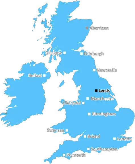
Leeds

Bridgewater Place and Leeds City Centre.

UK Map

Leeds (LS) Postcode Area

Leeds: Vibrant city, historic industrial roots, diverse cultural scene, thriving nightlife, and a hub of shopping and dining. A city that blends history with modernity in Yorkshire.

Leeds Postcode Area includes:

Leeds, Otley, Wetherby, Tadcaster, Pudsey, Ilkley.


Discover everything you need to know about Leeds with PostcodeArea. Scroll down to uncover demographics, property prices, crime stats, amenities and more.

Most Desirable Postcodes

Here are the top 10 most desirable postcode areas in Leeds (LS), based on a unique scoring system that weighs key factors like safety, schools, diversity, and affordability.

Whether you're a renter, homebuyer, or property investor, this tool lets you customise the score to focus on what matters most to you, helping you make smarter, data-driven decisions.

How are Desirability Scores calculated?

Our custom algorithm calculates a unique "Desirability Score" for any UK postcode by analysing a range of factors - including Census 2021 data, third-party insights, and socio-economic knowledge, to provide a tailored rating.
Explain more

Top Postcodes in "LS"

Postcode Score
LS8 2AA
8.8
LS8 1AA
8.8
LS16 8AA
8.2
LS16 7AA
8.0
LS27 7AA
8.0
LS29 7AA
8.0
LS15 8AB
8.0
LS24 8AA
8.0
LS8 5AA
8.0
LS3 1AA
7.9

Bottom Postcodes in "LS"

Postcode Score
LS6 1AA
6.3
LS14 5AA
6.2
LS12 5AA
6.2
LS17 8AA
6.2
LS9 1AA
6.2
LS14 2AA
6.2
LS5 3AB
6.2
LS14 9AD
6.2
LS2 9AA
6.2
LS22 7AD
6.0

Primary Industries

What makes Leeds tick? Find out with this list of the four dominant industries shaping the business landscape in this area.

Professional

Professional & Scientific

Leeds has a large proportion of professional and scientific businesses, which makes it a hub for specialised industries like law firms, consulting agencies, tech companies, or research labs. This suggests a high level of expertise and innovation, attracting professionals such as engineers, scientists, lawyers, and consultants. The Leeds area might have a more polished, business-focused atmosphere, with modern offices and co-working spaces. It's often well-connected, with good transport links and amenities to support a skilled workforce. Property prices could be higher, as these areas tend to attract well-paid professionals. It might not be the most vibrant or social place, but it will have a reputation for being smart, efficient, and future-focused.

Construction

Construction

Leeds has a strong presence of construction businesses, which usually means there's a lot of building going on - whether it's new homes, commercial spaces, or infrastructure. This can be a good sign that the Leeds area is growing and attracting investment. It could also mean there's a strong local economy, with plenty of work available for builders and tradespeople. On the flip side, it might suggest there's a fair bit of property in need of repair or updating. Either way, it tells you the Leeds area is pretty active and could be on the up.

Retail

Retail

Leeds area has a large quantity of retail businesses, making it a busy, commercial hub where people go to shop and socialise. High streets, shopping centres, and independent boutiques often thrive in these areas, making it a convenient place for residents and visitors alike. The presence of retail businesses can indicate that the local economy is fairly strong, with plenty of footfall and a demand for goods and services. This kind of area tends to have good transport links and a lively atmosphere, but it can also mean a bit more hustle and bustle, especially during weekends and sales events. If you're living in Leeds, it's handy for convenience, but it could also bring a lot of traffic and noise during peak shopping hours.

Business

Business Administration

If a postcode area such as LS has a lot of business administration services, such as accounting firms, HR consultancies, and management services, it's likely a centre for corporate and operational support. These businesses help other companies run smoothly, so the area might be more business-centric, attracting professionals like administrators, accountants, and consultants. The local economy could be quite strong, driven by a steady demand for services that keep companies ticking over. It's not necessarily the most exciting or creative environment, but it would be efficient, organised, and perhaps well-connected with reliable transport links. You'd expect to see a lot of office spaces in Leeds and maybe even shared workspaces catering to small and medium-sized businesses. The area could feel more formal and professional, with less of a residential or leisure focus.


Data showing the activity, size and location is from the Inter Departmental Business Register 2024, produced by the ONS.

Key Statistics

Leeds LS, part of the ceremonial county of West Yorkshire in England, presents a substantial geographical area with 29 outward codes (the first half of a postcode, e.g. LS 1AA). Its population stands at 835,922 individuals, reflecting a density of 3,217 people per square kilometre. The average household income here is £43,548 , which is 24.4% higher than the average UK median household income (£35,000), indicating a stable economic profile within the region.

Leeds LS - Postcode

Postcode Area

LS

Leeds

Leeds LS - Outward Codes

Total Outward Codes

29

Postcodes

Leeds LS - Population

Population

835,922

People

Leeds LS - Population Density

Population Density

3,217

People/km2

Leeds LS - Income

Average Income

£43,548

Per household

What's Leeds like to live and work in?

Leeds LS Photograph

Bridgewater Place and Leeds City Centre.

Adobe Stock

Leeds, a major city in West Yorkshire, has a population of around 800,000. The housing market is diverse, offering city centre apartments in developments like Leeds Dock, Victorian terraces in areas like Headingley, and suburban family homes in Roundhay and Horsforth.

Affordable housing is available in districts such as Armley and Beeston, while more upscale options can be found in neighborhoods like Alwoodley and Chapel Allerton.

Leeds benefits from excellent transport links, including the M1 and M62 motorways, and direct rail services to London.

This page contains a list of postcode districts for Leeds area. Select a postcode to see the map location, demographics, house prices, local information, tourist guides and statistics:

Leeds (LS) Postcode Districts

Leeds LS postcode area contains 29 postcode districts within its boundary.

Click on an outward postal code (the first half of a postcode, i.e. LS*) to explore information about the area.

House Prices in Leeds

How are property price trends?

The ONS (Office for National Statistics) regularly tracks and records average house prices and rents in this area (E08000035). Note that these estimates are based on local authority rather than postcode area. For more information about current house prices, choose an individual postcode below.

West Yorkshire

The wider county

Read more about West Yorkshire
West Yorkshire Photo

Local Transport

Transport in the LS Postal Area

The LS postal area, covering Leeds and its surroundings, offers an array of transport options making your commute and travels convenient. The region is well-served by rail, with Leeds City Station being a major hub connecting you to London, Manchester, and beyond. Smaller local stations also link surrounding neighbourhoods efficiently.

If you're travelling by air, Leeds Bradford Airport is just a short drive away, offering flights to various domestic and international destinations—perfect for both business trips and holidays.

For those commuting by car, the LS area has excellent road connections, including the M1 and M62 motorways, ensuring smooth travel to nearby cities and towns. Plus, the city centre offers ample parking facilities.

Buses are a reliable and frequent option, with numerous routes running through the area, connecting suburbs to the city. Leeds also has an expanding network of cycle lanes, ideal for eco-conscious commuters.

Train Stations

The following railway stations are within the LS postcode region:

Primary Destinations
Approx Journey Times

Ben Rhydding Railway Station

Northern Rail
Ben Rhydding
to Leeds - 40 mins
to Ilkley - 5 mins)
Leeds
to York - 25 mins
to Manchester - 1 hr)
York
to Edinburgh - 2 hrs
to London - 2 hrs 10 mins)

Bramley (West Yorkshire) Railway Station

Northern Rail
Leeds
6 mins
Bramley
13 mins
New Pudsey
17 mins
Bradford Interchange
25 mins

Burley Park Railway Station

Northern Rail
Leeds
5mins
Burley Park
8mins
Headingley
12mins
Horsforth
19mins
Ilkley
35mins

Burley-In-Wharfedale Railway Station

Northern Rail
Burley-In-Wharfedale Train Station
Menston Train Station
5 mins
Guiseley Train Station
10 mins
Leeds Train Station
20 mins

Church Fenton Railway Station

Northern Rail
Leeds
20 mins
Church Fenton
40 mins
York
1 hr
Doncaster
1 hr 30 mins
London King's Cross
2 hrs 30 mins

Cottingley Railway Station

Northern Rail
Cottingley Train Station
Leeds
15mins
Shipley
20mins
Bradford Forster Square
25mins
Keighley
35mins
Skipton
50mins

Cross Gates Railway Station

Northern Rail
Cross Gates
Garforth
5 mins
Leeds
15 mins
Wakefield
30 mins
Doncaster
1 hr

East Garforth Railway Station

Northern Rail
Leeds
8mins
Micklefield
3mins
Church Fenton
11mins
Ulleskelf
15mins
York
23mins

Garforth Railway Station

Northern Rail
Garforth
Leeds
Cross Gates
Leeds
East Garforth
Leeds
Micklefield
Leeds
Church Fenton
Leeds
Ulleskelf
Leeds
Sherburn-in-Elmet
Leeds
South Milford
Leeds
Hambleton
Leeds
Selby
Leeds
Burn
Leeds

Guiseley Railway Station

Northern Rail
Guiseley
Shipley
6 mins
Bradford Forster Square
15 mins
Leeds
30 mins

Headingley Railway Station

Northern Rail
Leeds
6mins
Burley Park
9mins
Headingley
12mins
Kirkstall Forge
16mins
Apperley Bridge
24mins
Shipley
29mins
Saltaire
32mins
Bingley
39mins
Keighley
51mins
Skipton
1hr 6mins

Horsforth Railway Station

Northern Rail
Leeds
12 mins
Headingley
5 mins
Burley Park
8 mins
Kirkstall Forge
11 mins
Apperley Bridge
15 mins
Shipley
18 mins
Frizinghall
22 mins
Bradford Forster Square
24 mins
Bradford Interchange
26 mins

Ilkley Railway Station

Northern Rail
Ilkley
to Leeds
33 mins)
Ben Rhydding
to Leeds
36 mins)
Burley-in-Wharfedale
to Leeds
41 mins)
Menston
to Leeds
42 mins)
Guiseley
to Leeds
46 mins)
Kirkstall Forge
to Leeds
30 mins)
Headingley
to Leeds
22 mins)

Leeds Railway Station

Network Rail
Leeds
0
Wakefield Westgate
15mins
Sheffield
1hr
London Kings Cross
2hrs 15mins

Menston Railway Station

Northern Rail
Bradford Forster Square
20 mins
Ilkley
4 mins
Leeds
30 mins
Skipton
17 mins

Micklefield Railway Station

Northern Rail
Leeds
5mins
Garforth
10mins
York
30mins
Hull
1hr 30mins

Morley Railway Station

Northern Rail
Leeds
5 mins
Cottingley
9 mins
Morley Train Station
12 mins

New Pudsey Railway Station

Northern Rail
New Pudsey
Leeds
10 mins
Bradford Interchange
20 mins
Halifax
35 mins
Huddersfield
50 mins
Manchester Victoria
1 hr 30 mins

Sherburn-In-Elmet Railway Station

Northern Rail
Sherburn-In-Elmet Train Station
Church Fenton Train Station
5mins
Micklefield Train Station
15mins
Leeds Train Station
30mins

South Milford Railway Station

Northern Rail
Leeds
18 mins
Micklefield
5 mins
South Milford
3 mins
Church Fenton
4 mins
York
22 mins

Ulleskelf Railway Station

Northern Rail
Ulleskelf
Church Fenton
4 mins
Sherburn-in-Elmet
7 mins
South Milford
10 mins
Hambleton West Junction
16 mins
Micklefield
21 mins
Cross Gates
28 mins
Leeds
34 mins

Weeton Railway Station

Northern Rail
Weeton Train Station
0 mins
Headingley Train Station
18 mins
Leeds Train Station
24 mins
Dewsbury Train Station
46 mins
Huddersfield Train Station
1 hr 2 mins
Manchester Victoria Train Station
1 hr 25 mins

Woodlesford Railway Station

Northern Rail
Leeds
10 mins
Woodlesford
20 mins
Castleford
30 mins
Knottingley
45 mins
Goole
1 hr
Howden
1 hr 15 mins
Selby
1 hr 30 mins

Local Authorities

LS Postcode area

Local Authorities are government organisations responsible for providing local services and facilities such as education, housing, and social services within a specific area. The LS postcode area includes the following local authorities:

Bradford

Bradford Metropolitan District Council serves the diverse city of Bradford, focusing on urban renewal, economic development, and providing comprehensive public services to support community well-being and enhance residents' quality of life.

Bradford Metropolitan District Council Website

Craven

Craven District Council governs the district of Craven, focusing on rural development, economic growth, and providing extensive public services to support community well-being and enhance residents' quality of life.

Craven District Council Website

Harrogate

Harrogate Borough Council serves the borough of Harrogate, focusing on urban regeneration, economic development, and providing high-quality public services to support community well-being and enhance residents' quality of life.

Harrogate Borough Council Website

+ 3 more

Harrogate

Leeds

Selby

Wakefield

View all Local Authorities

GDP (Gross Domestic Product)

Economic Output

GDP (Gross Domestic Product) measures the total economic output of a country, region, or Local Authority. It tells us how much money is being made within a particular area. This includes everything from a business selling cars or consumers getting their hair cut.

This list of the Local Authorities within the Leeds (LS) postcode town gives us a snapshot of how much money is being generated at current market prices, based on what people are spending and earning. It's an important way to understand the economic health and activity levels across the UK.

For comparison purposes, we've included the top and bottom two local authorities across the UK in terms of GDP.

Local Authority

GDP (£)

City of London
£99,277
Westminster
£92,008
Bradford
£13,067
Na h Eileanan Siar
£674
Isles of Scilly
£86

GDP trends over time

The graph below shows the total GDP values for all Local Authorities within the Leeds (LS) area:

When we talk about GDP at current market prices, we're looking at the total value of all goods and services produced in an area, but the key bit here is "current market prices." This means it includes the value of goods and services as they're bought and sold right now, without adjusting for inflation or changes in prices over time.

So, for example a figure of £1,529 GDP means that, on average, each person within an area contributes this amount to the UK economy each year.

Republished from the ONS regional gross domestic product: local authorities under the Open Government Licence v3.0. Latest available data: April 2022.

Education

Highest Rated Schools in LS

As rated by Ofsted

Mortgage Calculator

This tool helps you quickly understand your potential mortgage payments, making it easier to plan your finances.

To use the mortgage calculator, simply enter the loan amount you wish to borrow in pounds (£), the annual interest rate as a percentage (%), and the loan term in years. Click the "Calculate" button to see your estimated monthly payment.

PostcodeArea Screenshots of Data

Unlock the full power of postcode insights.

Data is meaningless without context. Reveal the stories behind a neighbourhood, and make smarter decisions with data you can trust. Gain unlimited access to detailed statistics, exclusive reports, and essential tools.

PostcodeArea is grateful to our sponsors for their support.

  • Greens Water Systems
  • Alamin Media
  • Takeaway Tree
  • Yark Beds
  • Soccerbox
  • Gamechanger Consultancy

Share this page