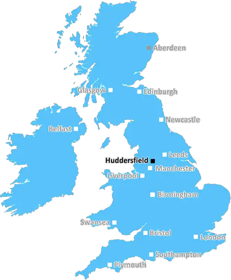
Huddersfield Town Football Club and Huddersfield Giants Rugby Club, HD1 6PG
Huddersfield: Industrial heritage, vibrant market town, stunning Victorian architecture, scenic Pennine views, and a strong community spirit. A town blending history, culture, and natural beauty in West Yorkshire.
Huddersfield, Brighouse, Holmfirth.
Discover everything you need to know about Huddersfield with PostcodeArea. Scroll down to uncover demographics, property prices, crime stats, amenities and more.
Here are the top 10 most desirable postcode areas in Huddersfield (HD), based on a unique scoring system that weighs key factors like safety, schools, diversity, and affordability.
Whether you're a renter, homebuyer, or property investor, this tool lets you customise the score to focus on what matters most to you, helping you make smarter, data-driven decisions.
Our custom algorithm calculates a unique "Desirability Score" for any UK postcode by analysing a range of factors - including Census 2021 data, third-party insights, and socio-economic knowledge, to provide a tailored rating.
Explain more
What makes Huddersfield tick? Find out with this list of the four dominant industries shaping the business landscape in this area.
Huddersfield has a strong presence of construction businesses, which usually means there's a lot of building going on - whether it's new homes, commercial spaces, or infrastructure. This can be a good sign that the Huddersfield area is growing and attracting investment. It could also mean there's a strong local economy, with plenty of work available for builders and tradespeople. On the flip side, it might suggest there's a fair bit of property in need of repair or updating. Either way, it tells you the Huddersfield area is pretty active and could be on the up.
Huddersfield has a large proportion of professional and scientific businesses, which makes it a hub for specialised industries like law firms, consulting agencies, tech companies, or research labs. This suggests a high level of expertise and innovation, attracting professionals such as engineers, scientists, lawyers, and consultants. The Huddersfield area might have a more polished, business-focused atmosphere, with modern offices and co-working spaces. It's often well-connected, with good transport links and amenities to support a skilled workforce. Property prices could be higher, as these areas tend to attract well-paid professionals. It might not be the most vibrant or social place, but it will have a reputation for being smart, efficient, and future-focused.
Huddersfield area has a large quantity of retail businesses, making it a busy, commercial hub where people go to shop and socialise. High streets, shopping centres, and independent boutiques often thrive in these areas, making it a convenient place for residents and visitors alike. The presence of retail businesses can indicate that the local economy is fairly strong, with plenty of footfall and a demand for goods and services. This kind of area tends to have good transport links and a lively atmosphere, but it can also mean a bit more hustle and bustle, especially during weekends and sales events. If you're living in Huddersfield, it's handy for convenience, but it could also bring a lot of traffic and noise during peak shopping hours.
When postcode areas like Huddersfield have a lot of production industries, like manufacturing plants or factories, it usually means the area has a strong industrial base. These businesses are often linked to making goods, whether it's food, machinery, or consumer products. The presence of production industries suggests there's a lot of local employment in manufacturing or skilled trades, and the area is likely to be well-connected by transport links to move goods in and out efficiently. While it might be great for jobs and the local economy, the area could feel more functional and less residential, with a focus on industry rather than community life. It might also be a bit noisier or busier due to the nature of the work, especially during the day.
Major employers and businesses in the HD postcode area include:
Leisure and Fitness, Huddersfield
Manages sports and leisure facilities across the Kirklees district.
Postcode Location: HD1
Financial Services, Huddersfield
Provides a wide range of banking and financial services to personal and business customers.
Postcode Location: HD1
Postal Services, Huddersfield
The UK’s designated universal postal service provider, delivering mail and parcels.
Postcode Location: HD1
Transportation, Huddersfield
Operates bus services connecting Huddersfield with other towns and cities in Yorkshire.
Postcode Location: HD1
Transportation, Huddersfield
Provides bus services across West Yorkshire, including routes in Huddersfield.
Postcode Location: HD1
Transportation, Huddersfield
Operates bus services in South and West Yorkshire, serving Huddersfield and surrounding areas.
Postcode Location: HD1
Data showing the activity, size and location is from the Inter Departmental Business Register 2024, produced by the ONS.
Huddersfield HD, part of the ceremonial county of West Yorkshire in England, presents a substantial geographical area with 9 outward codes (the first half of a postcode, e.g. HD 1AA). Its population stands at 266,048 individuals, reflecting a density of 1,926 people per square kilometre. The average household income here is £39,495 , which is 12.8% higher than the average UK median household income (£35,000), indicating a stable economic profile within the region.
Huddersfield
Postcodes
People
People/km2
Per household
Huddersfield Town Football Club and Huddersfield Giants Rugby Club, HD1 6PG
Adobe Stock
Huddersfield, located in West Yorkshire, is a vibrant town known for its industrial heritage and lively community. Within the HD postcode area, Huddersfield is home to around 165,000 residents.
The town features notable landmarks such as the historic Victoria Tower on Castle Hill and the University of Huddersfield, which brings a youthful energy to the area.
The local economy thrives on education, manufacturing, and retail. Excellent transport links, including the M62 motorway and regular train services, make Huddersfield easily accessible.
This page contains a list of postcode districts for Huddersfield area. Select a postcode to see the map location, demographics, house prices, local information, tourist guides and statistics:
The HD postal area, centred around Huddersfield in West Yorkshire, offers a variety of transport options making it a convenient location for commuters and travellers alike.
Huddersfield railway station is a key hub with regular services to major cities like Leeds, Manchester, and Liverpool. The station is well-connected, providing easy access to both local and long-distance destinations.
The area boasts an extensive bus network, operated primarily by First West Yorkshire. Frequent services connect residential neighbourhoods with Huddersfield town centre and beyond, making local travel straightforward and efficient.
For car commuters, the M62 motorway is just a short drive away, linking the HD area to Greater Manchester and West Yorkshire. Local roads are well-maintained, ensuring smooth travels within the region.
Leeds Bradford Airport is the nearest major airport, just under an hour’s drive from Huddersfield. Manchester Airport, approximately a 75-minute drive away, offers a broader range of international flights.
The following railway stations are within the HD postcode region:
Local Authorities are government organisations responsible for providing local services and facilities such as education, housing, and social services within a specific area. The HD postcode area includes the following local authorities:
Barnsley Metropolitan Borough Council serves the vibrant community of Barnsley, focusing on urban regeneration, economic development, and providing extensive public services to support community well-being and enhance residents' quality of life.
Calderdale Council manages a diverse urban area, focusing on urban renewal, cultural enrichment, and providing high-quality public services to support community well-being and enhance residents' quality of life.
Kirklees Council serves the dynamic area of Kirklees, focusing on urban regeneration, economic growth, and providing comprehensive public services to support community well-being and enhance residents' quality of life.
GDP (Gross Domestic Product) measures the total economic output of a country, region, or Local Authority. It tells us how much money is being made within a particular area. This includes everything from a business selling cars or consumers getting their hair cut.
This list of the Local Authorities within the Huddersfield (HD) postcode town gives us a snapshot of how much money is being generated at current market prices, based on what people are spending and earning. It's an important way to understand the economic health and activity levels across the UK.
For comparison purposes, we've included the top and bottom two local authorities across the UK in terms of GDP.
The graph below shows the total GDP values for all Local Authorities within the Huddersfield (HD) area:
When we talk about GDP at current market prices, we're looking at the total value of all goods and services produced in an area, but the key bit here is "current market prices." This means it includes the value of goods and services as they're bought and sold right now, without adjusting for inflation or changes in prices over time.
So, for example a figure of £1,107 GDP means that, on average, each person within an area contributes this amount to the UK economy each year.
Republished from the ONS regional gross domestic product: local authorities under the Open Government Licence v3.0. Latest available data: April 2022.
As rated by Ofsted
Towngate, Brighouse, HD6 4HP
Primary School (4-11)
Carr Green Lane, Brighouse, HD6 3LT
Primary School (3-11)
Waterloo Road, Brighouse, HD6 2AN
Primary School (7-11)
Boothroyd, Brighouse, HD6 3JW
Secondary School (5-19)
Lower Edge Road, Brighouse, HD6 3LD
Primary School (4-11)
Blacker Road, Huddersfield, HD1 5HQ
Primary School (3-7)
Huddersfield Road, Huddersfield, HD8 8NL
Secondary School (13-18)
Bow Street, Huddersfield, HD1 4BJ
Primary School (3-11)
School Lane, Huddersfield, HD8 9RT
Primary School (4-10)
Newsome Road South, Huddersfield, HD4 6JL
Secondary School (3-19)
Data is meaningless without context. Reveal the stories behind a neighbourhood, and make smarter decisions with data you can trust. Gain unlimited access to detailed statistics, exclusive reports, and essential tools.
PostcodeArea is grateful to our sponsors for their support.