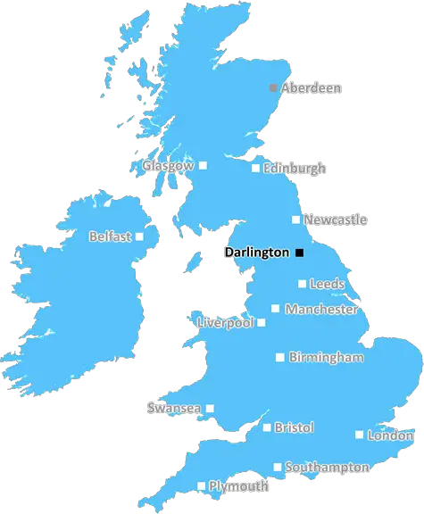
Raby Castle and Deer Park, Staindrop, Darlington DL2 3AH
Darlington: Railway heritage, Victorian architecture, bustling market town, scenic riverside, and a warm community spirit. A historic gem in County Durham.
Darlington, Shildon, Newton Aycliffe, Northallerton, Bedale, Hawes, Leyburn, Catterick Garrison, Richmond, Barnard Castle, Bishop Auckland, Crook, Spennymoor, Ferryhill.
Discover everything you need to know about Darlington with PostcodeArea. Scroll down to uncover demographics, property prices, crime stats, amenities and more.
Here are the top 10 most desirable postcode areas in Darlington (DL), based on a unique scoring system that weighs key factors like safety, schools, diversity, and affordability.
Whether you're a renter, homebuyer, or property investor, this tool lets you customise the score to focus on what matters most to you, helping you make smarter, data-driven decisions.
Our custom algorithm calculates a unique "Desirability Score" for any UK postcode by analysing a range of factors - including Census 2021 data, third-party insights, and socio-economic knowledge, to provide a tailored rating.
Explain more
Explore the key industries that define the Darlington postcode area! These top four sectors give a snapshot of what drives the local economy and keeps things moving.
The prevalance of agricultural industries (including forestry and fishing) in Darlington suggests this is a lively and creative postcode sector. These kinds of businesses tend to pop up in areas that are known for their cultural scene, where people value things like theatres, galleries, music venues, and independent cinemas. It could mean the area attracts a mix of creatives, young professionals, and tourists, making it a vibrant and potentially trendy spot. This could also be a sign of a more laid-back, community-focused vibe, with lots of local events and activities in and around Darlington. It might push property prices up if the area becomes particularly popular, but it's also a good indicator of a strong local identity and a thriving social scene.
Darlington has a strong presence of construction businesses, which usually means there's a lot of building going on - whether it's new homes, commercial spaces, or infrastructure. This can be a good sign that the Darlington area is growing and attracting investment. It could also mean there's a strong local economy, with plenty of work available for builders and tradespeople. On the flip side, it might suggest there's a fair bit of property in need of repair or updating. Either way, it tells you the Darlington area is pretty active and could be on the up.
Darlington has a large proportion of professional and scientific businesses, which makes it a hub for specialised industries like law firms, consulting agencies, tech companies, or research labs. This suggests a high level of expertise and innovation, attracting professionals such as engineers, scientists, lawyers, and consultants. The Darlington area might have a more polished, business-focused atmosphere, with modern offices and co-working spaces. It's often well-connected, with good transport links and amenities to support a skilled workforce. Property prices could be higher, as these areas tend to attract well-paid professionals. It might not be the most vibrant or social place, but it will have a reputation for being smart, efficient, and future-focused.
When postcode areas have a lot of accommodation and food businesses, areas like Darlington are a popular spot for visitors or tourists, or it could be a bustling community with a strong local hospitality scene. You'd expect to find hotels, B&Bs, restaurants, cafes, and maybe a few pubs or bars, creating a vibrant atmosphere, especially during peak seasons or weekends. It's the kind of area where people come to relax, socialise, or enjoy a good meal out, making it feel welcoming and lively. This could boost property demand if it's a desirable place to live or visit, but it might also mean the area gets busier, especially if Darlington is a tourist hotspot. It gives the impression of a friendly, service-oriented place where people come to enjoy themselves.
Major employers and businesses in the DL postcode area include:
Further Education, Darlington
A provider of vocational training, apprenticeships, and adult education in the Darlington area.
Postcode Location: DL1
Higher Education, Darlington
A university offering a range of undergraduate and postgraduate courses, with a campus in Darlington.
Postcode Location: DL1
Marine Services & Engineering, Darlington
Provides subsea services for the oil and gas, offshore wind, and telecommunications industries.
Postcode Location: DL1
Manufacturing & Engineering, Darlington
A global leader in the design and manufacturing of engines and power solutions, with a large plant in Darlington.
Postcode Location: DL1
Engineering & Construction, Darlington
Provides engineering services in the energy and oil & gas sectors, specialising in storage tanks and pressure vessels.
Postcode Location: DL1
Data showing the activity, size and location is from the Inter Departmental Business Register 2024, produced by the ONS.
Darlington DL, part of the ceremonial county of Durham in England, presents a substantial geographical area with 17 outward codes (the first half of a postcode, e.g. DL 1AA). Its population stands at 363,985 individuals, reflecting a density of 1,266 people per square kilometre. The average household income here is £39,459 , which is 12.7% higher than the average UK median household income (£35,000), indicating a stable economic profile within the region.
Darlington
Postcodes
People
People/km2
Per household
Raby Castle and Deer Park, Staindrop, Darlington DL2 3AH
Adobe Stock
Nestled in the heart of County Durham, Darlington is a vibrant town known for its rich railway history and welcoming community.
With a postcode area of DL, Darlington boasts a diverse population of around 100,000 residents. This charming town blends historical architecture with modern amenities, making it a delightful place to live and visit. The River Skerne flows gracefully through, adding natural beauty to its urban landscape. Economically, Darlington thrives on a mix of retail, manufacturing, and services sectors.
This page contains a list of postcode districts for Darlington area. Select a postcode to see the map location, demographics, house prices, local information, tourist guides and statistics:
The ONS (Office for National Statistics) regularly tracks and records average house prices and rents in this area (E06000005). Note that these estimates are based on local authority rather than postcode area. For more information about current house prices, choose an individual postcode below.
Whilst Durham town is a well deserving highlight of County Durham, it is by no means the only reason to visit. County Durham is an unspoiled northern county, defined by the calm ochre uplands of Teesdale and the empty but inspiring northern Pennines. A county of charming, gentle villages and bustling independent market towns, rich in produce and rich in history.
It is a county with an industrial heritage and its economy used to be almost completely based around iron and coal. Now however, it is a popular tourist destination with a World Heritage Site (Durham Castle and Cathedral) at its heart. Stretching from the North Sea Coast in the east to the North Pennines in the west, the county of Durham is bordered by Northumberland, Cumbria, Yorkshire and Tyne and Wear.
Read more about DurhamConsidering a move to the DL postal area? You’ll be pleased to know there are plenty of transport options to suit your needs.
The DL area boasts several railway stations, including Darlington and Durham. These stations offer excellent connections to major cities like London, Newcastle, and Edinburgh, making commuting or leisure trips straightforward.
If air travel is essential, Newcastle International Airport and Durham Tees Valley Airport are conveniently accessible. Both airports provide a variety of domestic and international flights, perfect for business or holidays.
For those who prefer to drive, the A1(M) motorway runs through the DL area, facilitating easy commutes to nearby cities. Additionally, the region’s road network is well-maintained, ensuring a smooth driving experience.
Public bus services are extensive, connecting most towns and villages within the DL postal area. Companies like Arriva and Go North East provide reliable and frequent routes, ensuring you can travel around with ease.
The following railway stations are within the DL postcode region:
Local Authorities are government organisations responsible for providing local services and facilities such as education, housing, and social services within a specific area. The DL postcode area includes the following local authorities:
County Durham County Council focuses on rural development, heritage preservation, and providing comprehensive public services to enhance residents' quality of life in this picturesque region.
Darlington Borough Council promotes economic growth, urban development, and provides high-quality public services to support community well-being and enhance residents' quality of life in this vibrant town.
Eden District Council is committed to rural development, environmental preservation, and providing extensive public services to enhance residents' quality of life in this scenic district.
GDP (Gross Domestic Product) measures the total economic output of a country, region, or Local Authority. It tells us how much money is being made within a particular area. This includes everything from a business selling cars or consumers getting their hair cut.
This list of the Local Authorities within the Darlington (DL) postcode town gives us a snapshot of how much money is being generated at current market prices, based on what people are spending and earning. It's an important way to understand the economic health and activity levels across the UK.
For comparison purposes, we've included the top and bottom two local authorities across the UK in terms of GDP.
The graph below shows the total GDP values for all Local Authorities within the Darlington (DL) area:
When we talk about GDP at current market prices, we're looking at the total value of all goods and services produced in an area, but the key bit here is "current market prices." This means it includes the value of goods and services as they're bought and sold right now, without adjusting for inflation or changes in prices over time.
So, for example a figure of £1,414 GDP means that, on average, each person within an area contributes this amount to the UK economy each year.
Republished from the ONS regional gross domestic product: local authorities under the Open Government Licence v3.0. Latest available data: April 2022.
As rated by Ofsted
New Biggin Lane, Darlington, DL2 2UH
Secondary School (8-18)
Prospect Place, Barnard Castle, DL12 8HH
Secondary School (11-18)
Rock Road, Spennymoor, DL16 7DB
Secondary School (11-19)
Front Street, Spennymoor, DL16 6TJ
Primary School (4-11)
The Headlands, Darlington, DL3 8RW
Secondary School (11-18)
Gibson Street, Bishop Auckland, DL14 8DY
Primary School (2-11)
Cotherstone, Barnard Castle, DL12 9QB
Primary School (3-11)
Front Street, Ferryhill, DL17 9AL
Primary School (3-11)
South View, Spennymoor, DL16 7JB
Primary School (4-11)
High Street, Ferryhill, DL17 9HP
Primary School (2-11)
Data is meaningless without context. Reveal the stories behind a neighbourhood, and make smarter decisions with data you can trust. Gain unlimited access to detailed statistics, exclusive reports, and essential tools.
PostcodeArea is grateful to our sponsors for their support.