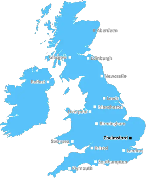
Chelmsford

Chelmsford Essex UK Aerial

UK Map

Chelmsford (CM) Postcode Area

Chelmsford: Essex's county town, historic cathedral, green spaces, vibrant shopping, and a growing cultural scene. A blend of heritage and modernity.

Chelmsford Postcode Area includes:

Burnham On Crouch, Chelmsford, Ingatestone, Ongar, Dunmow, Braintree, Witham, Maldon, Billericay, Brentwood, Epping, Harlow, Sawbridgeworth, Bishop's Stortford, Stansted.


Discover everything you need to know about Chelmsford with PostcodeArea. Scroll down to uncover demographics, property prices, crime stats, amenities and more.

Most Desirable Postcodes

Here are the top 10 most desirable postcode areas in Chelmsford (CM), based on a unique scoring system that weighs key factors like safety, schools, diversity, and affordability.

Whether you're a renter, homebuyer, or property investor, this tool lets you customise the score to focus on what matters most to you, helping you make smarter, data-driven decisions.

How are Desirability Scores calculated?

Our custom algorithm calculates a unique "Desirability Score" for any UK postcode by analysing a range of factors - including Census 2021 data, third-party insights, and socio-economic knowledge, to provide a tailored rating.
Explain more

Top Postcodes in "CM"

Postcode Score
CM1 7AA
7.9
CM23 4AA
7.8
CM77 7AA
7.8
CM7 8ZZ
7.6
CM7 9AA
7.6
CM1 6AF
7.6
CM7 1AA
7.5
CM99 2AA
7.5
CM1 5ZW
7.4
CM77 6AB
7.4

Bottom Postcodes in "CM"

Postcode Score
CM20 1AA
5.8
CM16 5AA
5.7
CM17 0AA
5.5
CM16 6AA
5.4
CM14 5AA
5.4
CM6 4FU
5.4
CM15 9AA
4.6
CM1 9AA
3.3
CM99 1AB
3.3
CM1 1AA
3.3

Primary Industries

Explore the key industries that define the Chelmsford postcode area! These top four sectors give a snapshot of what drives the local economy and keeps things moving.

Professional

Professional & Scientific

Chelmsford has a large proportion of professional and scientific businesses, which makes it a hub for specialised industries like law firms, consulting agencies, tech companies, or research labs. This suggests a high level of expertise and innovation, attracting professionals such as engineers, scientists, lawyers, and consultants. The Chelmsford area might have a more polished, business-focused atmosphere, with modern offices and co-working spaces. It's often well-connected, with good transport links and amenities to support a skilled workforce. Property prices could be higher, as these areas tend to attract well-paid professionals. It might not be the most vibrant or social place, but it will have a reputation for being smart, efficient, and future-focused.

Construction

Construction

Chelmsford has a strong presence of construction businesses, which usually means there's a lot of building going on - whether it's new homes, commercial spaces, or infrastructure. This can be a good sign that the Chelmsford area is growing and attracting investment. It could also mean there's a strong local economy, with plenty of work available for builders and tradespeople. On the flip side, it might suggest there's a fair bit of property in need of repair or updating. Either way, it tells you the Chelmsford area is pretty active and could be on the up.

Business

Business Administration

If a postcode area such as CM has a lot of business administration services, such as accounting firms, HR consultancies, and management services, it's likely a centre for corporate and operational support. These businesses help other companies run smoothly, so the area might be more business-centric, attracting professionals like administrators, accountants, and consultants. The local economy could be quite strong, driven by a steady demand for services that keep companies ticking over. It's not necessarily the most exciting or creative environment, but it would be efficient, organised, and perhaps well-connected with reliable transport links. You'd expect to see a lot of office spaces in Chelmsford and maybe even shared workspaces catering to small and medium-sized businesses. The area could feel more formal and professional, with less of a residential or leisure focus.

Information

Information & Communication

Chelmsford has a large percentage of Information & Communication businesses, making it a tech-savvy, modern, and highly connected place. These industries include IT services, telecommunications, media, and software development companies, so the area might have a strong digital infrastructure and attract tech professionals, creatives, and innovators. It suggests the Chelmsford area is dynamic and forward-thinking, often with a mix of startups and established firms working in cutting-edge fields like software, digital marketing, or broadcasting. You'll likely find a lot of modern office spaces, co-working hubs, and good transport links to support these businesses. The vibe could feel energetic and entrepreneurial, but also professional, with a focus on innovation and staying connected.


Major Employers

Major employers and businesses in the CM postcode area include:

Chelmsford City Council

Public Administration, Chelmsford

The local authority providing services to the Chelmsford district, including housing, planning, and community services.

Postcode Location: CM1

Essex County Council

Public Administration, Chelmsford

The local government authority responsible for providing public services across Essex, including education, social care, and transport.

Postcode Location: CM1

The A12 Partnership

Construction & Engineering, Chelmsford

Involved in the construction and improvement of infrastructure projects such as the A12 motorway.

Postcode Location: CM1

Anglia Ruskin University

Higher Education, Chelmsford

A modern university offering a range of undergraduate and postgraduate courses, with a campus in Chelmsford.

Postcode Location: CM1

e2v Technologies (Teledyne e2v)

Technology & Engineering, Chelmsford

A global provider of high-performance technology solutions in the aerospace, medical, and industrial sectors.

Postcode Location: CM1

Teledyne Defence & Space

Aerospace & Defence, Chelmsford

A division of Teledyne providing advanced technologies for space, defence, and communications.

Postcode Location: CM1

Show more employers

Data showing the activity, size and location is from the Inter Departmental Business Register 2024, produced by the ONS.

Key Statistics

Chelmsford CM, part of the ceremonial county of Essex in England, presents a substantial geographical area with 25 outward codes (the first half of a postcode, e.g. CM 1AA). Its population stands at 707,666 individuals, reflecting a density of 1,864 people per square kilometre. The average household income here is £51,242 , which is 46.4% higher than the average UK median household income (£35,000), indicating a stable economic profile within the region.

Chelmsford CM - Postcode

Postcode Area

CM

Chelmsford

Chelmsford CM - Outward Codes

Total Outward Codes

25

Postcodes

Chelmsford CM - Population

Population

707,666

People

Chelmsford CM - Population Density

Population Density

1,864

People/km2

Chelmsford CM - Income

Average Income

£51,242

Per household

What's Chelmsford like to live and work in?

Chelmsford CM Photograph

Chelmsford Essex UK Aerial

Adobe Stock

The CM postcode area covers the lively city of Chelmsford. In CM1 and CM2, you'll find the bustling city centre with its fantastic shopping, historic cathedral, and beautiful parks. Chelmsford's demographics feature a diverse mix of families, professionals, and students, fostering a vibrant community.

Located in Essex, Chelmsford offers excellent transport links, including direct trains to London and easy access to major roads. Chelmsford's blend of urban amenities and suburban charm makes it a great place to visit and live.

This page contains a list of postcode districts for Chelmsford area. Select a postcode to see the map location, demographics, house prices, local information, tourist guides and statistics:

Chelmsford (CM) Postcode Districts

Chelmsford CM postcode area contains 25 postcode districts within its boundary.

Click on an outward postal code (the first half of a postcode, i.e. CM*) to explore information about the area.

House Prices in Chelmsford

How are property price trends?

The ONS (Office for National Statistics) regularly tracks and records average house prices and rents in this area (E07000070). Note that these estimates are based on local authority rather than postcode area. For more information about current house prices, choose an individual postcode below.

Essex

The wider county

Essex offers everything from beautiful landscape to historic towns and buildings, and from cultural attractions to quiet medieval villages to well, yes, the 'kiss 'n' cuddle' of Southend-on-Sea. Get past the stereotype and there is a region waiting to be discovered and which should be as lauded as some of the more famous tourism destinations across the UK.

One of the home-counties, Essex sits on the Thames and looks out on the North Sea. It is to the north-east of Greater London and borders Hertfordshire to the west, Suffolk and Cambridgeshire to the north. The Essex landscape varies greatly making for some wonderful scenery, from jagged coastline and low salt marshes and streams to gently undulating pastoral countryside and farmland populated by sheep and cows.

Read more about Essex
Essex Photo

Local Transport

Rail

The CM postcode area is well-served by several railway stations, making it ideal for commuters and travellers alike. Key stations include Chelmsford, Braintree, and Witham, offering regular services to London Liverpool Street, Ipswich, and beyond. The reliable and frequent services ensure that London is just a short journey away.

Air

For international and domestic flights, residents have easy access to London Stansted Airport, which is just a short drive or train ride away. Stansted offers a plethora of flight options to destinations across Europe and further afield.

Commuting by Car

The CM area benefits from excellent road links. The A12, M11, and A120 provide quick routes to London, Colchester, and Cambridge. The well-maintained road network ensures that commuting by car is convenient and efficient.

Buses

Local bus services in the CM area are reliable and frequent. They connect towns such as Chelmsford, Braintree, and Harlow, making it simple to get around without a car. Services cater to both local and longer-distance travel, offering flexibility and convenience.

Train Stations

The following railway stations are within the CM postcode region:

Primary Destinations
Approx Journey Times

Althorne Railway Station

National Express East Anglia
Althorne Train Station
Burnham-on-Crouch Train Station
4 mins
Southminster Train Station
9 mins
Wickford Train Station
17 mins
Billericay Train Station
25 mins
Shenfield Train Station
41 mins
London Liverpool Street Train Station
1 hr 2 mins

Billericay Railway Station

National Express East Anglia
Shenfield
10 mins
Liverpool Street
35 mins

Bishops Stortford Railway Station

National Express East Anglia
Bishops Stortford
Harlow Town
9 mins
Stansted Mountfitchet
15 mins
Audley End
25 mins
Cambridge
1 hr.

Braintree Railway Station

National Express East Anglia
Witham
10 mins
Chelmsford
20 mins
Shenfield
45 mins
Stratford
1 hr
London Liverpool Street
1 hr 15 mins

Braintree Freeport Railway Station

National Express East Anglia
Braintree Freeport Train Station
Witham
10 mins
Chelmsford
25 mins
Stratford
1 hr
London Liverpool Street
1 hr 10 mins

Brentwood Railway Station

National Express East Anglia
Shenfield
5 mins
Harold Wood
10 mins
Gidea Park
15 mins
Romford
20 mins
Chadwell Heath
25 mins
Goodmayes
30 mins
Seven Kings
35 mins
Ilford
40 mins
Stratford
45 mins
Maryland
50 mins
Forest Gate
55 mins
Manor Park
1 hr
Ilford
1 hr 5 mins
Shenfield
1 hr 10 mins

Burnham-On-Crouch Railway Station

National Express East Anglia
Wickford
15 mins
South Woodham Ferrers
25 mins
North Fambridge
35 mins
Burnham-On-Crouch
45 mins

Chelmsford Railway Station

National Express East Anglia
London Liverpool Street
35 mins
Stratford
25 mins
Shenfield
10 mins
Colchester
30 mins
Ipswich
55 mins
Norwich
1 hr 50 mins

Cressing Railway Station

National Express East Anglia
Braintree
8 mins
White Notley
14 mins
Witham
20 mins
Chelmsford
38 mins
Shenfield
1hr 5 mins

Elsenham Railway Station

National Express East Anglia
Elsenham
London Liverpool Street - 50 mins
Stansted Airport
Cambridge - 30 mins
Audley End
London Liverpool Street - 1hr
Newport
Cambridge - 20 mins
Audley End
London Liverpool Street - 1hr 15 mins

Fambridge Railway Station

National Express East Anglia
Fambridge Train Station
0 mins
Battlesbridge Train Station
3 mins
South Woodham Ferrers Train Station
7 mins
North Fambridge Train Station
11 mins
Wickford Train Station
17 mins
Shenfield Train Station
34 mins
London Liverpool Street Train Station
55 mins

Harlow Mill Railway Station

National Express East Anglia
Harlow Town
2mins
Harlow Mill
5mins
Sawbridgeworth
10mins
Bishop's Stortford
15mins
Stansted Mountfitchet
20mins
Stansted Airport
25mins

Harlow Town Railway Station

National Express East Anglia
London Liverpool Street
30 mins
Stratford
20 mins
Sawbridgeworth
10 mins
Bishop's Stortford
15 mins
Stansted Mountfitchet
20 mins

Hatfield Peverel Railway Station

National Express East Anglia
Hatfield Peverel
Chelmsford
6 mins
Witham
15 mins
Colchester
25 mins
Ipswich
1 hr 10 mins

Ingatestone Railway Station

National Express East Anglia
London Liverpool Street
35 mins
Shenfield
5 mins
Chelmsford
12 mins
Colchester
30 mins
Ipswich
1 hr
Norwich
1 hr 50 mins

Roydon Railway Station

National Express East Anglia
London Liverpool Street
38mins
Harlow Town
7mins
Broxbourne
15mins
Cambridge
45mins
Stansted Airport
30mins
Bishops Stortford
24mins
Chelmsford
19mins
Ipswich
1hr 13mins

Sawbridgeworth Railway Station

National Express East Anglia
London Liverpool Street
45 mins
Stansted Airport
15 mins
Bishop's Stortford
5 mins
Harlow Town
10 mins
Broxbourne
15 mins

Shenfield Railway Station

National Express East Anglia
Shenfield
Romford
10 mins
Stratford
20 mins
Liverpool Street
30 mins

Southminster Railway Station

National Express East Anglia
Wickford
9mins
Hockley
16mins
Rayleigh
20mins
Rochford
26mins
Prittlewell
31mins
Southend Airport
35mins
Southend Victoria
39mins.

Stansted Airport Railway Station

National Express East Anglia
London Liverpool Street
50 mins
Tottenham Hale
35 mins
Stansted Airport
45 mins

Stansted Mountfitchet Railway Station

National Express East Anglia
London Liverpool Street
1hr
Harlow Town
10 mins
Stansted Mountfitchet
6 mins
Bishop's Stortford
11 mins

West Horndon Railway Station

c2c
West Horndon
to London Fenchurch Street - 35 mins
Upminster
to London Fenchurch Street - 25 mins
Barking
to London Fenchurch Street - 30 mins
West Ham
to London Fenchurch Street - 19 mins
Limehouse
to London Fenchurch Street - 15 mins
London Fenchurch Street
to West Horndon - 35 mins

White Notley Railway Station

National Express East Anglia
White Notley
to Witham - 9mins
Witham
to London Liverpool Street - 45mins
London Liverpool Street

Witham Railway Station

National Express East Anglia
Witham
0 mins
Chelmsford
15 mins
London Liverpool Street
1 hr 15 mins.

Woodham Ferrers Railway Station

National Express East Anglia
Woodham Ferrers Train Station
Southminster
30 mins
Wickford
15 mins
Shenfield
35 mins
London Liverpool Street
1 hr 5 mins

Local Authorities

CM Postcode area

Local Authorities are government organisations responsible for providing local services and facilities such as education, housing, and social services within a specific area. The CM postcode area includes the following local authorities:

Basildon

Basildon is a borough in Essex, known for being a post-war new town, designed to alleviate overpopulation in London. Today, it combines a mix of residential, industrial, and commercial zones, with key attractions like the Eastgate Shopping Centre and Festival Leisure Park, providing a diverse economy and community amenities.

Braintree

Located in Essex, Braintree is a historic market town with a rich heritage dating back to the Domesday Book. The district includes charming villages and the famous designer outlet, Braintree Village. The area is a blend of rural beauty and modern convenience, making it attractive for residents and visitors alike.

Brentwood

Brentwood is a suburban town in Essex, surrounded by open countryside and woodland. Known for its affluent areas and historic sites, such as the 12th-century Brentwood Cathedral, the town also hosts the popular reality TV series "The Only Way is Essex," which has increased its cultural profile.

+ 10 more

Brentwood

Camden

Chelmsford

Colchester

East Hertfordshire

Epping Forest

Harlow

Havering

Maldon

Thurrock

Uttlesford

View all Local Authorities

GDP (Gross Domestic Product)

Economic Output

GDP (Gross Domestic Product) measures the total economic output of a country, region, or Local Authority. It tells us how much money is being made within a particular area. This includes everything from a business selling cars or consumers getting their hair cut.

This list of the Local Authorities within the Chelmsford (CM) postcode town gives us a snapshot of how much money is being generated at current market prices, based on what people are spending and earning. It's an important way to understand the economic health and activity levels across the UK.

For comparison purposes, we've included the top and bottom two local authorities across the UK in terms of GDP.

Local Authority

GDP (£)

City of London
£99,277
Westminster
£92,008
Basildon
£8,011
Braintree
£4,666
Brentwood
£3,683
Na h Eileanan Siar
£674
Isles of Scilly
£86

GDP trends over time

The graph below shows the total GDP values for all Local Authorities within the Chelmsford (CM) area:

When we talk about GDP at current market prices, we're looking at the total value of all goods and services produced in an area, but the key bit here is "current market prices." This means it includes the value of goods and services as they're bought and sold right now, without adjusting for inflation or changes in prices over time.

So, for example a figure of £2,504 GDP means that, on average, each person within an area contributes this amount to the UK economy each year.

Republished from the ONS regional gross domestic product: local authorities under the Open Government Licence v3.0. Latest available data: April 2022.

Education

Highest Rated Schools in CM

As rated by Ofsted

Mortgage Calculator

This tool helps you quickly understand your potential mortgage payments, making it easier to plan your finances.

To use the mortgage calculator, simply enter the loan amount you wish to borrow in pounds (£), the annual interest rate as a percentage (%), and the loan term in years. Click the "Calculate" button to see your estimated monthly payment.

PostcodeArea Screenshots of Data

Unlock the full power of postcode insights.

Data is meaningless without context. Reveal the stories behind a neighbourhood, and make smarter decisions with data you can trust. Gain unlimited access to detailed statistics, exclusive reports, and essential tools.

PostcodeArea is grateful to our sponsors for their support.

  • Greens Water Systems
  • Alamin Media
  • Takeaway Tree
  • Yark Beds
  • Soccerbox
  • Gamechanger Consultancy

Share this page