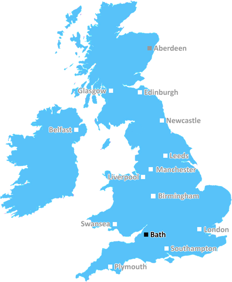
Bath, UK - Pulteney Bridge and the River Avon at Sunset
Bath: UNESCO World Heritage site, Roman baths, Georgian architecture, picturesque surroundings, and a haven for relaxation and history lovers alike.
Bath, Radstock, Shepton Mallet, Wells, Glastonbury, Castle Cary, Templecombe, Wincanton, Bruton, Frome, Warminster, Westbury, Trowbridge, Bradford On Avon, Street, Yeovil.
Discover everything you need to know about Bath with PostcodeArea. Scroll down to uncover demographics, property prices, crime stats, amenities and more.
Here are the top 10 most desirable postcode areas in Bath (BA), based on a unique scoring system that weighs key factors like safety, schools, diversity, and affordability.
Whether you're a renter, homebuyer, or property investor, this tool lets you customise the score to focus on what matters most to you, helping you make smarter, data-driven decisions.
Our custom algorithm calculates a unique "Desirability Score" for any UK postcode by analysing a range of factors - including Census 2021 data, third-party insights, and socio-economic knowledge, to provide a tailored rating.
Explain more
Curious about the local business scene? These are the top four industries shaping Bath, from thriving services to key local employers.
Bath has a strong presence of construction businesses, which usually means there's a lot of building going on - whether it's new homes, commercial spaces, or infrastructure. This can be a good sign that the Bath area is growing and attracting investment. It could also mean there's a strong local economy, with plenty of work available for builders and tradespeople. On the flip side, it might suggest there's a fair bit of property in need of repair or updating. Either way, it tells you the Bath area is pretty active and could be on the up.
Bath has a large proportion of professional and scientific businesses, which makes it a hub for specialised industries like law firms, consulting agencies, tech companies, or research labs. This suggests a high level of expertise and innovation, attracting professionals such as engineers, scientists, lawyers, and consultants. The Bath area might have a more polished, business-focused atmosphere, with modern offices and co-working spaces. It's often well-connected, with good transport links and amenities to support a skilled workforce. Property prices could be higher, as these areas tend to attract well-paid professionals. It might not be the most vibrant or social place, but it will have a reputation for being smart, efficient, and future-focused.
The prevalance of agricultural industries (including forestry and fishing) in Bath suggests this is a lively and creative postcode sector. These kinds of businesses tend to pop up in areas that are known for their cultural scene, where people value things like theatres, galleries, music venues, and independent cinemas. It could mean the area attracts a mix of creatives, young professionals, and tourists, making it a vibrant and potentially trendy spot. This could also be a sign of a more laid-back, community-focused vibe, with lots of local events and activities in and around Bath. It might push property prices up if the area becomes particularly popular, but it's also a good indicator of a strong local identity and a thriving social scene.
If a postcode area such as BA has a lot of business administration services, such as accounting firms, HR consultancies, and management services, it's likely a centre for corporate and operational support. These businesses help other companies run smoothly, so the area might be more business-centric, attracting professionals like administrators, accountants, and consultants. The local economy could be quite strong, driven by a steady demand for services that keep companies ticking over. It's not necessarily the most exciting or creative environment, but it would be efficient, organised, and perhaps well-connected with reliable transport links. You'd expect to see a lot of office spaces in Bath and maybe even shared workspaces catering to small and medium-sized businesses. The area could feel more formal and professional, with less of a residential or leisure focus.
Major employers and businesses in the BA postcode area include:
Financial Services, Bath
An investment platform provider offering wealth management and financial services.
Postcode Location: BA1
Leisure & Tourism, Bath
A popular spa destination in the heart of Bath, providing jobs in hospitality, therapy, and tourism services.
Postcode Location: BA1
Media & Publishing, Bath
A global multi-platform media company that publishes magazines and websites in a range of sectors including technology, games, and photography.
Postcode Location: BA1
Financial Services, Bath
A local building society offering mortgages, savings accounts, and financial advice to the community.
Postcode Location: BA1
Engineering & Consultancy, Bath
A global engineering consultancy with its headquarters in Bath, providing engineering and consulting services for buildings and infrastructure.
Postcode Location: BA1
Data showing the activity, size and location is from the Inter Departmental Business Register 2024, produced by the ONS.
Bath BA, part of the ceremonial county of Somerset in England, presents a substantial geographical area with 19 outward codes (the first half of a postcode, e.g. BA 1AA). Its population stands at 466,274 individuals, reflecting a density of 1,805 people per square kilometre. The average household income here is £47,732 , which is 36.4% higher than the average UK median household income (£35,000), indicating a stable economic profile within the region.
Bath
Postcodes
People
People/km2
Per household
Bath, UK - Pulteney Bridge and the River Avon at Sunset
Adobe Stock
Welcome to Bath, a city renowned for its Roman baths and Georgian architecture.
The BA postcode area encompasses this historic gem and its charming surroundings. In BA1 and BA2, you'll find the heart of Bath with its stunning crescents, vibrant shops, and cultural landmarks.
Demographically, Bath is a lively mix of students, professionals, and families, creating a dynamic community. Located in the picturesque Somerset countryside, Bath offers excellent transport links, including direct trains to London. Whether you're exploring, researching, or simply soaking in the beauty, Bath promises a delightful experience.
This page contains a list of postcode districts for Bath area. Select a postcode to see the map location, demographics, house prices, local information, tourist guides and statistics:
The ONS (Office for National Statistics) regularly tracks and records average house prices and rents in this area (E06000022). Note that these estimates are based on local authority rather than postcode area. For more information about current house prices, choose an individual postcode below.
If you want to experience the real English countryside then few places offer a better example than Somerset. From the gentle pace of day-to-day life, to the endless broad fields and haystacks, cattle and combine harvesters, to the hundreds of tiny picturesque villages and cottage gardens, ivy clad pubs and windy country lanes, Somerset is certainly the county to get away from it all.
That's not to say there is no excitement there. Head over to the caves at Wookey Hole which have been used by humans for over 50,000 years and are surely the most spectacular (and eerie) caves in all of the UK. Alternatively there is the awesome Cheddar Gorge, a limestone gorge in the Mendip Hills and site of numerous caves with fantastic stalactites and stalagmites.
Read more about SomersetThe BA postal area offers a variety of transport options, making it convenient for both local and long-distance travel. For rail commuters, there are multiple stations including Bath Spa and Chippenham, providing frequent services to major cities like London and Bristol.
If you're travelling by air, Bristol Airport is the nearest major hub, offering flights to numerous domestic and international destinations. It's easily reachable by car or public transport.
Commuting by car is straightforward, with excellent road networks including the M4 and A36, ensuring quick access to nearby urban centres and the beautiful countryside. Parking is generally available but can be competitive in busier towns.
Buses are a reliable option for getting around the BA area. Regular services connect smaller villages with larger towns, making daily commutes and weekend outings hassle-free.
The following railway stations are within the BA postcode region:
Local Authorities are government organisations responsible for providing local services and facilities such as education, housing, and social services within a specific area. The BA postcode area includes the following local authorities:
Bath and North East Somerset Council focuses on preserving the area's historical heritage, promoting tourism, and providing high-quality public services to enhance residents' quality of life.
Mendip District Council supports rural communities, promoting sustainable development, tourism, and providing comprehensive public services to improve residents' quality of life.
North Dorset District Council focuses on supporting rural areas, promoting sustainable development, and providing high-quality public services to enhance community well-being.
GDP (Gross Domestic Product) measures the total economic output of a country, region, or Local Authority. It tells us how much money is being made within a particular area. This includes everything from a business selling cars or consumers getting their hair cut.
This list of the Local Authorities within the Bath (BA) postcode town gives us a snapshot of how much money is being generated at current market prices, based on what people are spending and earning. It's an important way to understand the economic health and activity levels across the UK.
For comparison purposes, we've included the top and bottom two local authorities across the UK in terms of GDP.
The graph below shows the total GDP values for all Local Authorities within the Bath (BA) area:
When we talk about GDP at current market prices, we're looking at the total value of all goods and services produced in an area, but the key bit here is "current market prices." This means it includes the value of goods and services as they're bought and sold right now, without adjusting for inflation or changes in prices over time.
So, for example a figure of £1,560 GDP means that, on average, each person within an area contributes this amount to the UK economy each year.
Republished from the ONS regional gross domestic product: local authorities under the Open Government Licence v3.0. Latest available data: April 2022.
As rated by Ofsted
Church Street, Frome, BA11 6TG
Primary School (5-9)
Church Lane, Glastonbury, BA6 8NT
Primary School (4-11)
Carisbrooke Gardens, Yeovil, BA20 1AY
Primary School (4-11)
Silver Street, Midsomer Norton, BA3 2UD
Primary School (2-11)
Kingfisher Drive, Yeovil, BA22 8FJ
Primary School (2-11)
Cunningham Road, Yeovil, BA21 5FH
Primary School (2-11)
Victoria Road, Yeovil, BA21 5AZ
Secondary School (4-19)
The Toose, Yeovil, BA21 3SN
Primary School (4-11)
St Mary's Road, Glastonbury, BA6 9SP
Primary School (4-11)
Wells Road, Wells, BA5 1LQ
Primary School (4-11)
Data is meaningless without context. Reveal the stories behind a neighbourhood, and make smarter decisions with data you can trust. Gain unlimited access to detailed statistics, exclusive reports, and essential tools.
PostcodeArea is grateful to our sponsors for their support.