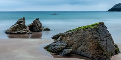
BEACHES IN HR3 5QQ
Hotels near HR35QQ
Nearest Beaches
Beaches near HR3 5QQ
| Distance | Beach | Details |
|---|---|---|
41.8MILES | ABERAFAN BEACHABERAFANGlamorgan |
Water quality: Bathing water at this beach meets or exceeds legal guidelines for water quality, and is safe for swimming/bathing. Compliant with the Blue Flag Directive 2010. |
43.4MILES | CLEVEDON BEACH BEACHWOODSPRINGSomerset |
Water quality: Bathing water at this beach meets or exceeds legal guidelines for water quality, and is safe for swimming/bathing. Compliant with the Blue Flag Directive 2010. |
44.9MILES | JACKSONS BAY BARRY BEACHJACKSONS BAY BARRYGlamorgan |
Water quality: Bathing water at this beach complies with mandatory requirements for water quality, and is safe for swimming/bathing Compliant with the Blue Flag Directive 2010. |
44.9MILES | TRECCO BAY PORTHCAWL BEACHTRECCO BAY PORTHCAWLGLAMORGAN |
Water quality: Bathing water at this beach meets or exceeds legal guidelines for water quality, and is safe for swimming/bathing. Compliant with the Blue Flag Directive 2010. |
45MILES | SWANSEA BAY BEACHSWANSEA BAYGlamorgan |
Water quality: Bathing water at this beach complies with mandatory requirements for water quality, and is safe for swimming/bathing Compliant with the Blue Flag Directive 2010. |
45.1MILES | SANDY BAY PORTHCAWL BEACHSANDY BAY PORTHCAWLGLAMORGAN |
Water quality: Bathing water at this beach meets or exceeds legal guidelines for water quality, and is safe for swimming/bathing. Compliant with the Blue Flag Directive 2010. |
45.1MILES | REST BAY PORTHCAWL BEACHREST BAY PORTHCAWLGLAMORGAN |
Water quality: Bathing water at this beach meets or exceeds legal guidelines for water quality, and is safe for swimming/bathing. Compliant with the Blue Flag Directive 2010. |
45.1MILES | WHITMORE BAY BARRY BEACHWHITMORE BAY BARRYGlamorgan |
Water quality: Bathing water at this beach meets or exceeds legal guidelines for water quality, and is safe for swimming/bathing. Compliant with the Blue Flag Directive 2010. |
45.2MILES | COLD KNAP BARRY BEACHCOLD KNAP BARRYGlamorgan |
Water quality: Bathing water at this beach meets or exceeds legal guidelines for water quality, and is safe for swimming/bathing. Compliant with the Blue Flag Directive 2010. |
45.2MILES | SOUTHERNDOWN BEACHSOUTHERNDOWNGlamorgan |
Water quality: Bathing water at this beach meets or exceeds legal guidelines for water quality, and is safe for swimming/bathing. Compliant with the Blue Flag Directive 2010. |
47MILES | ABERYSTWYTH SOUTH BEACHABERYSTWYTH SOUTHCEREDIGION |
Water quality: Bathing water at this beach meets or exceeds legal guidelines for water quality, and is safe for swimming/bathing. Compliant with the Blue Flag Directive 2010. |
47.1MILES | ABERYSTWYTH NORTH BEACHABERYSTWYTH NORTHCEREDIGION |
Water quality: Bathing water at this beach meets or exceeds legal guidelines for water quality, and is safe for swimming/bathing. Compliant with the Blue Flag Directive 2010. |
47.3MILES | WESTON-SUPER-MARE SAND BAY BEACHWOODSPRINGSomerset |
Water quality: Bathing water at this beach meets or exceeds legal guidelines for water quality, and is safe for swimming/bathing. Compliant with the Blue Flag Directive 2010. |
47.5MILES | CLARACH SOUTH BEACHCLARACH SOUTHCEREDIGION |
Water quality: Bathing water at this beach meets or exceeds legal guidelines for water quality, and is safe for swimming/bathing. Compliant with the Blue Flag Directive 2010. |
47.7MILES | BRACELET BAY BEACHBRACELET BAYGlamorgan |
Water quality: Bathing water at this beach meets or exceeds legal guidelines for water quality, and is safe for swimming/bathing. Compliant with the Blue Flag Directive 2010. |
48MILES | LIMESLADE BAY BEACHLIMESLADE BAYGlamorgan |
Water quality: Bathing water at this beach meets or exceeds legal guidelines for water quality, and is safe for swimming/bathing. Compliant with the Blue Flag Directive 2010. |
48.7MILES | WESTON MAIN BEACHWOODSPRINGSomerset |
Water quality: Bathing water at this beach meets or exceeds legal guidelines for water quality, and is safe for swimming/bathing. Compliant with the Blue Flag Directive 2010. |
48.8MILES | LANGLAND BAY BEACHLANGLAND BAYGlamorgan |
Water quality: Bathing water at this beach meets or exceeds legal guidelines for water quality, and is safe for swimming/bathing. Compliant with the Blue Flag Directive 2010. |
49MILES | BORTH BEACHBORTHCEREDIGION |
Water quality: Bathing water at this beach meets or exceeds legal guidelines for water quality, and is safe for swimming/bathing. Compliant with the Blue Flag Directive 2010. |
49.4MILES | CASWELL BAY BEACHCASWELL BAYGlamorgan |
Water quality: Bathing water at this beach meets or exceeds legal guidelines for water quality, and is safe for swimming/bathing. Compliant with the Blue Flag Directive 2010. |


The nearest beach might be 42 away from HR3 5QQ, but it still makes a great day out.
Grab the kids, the sun cream and the bucket and spade. HR3 5QQ is never too far away that you should miss out on some family fun at the beach.
Luckily, we've got a list of the nearest beaches to HR3 5QQ, so you can take your pick of the bunch!
Useful Resources
- The Beach Guide
A collection of the best beaches in Britain as of 2018. - Great British Beach Clean
The Great British Beach Clean is the biggest beach clean and survey in the UK. - Gov.uk
Find out how clean the water is on beaches and in other bathing areas in England, and if there is a problem with pollution. - Blue Flag
The iconic Blue Flag is one of the world’s most recognised voluntary eco-labels awarded to beaches, marinas, and sustainable boating tourism operators.
About Us
Postcode Area helps people in all areas of the UK to locate and find postcode data and information for cities and towns in England, Scotland, Northern Ireland and Wales.
Share and Share Alike
Find this information useful? Don't keep it a secret - spread the word.
© Postcode Area / CliqTo Ltd and Chris Haycock. Registered company number 7575287.
Unit 8 Palmbourne Industrial Park, Castle Street, Stafford, England, ST16 2TB,
UNITED KINGDOM.
