york YO43 Postcodes
Spending a fortune on conveyancing?

Compare instant, low-cost online quotes from trusted conveyancing solicitors.
Backed by experts, our no-obligation service searches through the best conveyancing quotes on the market to save you time and money.
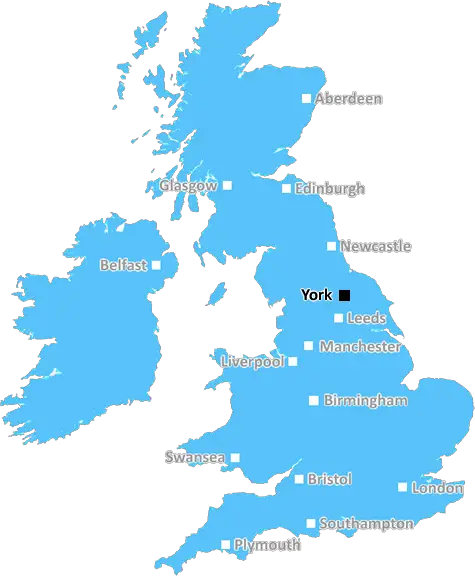
York (YO43)
The YO43 postcode area is located in the York postcode town region, within the county of Yorkshire, and contains a total of 498 individual postcodes.
There are 44 electoral wards in the YO43 postcode area, including Bridlington, Driffield, Filey, Malton, Pickering, Scarborough, Selby, Thirsk, Whitby, York which come under the local authority of the East Riding of Yorkshire Council.
Combining the whole postcode region, 28% of people in YO43 are classed as having an AB social grade, (i.e. 'white-collar' middle-upper class), compared to 27% across the UK.
This does not mean that the people of YO43 are wealthier - or higher class - than average, but it can be an indication that the area may be prospering and desirable to live in.
The YO43 postcode covers several areas in and around the city of York, including Sheriff Hutton, Burn, Ryther and Whitwell on the Hill. It is located within the York district of North Yorkshire and is one of approximately 1,700 postcodes that service the city.
The YO43 postcode district is predominantly residential and includes a small number of housing development sites. There are a range of local amenities in the area including a primary school, several shops and a public house. There is also a local train station located in the nearby village of Burn.
The area is served by the York Outer Ring Road, which provides access to other parts of the city, and can be easily reached by bus or taxi. The postcode includes parts of two civil parishes, Sheriff Hutton and Whitwell on the Hill, both of which are located in the Ryedale district of North Yorkshire.
The YO43 postcode contains several villages, towns and hamlets, including Sheriff Hutton, Ryther, Linton-on-Ouse, Burn, Little Fenton and Portington. Nearby attractions include Castle Howard and the North Yorkshire Moors Railway. The nearby river Ouse is a popular destination for wildlife and angling.
The YO43 postcode has been in use since 1996 and is part of the YO postcode area, which covers part of the North and East Riding of Yorkshire, as well as parts of North Lincolnshire and South Yorkshire. The postcode district was previously part of the YO4 and YO5 postcodes until it was divided in 1996.

Demographics
Yorkshire

YO43 is located in the county of Yorkshire, in England.
Yorkshire has a total population of 0, making it the largest county in the UK.
Yorkshire has a total area of square miles, and a population density of people per square kilometre. For comparison, Greater London has a density of 5,618 people/km2.
| Outward Code | YO43 |
| Postal Town | York |
| MSOA Name | East Riding of Yorkshire 015 |
| LSOA Name | East Riding of Yorkshire 015D |
| County | Yorkshire |
| Region | Yorkshire |
| Country | England |
| Local Authority | East Riding of Yorkshire |
| Area Classification | Largely Rural (rural including hub towns 50-79%) |
YO43 Electoral Wards
The postal region of YO43, includes the local towns, villages, electoral wards and stations of:
Dig even deeper into the YO43 postcode by clicking on a postcode below:
Click on an outward postal code below for more information about the area. Each 'outward' postcode give you a comprehensive list of all postcodes within the outward code area (YO) and estimated address.
Click on an 'outward' code for more information. For example, the outward postcode page 'EC2M' will give you an alphabetical list covering all postcodes located in the region, from 'EC2M 1BB' through to 'EC2M 7YA'.
Chris H
Sunday, April 7, 2024
We don't have any views of YO43 right now. If you live in YO43 or have visited it, please help us to help others by telling others what you think of this neighbourhood.
Add your view of YO43
People need your local expertise. If you live in YO43 or have first-hand knowledge of the neighbourhood, please consider sharing your views. It's completely anonymous - all we ask is for your initials.
Please tell us what you like about the YO43 postcode area, what you don't like, and what it's like to live or work here.
| LOCAL AMENITIES | |
| FAMILY FRIENDLY | |
| PARKING | |
| GREEN SPACES |
Local News North Yorkshire
Harrogate Spring Water plant expansion proposals spark concerns
Harrogate Spring Water's plans for its HQ in Harrogate receive over 200 objections in two weeks.
BBC NewsDrax: UK power station still burning rare forest wood
Owner Drax, which received 6bn in subsidies, continues to burn timber from Canadian trees - BBC finds.
BBC NewsHS2: Midlands and northern England to get 'reallocated' funds
Labour says the plans are a "reannouncement" of funds from scrapping parts of the high-speed line.
BBC NewsFebruary 29: 'Leaplings' finally get to celebrate their birthdays
Three people in Yorkshire born on 29 February can only mark their "real" birthdays every four years.
BBC NewsWhitby's Duke of York applies to expand with second bar
The Duke of York sits just yards from the famous 199 steps which lead to the abbey.
BBC NewsTadcaster Bridge a 'lifeline' to the town's residents
People living in Tadcaster face a 16-mile journey by car when the bridge over the River Wharfe shuts.
BBC NewsFC Halifax Town 1-1 York City
Rob Harker snatches a stoppage-time equaliser for Halifax, who miss the chance to move into the play-off places after drawing at home to York.
BBC NewsCounty Championship: Yorkshire take five Leicestershire wickets on rain-hit day one
George Hill takes three wickets as Yorkshire chip away at Leicestershire on a rain-hit opening day.
BBC NewsFrom the Postcode Area blog

Deciphering Crime Rates - a Deep Dive Into UK Postcode Analysis
Ever wondered about the crime rate in your UK postcode? You're not alone. We've dug deep into the data, uncovering trends and patterns that'll make your head spin.

Death of the High Street?
The BBC reports that despite councils' attempts to kurb them, the UK's high streets have seen a huge growth in fast food outlets. Could this mark the death knell for the Great British high street, and what can we do about it to halt its decline?

Discrimination by Postcode
You really couldn't make it up, could you? Some of the country's most vulnerable people are missing out on their weekly £25 Cold Weather Payment, just because the system that's in operation is discriminating against them because payments are based on postcode, rather than geographic location.

The Redesign is Underway
Well, the current website was absolutely in dire need of a good redesign - from the ground up. So I set out to pull it all apart and get it up and running again to become the most comprehensive guide to every postcode in the UK. And it's been a long, tough job from start to finish - and quite possibly the biggest project I've ever undertaken.
SOCIAL GRADES
According to census records, 28% of people here have a social grade of AB (highest), compared to the national average of 27%.