worcester WR12 Postcodes
Spending a fortune on conveyancing?

Compare instant, low-cost online quotes from trusted conveyancing solicitors.
Backed by experts, our no-obligation service searches through the best conveyancing quotes on the market to save you time and money.
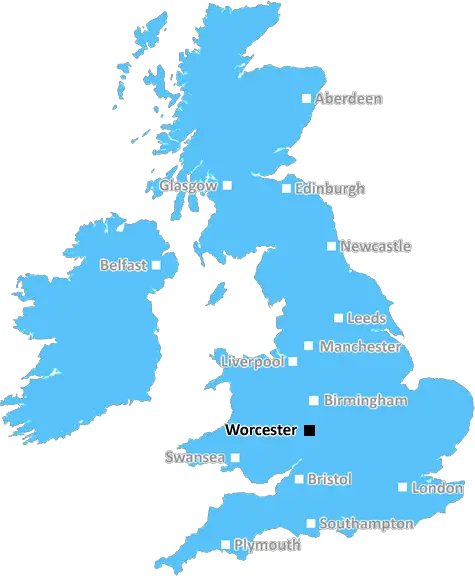
Worcester (WR12)
The WR12 postcode area is located in the Worcester postcode town region, within the county of Worcestershire, and contains a total of 244 individual postcodes.
There are 17 electoral wards in the WR12 postcode area, including Broadway, Droitwich, Evesham, Malvern, Pershore, Tenbury Wells, Worcester which come under the local authority of the Wychavon Council.
Combining the whole postcode region, 27% of people in WR12 are classed as having an AB social grade, (i.e. 'white-collar' middle-upper class), compared to 27% across the UK.
This does not mean that the people of WR12 are wealthier - or higher class - than average, but it can be an indication that the area may be prospering and desirable to live in.
WR12 postcode lies within the Worcester district, and is mostly made up of rural countryside and villages. It comprises of the following wards: Broadway, Norton & Lenchwick, and Overbury.
WR12 has a population of around 8,000 people according to latest figures from the 2011 census. The overwhelming majority of residents in the area are of White British ethnic origin, with just over 3% from multiple ethnic groups, 1.9% being of Asian origin, yet 0.3% of black origin. The number of non-UK born residents is relatively low compared to other parts of the UK.
The postcode is a mainly residential area, with a population of mostly retired and semi-retired individuals. However, there is still high educational attainment in the district, with 79.3% having a level of qualification, significantly higher than the UK average.
Median household incomes are slightly lower in WR12 than other parts of the UK. This could be in part because older residents may rent accommodation or are in receipt of pensions and benefits. There is also a significant number of people in the district who are economically inactive.
Surrounding areas in the Worcester district often have higher levels of crime, with a decrease in WR12. This may relate to lower levels of deprivation and a lack of 'social housing estates'.
Businesses and services in the area generally cater to the needs of the population, with many private practice doctors and dentists. There is also a Tourist Information Centre in the district.
WR12 is well served in terms of transport links, with access to the M5 motorway and direct links to Birmingham and the wider Worcester district. near-by Worcester Shrub Hill and Great Malvern stations provide access to London and the South West. Regular bus services also operate within the area.
WR12 is surrounded by beautiful countryside with many notable tourist attractions. These include Great Malvern Priory, Eastnor Castle, Croome Court and the Malvern Hills. There are also many places to eat and drink, from traditional pubs to fine dining experiences.

Demographics
Worcestershire

WR12 is located in the county of Worcestershire, in England.
Worcestershire has a total population of 583,100, making it the 38th largest county in the UK.
Worcestershire has a total area of 670 square miles, and a population density of 334 people per square kilometre. For comparison, Greater London has a density of 5,618 people/km2.
| Outward Code | WR12 |
| Postal Town | Worcester |
| MSOA Name | Wychavon 018 |
| LSOA Name | Wychavon 018C |
| County | Worcestershire |
| Region | Worcestershire |
| Country | England |
| Local Authority | Wychavon |
| Area Classification | Mainly Rural (rural including hub towns >=80%) |
WR12 Electoral Wards
The postal region of WR12, includes the local towns, villages, electoral wards and stations of:
Dig even deeper into the WR12 postcode by clicking on a postcode below:
Click on an outward postal code below for more information about the area. Each 'outward' postcode give you a comprehensive list of all postcodes within the outward code area (WR) and estimated address.
Click on an 'outward' code for more information. For example, the outward postcode page 'EC2M' will give you an alphabetical list covering all postcodes located in the region, from 'EC2M 1BB' through to 'EC2M 7YA'.
Chris H
Wednesday, April 10, 2024
We don't have any views of WR12 right now. If you live in WR12 or have visited it, please help us to help others by telling others what you think of this neighbourhood.
Add your view of WR12
People need your local expertise. If you live in WR12 or have first-hand knowledge of the neighbourhood, please consider sharing your views. It's completely anonymous - all we ask is for your initials.
Please tell us what you like about the WR12 postcode area, what you don't like, and what it's like to live or work here.
| LOCAL AMENITIES | |
| FAMILY FRIENDLY | |
| PARKING | |
| GREEN SPACES |
Local News Worcestershire
Redditch dog detective 'saves lost pooches'
Meet John Watton, who volunteers his skills and his thermal drone to detect lost dogs.
BBC NewsKashif's second ton helps Pears build lead over Bears
Kashif Ali hits his second century of the match to help Worcestershire build a potentially match-winning lead over Warwickshire.
BBC NewsNew city dental practice given go-ahead
The surgery will take over part of a community centre after concern about a lack of dental services.
BBC NewsBears-Pears ends in weather-hit Edgbaston draw
Jake Libby hits a final-day century as promoted Worcestershire's game with Warwickshire ends in a draw at Edgbaston.
BBC NewsCathedral's clock tower to reopen after four years
Worcester Cathedral's clock tower has been closed due to the pandemic and maintenance work.
BBC NewsWatch: The Dancefloor Murder
The story of footballer Cody Fisher who was stabbed to death in a nightclub in Birmingham.
BBC NewsCody Fisher killers jailed for life for footballer's murder
Cody Fisher was killed on the dance floor of the Crane club in Birmingham on 26 December 2022.
BBC NewsHow to deal with ratflation'
Rat-catcher Phil Martin shares tips on how to spot tell-tale signs of infestations.
BBC NewsFrom the Postcode Area blog

Deciphering Crime Rates - a Deep Dive Into UK Postcode Analysis
Ever wondered about the crime rate in your UK postcode? You're not alone. We've dug deep into the data, uncovering trends and patterns that'll make your head spin.

Death of the High Street?
The BBC reports that despite councils' attempts to kurb them, the UK's high streets have seen a huge growth in fast food outlets. Could this mark the death knell for the Great British high street, and what can we do about it to halt its decline?

Discrimination by Postcode
You really couldn't make it up, could you? Some of the country's most vulnerable people are missing out on their weekly £25 Cold Weather Payment, just because the system that's in operation is discriminating against them because payments are based on postcode, rather than geographic location.

The Redesign is Underway
Well, the current website was absolutely in dire need of a good redesign - from the ground up. So I set out to pull it all apart and get it up and running again to become the most comprehensive guide to every postcode in the UK. And it's been a long, tough job from start to finish - and quite possibly the biggest project I've ever undertaken.
SOCIAL GRADES
According to census records, 27% of people here have a social grade of AB (highest), compared to the national average of 27%.