wolverhampton WV3 Postcodes
Spending a fortune on conveyancing?

Compare instant, low-cost online quotes from trusted conveyancing solicitors.
Backed by experts, our no-obligation service searches through the best conveyancing quotes on the market to save you time and money.
Wolverhampton (WV3)
The WV3 postcode area is located in the Wolverhampton postcode town region, within the county of West Midlands, and contains a total of 918 individual postcodes.
There are 17 electoral wards in the WV3 postcode area, including Bilston, Bridgnorth, Willenhall, Wolverhampton which come under the local authority of the Wolverhampton Council.
Combining the whole postcode region, 23% of people in WV3 are classed as having an AB social grade, (i.e. 'white-collar' middle-upper class), compared to 27% across the UK.
This does not mean that the people of WV3 are poorer than other areas, but it may give an indication that there are areas of deprivation.
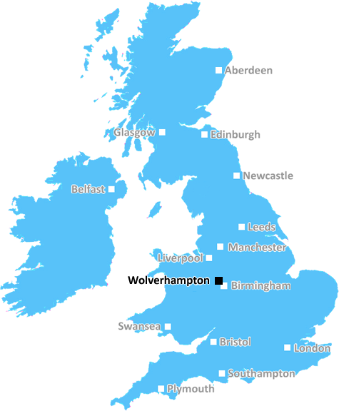
The WV3 postcode covers most of the western part of Wolverhampton town centre in the West Midlands in the United Kingdom. It covers an area stretching from the city centre east to Ettingshall, north to Whitmore Reans, and west to Tettenhall Wood and Finchfield.
This postcode region is largely residential, although it contains a few commercial and industrial areas at its edges. It is a diverse area, featuring small terraced homes, larger semis and detached houses, and modern apartment blocks. It benefits from having several parks, such as West Park, with its beautiful landscaped gardens and lake, and Glendale Park, which contains a popular children's play area.
The area is served by several bus routes and is well connected by road, with the A41, A449, and A454 all running through the postcode district.
WV3 is within easy access of the M54 and the city has a direct train service to Birmingham Snow Hill.
The area is served by a variety of shops, restaurants, and pubs. It is within a short walk of the city's main shopping street, the Crown Street Shopping Centre, and is close to two of Wolverhampton's universities � the University of Wolverhampton and City of Wolverhampton College. There is also an Edwardian theatre in the heart of WV3 where plays and musicals are often performed.
The area is within easy reach of Birmingham, Stourbridge, and Walsall, making it a good choice for both commute to work or leisure trips.
Wolverhampton's football team, Wolverhampton Wanderers, play at the Molineux Stadium which is close to WV3. The area is served by several other teams as well, such as the Bilston Town FC team.
The area is served by Wolverhampton City Council and is part of the Parliamentary Constituency of Wolverhampton South West. It is part of the Wolverhampton Metropolitan Borough and it has its own local watchdog group � WV3 Residents' Association � which is active in promoting the interests of the local community.

Demographics

West Midlands

WV3 is located in the county of West Midlands, in England.
West Midlands has a total population of 2,864,900, making it the 2nd largest county in the UK.
West Midlands has a total area of 348 square miles, and a population density of 3177 people per square kilometre. For comparison, Greater London has a density of 5,618 people/km2.
| Outward Code | WV3 |
| Postal Town | Wolverhampton |
| MSOA Name | Wolverhampton 026 |
| LSOA Name | Wolverhampton 026A |
| County | West Midlands |
| Region | West Midlands |
| Country | England |
| Local Authority | Wolverhampton |
| Area Classification | Urban with Major Conurbation |
WV3 Electoral Wards
The postal region of WV3, includes the local towns, villages, electoral wards and stations of:
Dig even deeper into the WV3 postcode by clicking on a postcode below:
Click on an outward postal code below for more information about the area. Each 'outward' postcode give you a comprehensive list of all postcodes within the outward code area (WV) and estimated address.
Click on an 'outward' code for more information. For example, the outward postcode page 'EC2M' will give you an alphabetical list covering all postcodes located in the region, from 'EC2M 1BB' through to 'EC2M 7YA'.
Chris H
Saturday, April 6, 2024
We don't have any views of WV3 right now. If you live in WV3 or have visited it, please help us to help others by telling others what you think of this neighbourhood.
Add your view of WV3
People need your local expertise. If you live in WV3 or have first-hand knowledge of the neighbourhood, please consider sharing your views. It's completely anonymous - all we ask is for your initials.
Please tell us what you like about the WV3 postcode area, what you don't like, and what it's like to live or work here.
| LOCAL AMENITIES | |
| FAMILY FRIENDLY | |
| PARKING | |
| GREEN SPACES |
Local News Staffordshire
Staffordshires biggest party is back
Staffordshire's biggest party of the year, Staffordshire Day, is back on Wednesday 1 May 2024, with a packed programme of events and activities.
Staffordshire County CouncilBroken hip Betsy, 83, lying on patio for three hours as Royal Stoke delays laid bare
48 ambulances were stuck outside the Royal Stoke University Hospital for more than an hour
Stoke SentinelA strategy to help unpaid carers of all ages across Staffordshire has been agreed by the county councils cabinet
The "Staffordshire's All Age Carers Strategy 2024 2029" has been produced by the county council and Integrated Care Board (ICB) alongside other partners.
Staffordshire County CouncilStaffordshire and Stoke On Trent to celebrate English Tourism Week
People are being reminded about the many great attractions and locations just waiting to be explored in Staffordshire and Stoke-on-Trent as part of the county's celebrations for English Tourism Week.
Staffordshire County CouncilStaffordshire receives 286million transport funding boost over seven years
Staffordshire has secured a huge funding boost from central Government for local transport projects which will span a seven-year period.
Staffordshire County CouncilDraws not good for boxing - Clarke
Frazer Clarke feels draws are bad for boxing as he seeks a rematch with British heavyweight champion Fabio Wardley.
BBC NewsHospice plans orange floral memorial for spring
People are being asked to dedicate a gerbera at the charity's memorial gardens.
BBC NewsPolice 'increasingly concerned' for Stoke-on-Trent man not seen for 22 days
Officers have launched an appeal to find the 63-year-old
Stoke SentinelFrom the Postcode Area blog

Deciphering Crime Rates - a Deep Dive Into UK Postcode Analysis
Ever wondered about the crime rate in your UK postcode? You're not alone. We've dug deep into the data, uncovering trends and patterns that'll make your head spin.

Death of the High Street?
The BBC reports that despite councils' attempts to kurb them, the UK's high streets have seen a huge growth in fast food outlets. Could this mark the death knell for the Great British high street, and what can we do about it to halt its decline?

Discrimination by Postcode
You really couldn't make it up, could you? Some of the country's most vulnerable people are missing out on their weekly £25 Cold Weather Payment, just because the system that's in operation is discriminating against them because payments are based on postcode, rather than geographic location.

The Redesign is Underway
Well, the current website was absolutely in dire need of a good redesign - from the ground up. So I set out to pull it all apart and get it up and running again to become the most comprehensive guide to every postcode in the UK. And it's been a long, tough job from start to finish - and quite possibly the biggest project I've ever undertaken.
SOCIAL GRADES
According to census records, 23% of people here have a social grade of AB (highest), compared to the national average of 27%.