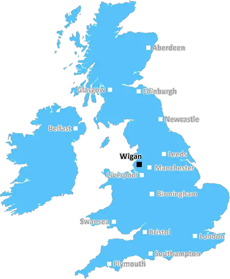
wigan WN4 Postcodes
Spending a fortune on conveyancing?

Compare instant, low-cost online quotes from trusted conveyancing solicitors.
Backed by experts, our no-obligation service searches through the best conveyancing quotes on the market to save you time and money.
Wigan (WN4)
The WN4 postcode area is located in the Wigan postcode town region, within the county of Greater Manchester, and contains a total of 737 individual postcodes.
There are 17 electoral wards in the WN4 postcode area, including Leigh, Skelmersdale, Wigan which come under the local authority of the Wigan Council.
Combining the whole postcode region, 19% of people in WN4 are classed as having an AB social grade, (i.e. 'white-collar' middle-upper class), compared to 27% across the UK.
This does not mean that the people of WN4 are poorer than other areas, but it may give an indication that there are areas of deprivation.
WN4 is a postcode district located in the Wigan Metropolitan Borough of Greater Manchester, England. It is a suburban area comprising of the towns of Billinge Higher End, Ashton in Makerfield, Marus Bridge, Marsh Green, and New Boston.
WN4 is relatively smaller compared to other postcode districts and has an estimated population of 19,608 as of the 2018 estimates. The WN4 postcode is currently divided into 6 postcode sectors and 24 posttowns.
The WN4 postcode is host to a variety of amenities and attractions. Residents have access to supermarkets, schools, and leisure facilities. Additionally, the area has two small shopping centres; the Moor Market (Ashton-in-Makerfield) and the Ashfield Shopping Centre (Winstanley).
Residents of the WN4 postcode have access to several bus routes providing easy transport around the region. There are several green spaces in the area; namely Garswood Park, Billinge Hill Park, Pennington Flash Country Park, and Garswood Hall. Pennington Flash Country Park is one of the most popular attractions in the WN4 postcode, with a 67 hectare wetland containing over 200 species of birds and wildlife.
Education wise, the WN4 postcode falls within the catchment area of St. Alfred's School, Wigan UTC, and the Wigan College. Additionally, residents have access to Saint Stephen's Catholic Primary School, The Heath Primary School, and St. John's Catholic Primary School.
The WN4 postcode has access to a range of sports facilities, such as Littletown Stadium, WBC Boxing Club, and Beechill Primary School. Additionally, the area has small local amateur football teams, a small golf club (The Riverside Club), and a Cricket Club (Winstanley Cricket Club).
TheWN4 postcode is a great place to live with a wide range of amenities and attractions. With accessible transport routes, plenty of parks and recreational facilities, and a range of schools, residents in the WN4 postcode are spoilt for choice!

Demographics

Greater Manchester

WN4 is located in the county of Greater Manchester, in England.
Greater Manchester has a total population of 2,782,100, making it the 3rd largest county in the UK.
Greater Manchester has a total area of 492 square miles, and a population density of 2180 people per square kilometre. For comparison, Greater London has a density of 5,618 people/km2.
| Outward Code | WN4 |
| Postal Town | Wigan |
| MSOA Name | Wigan 032 |
| LSOA Name | Wigan 032E |
| County | Greater Manchester |
| Region | Greater Manchester |
| Country | England |
| Local Authority | Wigan |
| Area Classification | Urban with Major Conurbation |
WN4 Electoral Wards
The postal region of WN4, includes the local towns, villages, electoral wards and stations of:
Dig even deeper into the WN4 postcode by clicking on a postcode below:
Click on an outward postal code below for more information about the area. Each 'outward' postcode give you a comprehensive list of all postcodes within the outward code area (WN) and estimated address.
Click on an 'outward' code for more information. For example, the outward postcode page 'EC2M' will give you an alphabetical list covering all postcodes located in the region, from 'EC2M 1BB' through to 'EC2M 7YA'.
Chris H
Sunday, April 7, 2024
We don't have any views of WN4 right now. If you live in WN4 or have visited it, please help us to help others by telling others what you think of this neighbourhood.
Add your view of WN4
People need your local expertise. If you live in WN4 or have first-hand knowledge of the neighbourhood, please consider sharing your views. It's completely anonymous - all we ask is for your initials.
Please tell us what you like about the WN4 postcode area, what you don't like, and what it's like to live or work here.
| LOCAL AMENITIES | |
| FAMILY FRIENDLY | |
| PARKING | |
| GREEN SPACES |
From the Postcode Area blog

Deciphering Crime Rates - a Deep Dive Into UK Postcode Analysis
Ever wondered about the crime rate in your UK postcode? You're not alone. We've dug deep into the data, uncovering trends and patterns that'll make your head spin.

Death of the High Street?
The BBC reports that despite councils' attempts to kurb them, the UK's high streets have seen a huge growth in fast food outlets. Could this mark the death knell for the Great British high street, and what can we do about it to halt its decline?

Discrimination by Postcode
You really couldn't make it up, could you? Some of the country's most vulnerable people are missing out on their weekly £25 Cold Weather Payment, just because the system that's in operation is discriminating against them because payments are based on postcode, rather than geographic location.

The Redesign is Underway
Well, the current website was absolutely in dire need of a good redesign - from the ground up. So I set out to pull it all apart and get it up and running again to become the most comprehensive guide to every postcode in the UK. And it's been a long, tough job from start to finish - and quite possibly the biggest project I've ever undertaken.
SOCIAL GRADES
According to census records, 19% of people here have a social grade of AB (highest), compared to the national average of 27%.