wigan WN2 Postcodes
Spending a fortune on conveyancing?

Compare instant, low-cost online quotes from trusted conveyancing solicitors.
Backed by experts, our no-obligation service searches through the best conveyancing quotes on the market to save you time and money.
Wigan (WN2)
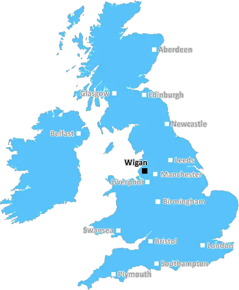
The WN2 postcode area is located in the Wigan postcode town region, within the county of Greater Manchester, and contains a total of 1425 individual postcodes.
There are 37 electoral wards in the WN2 postcode area, including Leigh, Skelmersdale, Wigan which come under the local authority of the Wigan Council.
Combining the whole postcode region, 14% of people in WN2 are classed as having an AB social grade, (i.e. 'white-collar' middle-upper class), compared to 27% across the UK.
This does not mean that the people of WN2 are poorer than other areas, but it may give an indication that there are areas of deprivation.
WN2 postcode refers to the postcode area of Wigan in the northwest of England. It is part of the WN postcode area, which covers the majority of the Borough of Wigan.
WN2 is bordered by the postcode areas of M41, BL6, BL3, WA10 and M30. The postcode area includes the districts of Abram, Ashton-in-Makerfield, Bryn, Golborne, Langtree, Leigh, Lowton, Newton-Le-Willows, Whelley and Winstanley.
The postcode area covers an area of about 26 square miles and is home to a population of over 40,000 people.
The area around WN2 is predominantly rural. To the south lies the Manchester Ship Canal, with agricultural land and industrial areas located to the east. The area also includes many green spaces, including Rye Wood and Garswood Hall Wood Nature Reserve, as well as Ashton and Pennington Flash Country Park.
Public transport in the area is provided mainly by Stagecoach buses, although there are also some train services linking Wigan and other surrounding towns. There are also plans for a local tram service that is due to start operating in 2020.
The area is home to a range of amenities and attractions, including the Three Sisters Race Circuit, an indoor karting centre, Garswood Hall Golf Club and a selection of local parks and historic sites. WN2 is also home to a number of annual events, including the Wigan 10K and the annual Wigan Festival of Music.
WN2 is served by a number of schools, including Bickershaw Primary, Golborne High, Lowton C of E Primary, St John Fisher Roman Catholic Primary and Hawkley Hall High School. It is also served by Leigh College and Wigan and Leigh College, providing higher education opportunities for local residents.
The area is served by a number of supermarkets and shops, as well as restaurants, bars and pubs. Wigan also has a vibrant cultural scene, with theatres, galleries and museums, and a range of cultural festivals taking place throughout the year.

Demographics

Greater Manchester

WN2 is located in the county of Greater Manchester, in England.
Greater Manchester has a total population of 2,782,100, making it the 3rd largest county in the UK.
Greater Manchester has a total area of 492 square miles, and a population density of 2180 people per square kilometre. For comparison, Greater London has a density of 5,618 people/km2.
| Outward Code | WN2 |
| Postal Town | Wigan |
| MSOA Name | Wigan 007 |
| LSOA Name | Wigan 007D |
| County | Greater Manchester |
| Region | Greater Manchester |
| Country | England |
| Local Authority | Wigan |
| Area Classification | Urban with Major Conurbation |
WN2 Electoral Wards
The postal region of WN2, includes the local towns, villages, electoral wards and stations of:
Dig even deeper into the WN2 postcode by clicking on a postcode below:
Click on an outward postal code below for more information about the area. Each 'outward' postcode give you a comprehensive list of all postcodes within the outward code area (WN) and estimated address.
Click on an 'outward' code for more information. For example, the outward postcode page 'EC2M' will give you an alphabetical list covering all postcodes located in the region, from 'EC2M 1BB' through to 'EC2M 7YA'.
KF, wigan
Saturday, April 6, 2019
Know most people who are friendly, there is a lot of eastern Europeans who don't mingle with anyone though.
Add your view of WN2
People need your local expertise. If you live in WN2 or have first-hand knowledge of the neighbourhood, please consider sharing your views. It's completely anonymous - all we ask is for your initials.
Please tell us what you like about the WN2 postcode area, what you don't like, and what it's like to live or work here.
| LOCAL AMENITIES | |
| FAMILY FRIENDLY | |
| PARKING | |
| GREEN SPACES |
From the Postcode Area blog

Deciphering Crime Rates - a Deep Dive Into UK Postcode Analysis
Ever wondered about the crime rate in your UK postcode? You're not alone. We've dug deep into the data, uncovering trends and patterns that'll make your head spin.

Death of the High Street?
The BBC reports that despite councils' attempts to kurb them, the UK's high streets have seen a huge growth in fast food outlets. Could this mark the death knell for the Great British high street, and what can we do about it to halt its decline?

Discrimination by Postcode
You really couldn't make it up, could you? Some of the country's most vulnerable people are missing out on their weekly £25 Cold Weather Payment, just because the system that's in operation is discriminating against them because payments are based on postcode, rather than geographic location.

The Redesign is Underway
Well, the current website was absolutely in dire need of a good redesign - from the ground up. So I set out to pull it all apart and get it up and running again to become the most comprehensive guide to every postcode in the UK. And it's been a long, tough job from start to finish - and quite possibly the biggest project I've ever undertaken.
SOCIAL GRADES
According to census records, 14% of people here have a social grade of AB (highest), compared to the national average of 27%.