walsall WS6 Postcodes
Spending a fortune on conveyancing?

Compare instant, low-cost online quotes from trusted conveyancing solicitors.
Backed by experts, our no-obligation service searches through the best conveyancing quotes on the market to save you time and money.
Walsall (WS6)
The WS6 postcode area is located in the Walsall postcode town region, within the county of Staffordshire, and contains a total of 409 individual postcodes.
There are 10 electoral wards in the WS6 postcode area, including Burntwood, Cannock, Lichfield, Rugeley, Walsall, Wednesbury which come under the local authority of the South Staffordshire Council.
Combining the whole postcode region, 17% of people in WS6 are classed as having an AB social grade, (i.e. 'white-collar' middle-upper class), compared to 27% across the UK.
This does not mean that the people of WS6 are poorer than other areas, but it may give an indication that there are areas of deprivation.
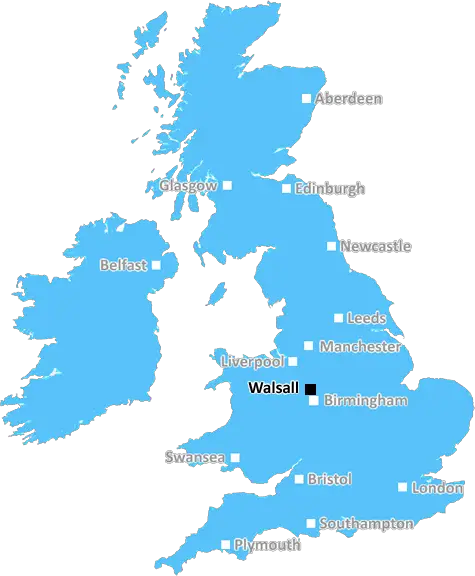
The Walsall South (WS6) Postcode area is situated in the Metropolitan District of Walsall in the West Midlands Region, England. Sitting on the western edge of Walsall, the WS6 postcode district is bounded by Cannock Chase, Staffordshire in the east and Bloxwich and Willenhall in the south.
The area of WS6 is home to a variety of landscapes and topology from undeveloped woodland to suburban areas. It includes a small area of Caldmore to the north and has a handful of settlements, such as Berryhill Park, Pelsall, Hammerwich and Rushall.
Engineer James Brindley built the Wyrley and Essington Canal through the area in 1797, and a portion of it still remains, sitting to the east of the area. The nearby M6 motorway and A5 dual carriageway create an array of transport links and provide direct access to Birmingham City Centre and other parts of the West Midlands.
The area of WS6 is principally residential with many villages, towns and other suburbs encompassing the area. The Walsall South postcode is renowned for its location, located just outside of Walsall town centre and close to Birmingham, West Bromwich, Wolverhampton, Cannock, Lichfield and Stafford.
Many of the suburbs within the district are popular with families, with open green spaces and school catchment areas providing safe environments for children to grow and prosper. Local amenities for leisure and shopping are plentiful and include two supermarkets, shops and restaurants. Bars, pubs and a cinema, alongside a range of quality restaurants, provide great amenities for visitors and locals to the area.
The area is well connected by bus routes operating in Walsall, as well as regular services to Birmingham and Wolverhampton. The nearest train station is located in Walsall town centre, connecting the area to other destinations on the West Midlands Network.
WS6 is a well developed region with many amenities, making it an ideal postcode for families, and commuters alike. Its proximity to Birmingham and other major schools and universities, coupled with its low crime rate and high quality of life, make it an increasingly popular area in the West Midlands.

Demographics

Staffordshire

WS6 is located in the county of Staffordshire, in England.
Staffordshire has a total population of 1,120,300, making it the 17th largest county in the UK.
Staffordshire has a total area of 1047 square miles, and a population density of 412 people per square kilometre. For comparison, Greater London has a density of 5,618 people/km2.
| Outward Code | WS6 |
| Postal Town | Walsall |
| MSOA Name | South Staffordshire 005 |
| LSOA Name | South Staffordshire 005E |
| County | Staffordshire |
| Region | Staffordshire |
| Country | England |
| Local Authority | South Staffordshire |
| Area Classification | Urban with Significant Rural (rural including hub towns 26-49%) |
WS6 Electoral Wards
The postal region of WS6, includes the local towns, villages, electoral wards and stations of:
Dig even deeper into the WS6 postcode by clicking on a postcode below:
Click on an outward postal code below for more information about the area. Each 'outward' postcode give you a comprehensive list of all postcodes within the outward code area (WS) and estimated address.
Click on an 'outward' code for more information. For example, the outward postcode page 'EC2M' will give you an alphabetical list covering all postcodes located in the region, from 'EC2M 1BB' through to 'EC2M 7YA'.
Chris H
Sunday, April 7, 2024
We don't have any views of WS6 right now. If you live in WS6 or have visited it, please help us to help others by telling others what you think of this neighbourhood.
Add your view of WS6
People need your local expertise. If you live in WS6 or have first-hand knowledge of the neighbourhood, please consider sharing your views. It's completely anonymous - all we ask is for your initials.
Please tell us what you like about the WS6 postcode area, what you don't like, and what it's like to live or work here.
| LOCAL AMENITIES | |
| FAMILY FRIENDLY | |
| PARKING | |
| GREEN SPACES |
Local News Staffordshire
Staffordshire and Stoke On Trent to celebrate English Tourism Week
People are being reminded about the many great attractions and locations just waiting to be explored in Staffordshire and Stoke-on-Trent as part of the county's celebrations for English Tourism Week.
Staffordshire County CouncilFormer Dignity Champion urges others to nominate
A former Staffordshire Dignity in Care award winner is now urging others to nominate for this year's awards.
Staffordshire County CouncilDriver handed court threat in row over 105 bus lane fine
Stoke-on-Trent City Council cameras caught Simon Ford, from Trentham, on College Road, in Shelton
Stoke SentinelA strategy to help unpaid carers of all ages across Staffordshire has been agreed by the county councils cabinet
The "Staffordshire's All Age Carers Strategy 2024 2029" has been produced by the county council and Integrated Care Board (ICB) alongside other partners.
Staffordshire County CouncilPlanning approval granted for top grade electric vehicle charging facility at i54
Planning approval has been granted for a GRIDSERVE Electric Forecourt at i54 South Staffordshire.
Staffordshire County CouncilRedevelopment plan for library after grant win
Staffordshire County Council successfully bid for 199,000 from the Arts Council England to revamp Wombourne library.
Staffordshire County CouncilTesco shoppers furious over TikTok user who claims to make 250 an hour by flipping stock
A man and his friends have been branded 'sad' after they boasted about making a quick profit by clearing out Tesco's stock of calculators and reselling them online
Stoke SentinelElectric vehicle charging network in Staffordshire set to progress with 4.6million backing
Development and growth of an electric charging network in Staffordshire is set to begin imminently with the release of 4.6million Government funding.
Staffordshire County CouncilFrom the Postcode Area blog

Deciphering Crime Rates - a Deep Dive Into UK Postcode Analysis
Ever wondered about the crime rate in your UK postcode? You're not alone. We've dug deep into the data, uncovering trends and patterns that'll make your head spin.

Death of the High Street?
The BBC reports that despite councils' attempts to kurb them, the UK's high streets have seen a huge growth in fast food outlets. Could this mark the death knell for the Great British high street, and what can we do about it to halt its decline?

Discrimination by Postcode
You really couldn't make it up, could you? Some of the country's most vulnerable people are missing out on their weekly £25 Cold Weather Payment, just because the system that's in operation is discriminating against them because payments are based on postcode, rather than geographic location.

The Redesign is Underway
Well, the current website was absolutely in dire need of a good redesign - from the ground up. So I set out to pull it all apart and get it up and running again to become the most comprehensive guide to every postcode in the UK. And it's been a long, tough job from start to finish - and quite possibly the biggest project I've ever undertaken.
SOCIAL GRADES
According to census records, 17% of people here have a social grade of AB (highest), compared to the national average of 27%.