walsall WS4 Postcodes
Spending a fortune on conveyancing?

Compare instant, low-cost online quotes from trusted conveyancing solicitors.
Backed by experts, our no-obligation service searches through the best conveyancing quotes on the market to save you time and money.
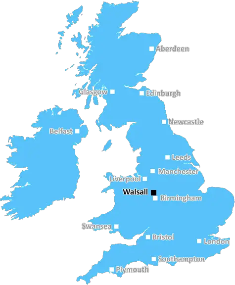
Walsall (WS4)
The WS4 postcode area is located in the Walsall postcode town region, within the county of West Midlands, and contains a total of 414 individual postcodes.
There are 14 electoral wards in the WS4 postcode area, including Burntwood, Cannock, Lichfield, Rugeley, Walsall, Wednesbury which come under the local authority of the Walsall Council.
Combining the whole postcode region, 17% of people in WS4 are classed as having an AB social grade, (i.e. 'white-collar' middle-upper class), compared to 27% across the UK.
This does not mean that the people of WS4 are poorer than other areas, but it may give an indication that there are areas of deprivation.
WS4 is a postcode district in the Walsall district which covers the area of Pelsall, Rushall, Shelfield and parts of Brownhills, Bloxwich and Palfrey. It is located in the West Midlands region of England.
WS4 postcode was created from historic local government districts in 1974, and is split between three Westminster constituencies: Walsall South and Walsall North, and Aldridge-Brownhills. The area has a population of approximately 32,100 people, with significant infrastructure such as motorways and railways nearby.
Pelsall is a village of around 12,000 people which sits in the centre of the postcode area. It has a village green, which is the site of many social events such as summer festivals and Christmas markets. The village centre also contains shops, restaurants, and a library.
The Rushall area is a residential and industrial area in the locality of WS4. It has many green spaces, such as Elmwood Park and several churches including St. Mary's Church. Shelfield is a suburb of WS4, with over 400 shops and businesses, situated between Pelsall and Rushall.
Brownhills is a town in WS4, between Pelsall and Walsall, known for its rich history and diverse architecture. The town is home to the Walker Wood, a protected nature reserve, and the children's playground, Cannock Chase.
Bloxwich is a village located within WS4, known for its canals, former industrial sites and popular St Thomas's Anglican Church. Alongside Bloxwich is Palfrey which is a suburb of Walsall, with a good transport network and many small parks and play areas.
WS4 is an interesting postcode district with a wide range of people from different backgrounds and walks of life living side-by-side. It has a variety of amenities, historical sites and cultural events all within close proximity. All of these characteristics contribute to make WS4 a unique and attractive place to live.

Demographics

West Midlands

WS4 is located in the county of West Midlands, in England.
West Midlands has a total population of 2,864,900, making it the 2nd largest county in the UK.
West Midlands has a total area of 348 square miles, and a population density of 3177 people per square kilometre. For comparison, Greater London has a density of 5,618 people/km2.
| Outward Code | WS4 |
| Postal Town | Walsall |
| MSOA Name | Walsall 010 |
| LSOA Name | Walsall 010D |
| County | West Midlands |
| Region | West Midlands |
| Country | England |
| Local Authority | Walsall |
| Area Classification | Urban with Major Conurbation |
WS4 Electoral Wards
The postal region of WS4, includes the local towns, villages, electoral wards and stations of:
Dig even deeper into the WS4 postcode by clicking on a postcode below:
Click on an outward postal code below for more information about the area. Each 'outward' postcode give you a comprehensive list of all postcodes within the outward code area (WS) and estimated address.
Click on an 'outward' code for more information. For example, the outward postcode page 'EC2M' will give you an alphabetical list covering all postcodes located in the region, from 'EC2M 1BB' through to 'EC2M 7YA'.
KK, walsall
Sunday, April 7, 2019
The area is a matured area with mostly pensioners living around. Clinic, school and a convenience store with post office around. The surrounding area has a Swag Lake and Boat centre which can enjoy a walk or boating. Neighbours are well known to each other and friendly.
Add your view of WS4
People need your local expertise. If you live in WS4 or have first-hand knowledge of the neighbourhood, please consider sharing your views. It's completely anonymous - all we ask is for your initials.
Please tell us what you like about the WS4 postcode area, what you don't like, and what it's like to live or work here.
| LOCAL AMENITIES | |
| FAMILY FRIENDLY | |
| PARKING | |
| GREEN SPACES |
Local News Staffordshire
County and city take steer on support for business and economic growth
Businesses across Staffordshire and Stoke-on-Trent will have a voice on a national level through a new joint committee set up by the county and city councils also ensuring they have expert support a&hellip
Staffordshire County CouncilDrivers over certain age exempt from road fines under new UK scheme
Elderly motorists can dodge tough penalties under a new alternative scheme but can run the risk of being banned indefinitely, it has been warned
Stoke SentinelBaby among two dead and dozens ill after outbreak at Brit holiday hotspot
Cases of whooping cough has boomed at the start of 2024 with sufferers at the highest in more than a decade and cases reported across Europe
Stoke SentinelFifty500 Midlands Growth Corridor receives backing from MPs in parliament
MPs have backed a 3 million bid for government funding, submitted by Staffordshire County Council and partners, to further develop the Fifty500 Midlands Growth Corridor.
Staffordshire County Council1,000 incentive to recruit childcare staff to be tested in Staffordshire
Staffordshire has been selected to join a national pilot to financially incentivise people to pursue a career in early years and childcare.
Staffordshire County CouncilNew Director of Finance Appointed
A new Director of Finance has been appointed by Staffordshire County Council.
Staffordshire County CouncilElectric vehicle charging network in Staffordshire set to progress with 4.6million backing
Development and growth of an electric charging network in Staffordshire is set to begin imminently with the release of 4.6million Government funding.
Staffordshire County CouncilSuspended jail sentences for Staffordshire farmers
Three Staffordshire farmers have been given suspended prison sentences for breaching cattle identification and movement rules to stop the spread of Bovine Tuberculosis.
Staffordshire County CouncilFrom the Postcode Area blog

Deciphering Crime Rates - a Deep Dive Into UK Postcode Analysis
Ever wondered about the crime rate in your UK postcode? You're not alone. We've dug deep into the data, uncovering trends and patterns that'll make your head spin.

Death of the High Street?
The BBC reports that despite councils' attempts to kurb them, the UK's high streets have seen a huge growth in fast food outlets. Could this mark the death knell for the Great British high street, and what can we do about it to halt its decline?

Discrimination by Postcode
You really couldn't make it up, could you? Some of the country's most vulnerable people are missing out on their weekly £25 Cold Weather Payment, just because the system that's in operation is discriminating against them because payments are based on postcode, rather than geographic location.

The Redesign is Underway
Well, the current website was absolutely in dire need of a good redesign - from the ground up. So I set out to pull it all apart and get it up and running again to become the most comprehensive guide to every postcode in the UK. And it's been a long, tough job from start to finish - and quite possibly the biggest project I've ever undertaken.
SOCIAL GRADES
According to census records, 17% of people here have a social grade of AB (highest), compared to the national average of 27%.