walsall WS12 Postcodes
Spending a fortune on conveyancing?

Compare instant, low-cost online quotes from trusted conveyancing solicitors.
Backed by experts, our no-obligation service searches through the best conveyancing quotes on the market to save you time and money.
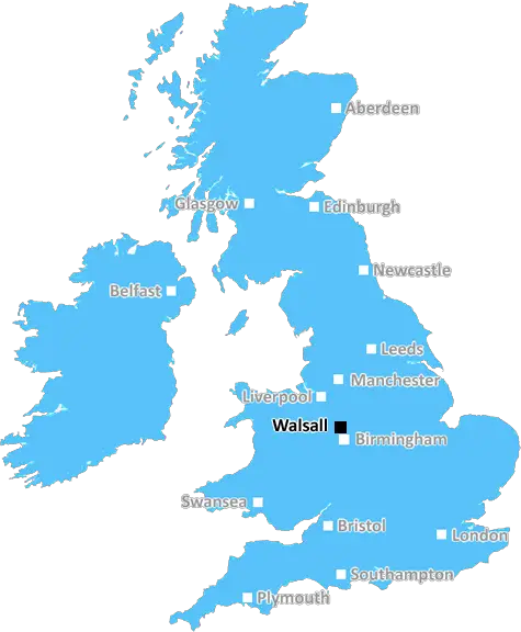
Walsall (WS12)
The WS12 postcode area is located in the Walsall postcode town region, within the county of Staffordshire, and contains a total of 1282 individual postcodes.
There are 25 electoral wards in the WS12 postcode area, including Burntwood, Cannock, Lichfield, Rugeley, Walsall, Wednesbury which come under the local authority of the Cannock Chase Council.
Combining the whole postcode region, 18% of people in WS12 are classed as having an AB social grade, (i.e. 'white-collar' middle-upper class), compared to 27% across the UK.
This does not mean that the people of WS12 are poorer than other areas, but it may give an indication that there are areas of deprivation.
WS12 postcode is based in Cannock, Staffordshire in the UK. It comprises of the villages of Hednesford, Church Hill, Norton Canes, Chadsmoor and Brereton, and includes the town of Cannock itself.
WS12 is close to the border of West Midlands and Staffordshire, and is known for its good transport links. The M6 Motorway is easily accessible to the area, as is the M6 Toll road, which provides a quick route to the nearby locations of Birmingham and Stafford. The nearby Cannock Railway station offers regular services to Birmingham New Street station, while services to Wolverhampton and beyond are also available. There are also regular bus services within the area and to towns such as Walsall, Wolverhampton and Stafford.
The area has a variety of places of interest, such as the Cannock Chase Area of Outstanding Natural Beauty, which is an Area of Outstanding Natural Beauty located just 5 miles away from Cannock. Other places of interest nearby include the Chasewater Country Park, Tamworth snowdome, Smith's Pool Hall and assorted outdoor pursuits.
Cannock has a range of supermarkets, including Asda, Morrisons and Aldi, as well as a variety of independent shopping opportunities. There are also large retail parks located near to the area, which offer a variety of shops, restaurants and leisure activities.
WS12 is home to a number of schools and educational establishments, including Chase Terrace Technology College, St John's Primary School and Cannock Chase High School.
There are four churches in Cannock, three Anglican churches and one Catholic church, the Cannock Chase Church of England Parish. The area also has a range of leisure facilities, including a leisure centre, swimming pool and sports centre.
The area is also home to various civic services, such as the Cannock Chase local authority, a library, and a range of health and social inquiry services, which are provided by nearby Cannock Chase Clinical Commissioning Group.
WS12 postcode has a range of housing opportunities, with detached and semi-detached Victorian houses being the most common. The newer housing within the area comprises of flats and terraced houses and the average price of property is reasonable. There are also various rural and agricultural parts of WS12, which are home to farms, livestock and countryside.

Demographics

Staffordshire

WS12 is located in the county of Staffordshire, in England.
Staffordshire has a total population of 1,120,300, making it the 17th largest county in the UK.
Staffordshire has a total area of 1047 square miles, and a population density of 412 people per square kilometre. For comparison, Greater London has a density of 5,618 people/km2.
| Outward Code | WS12 |
| Postal Town | Walsall |
| MSOA Name | Cannock Chase 011 |
| LSOA Name | Cannock Chase 011E |
| County | Staffordshire |
| Region | Staffordshire |
| Country | England |
| Local Authority | Cannock Chase |
| Area Classification | Urban with Significant Rural (rural including hub towns 26-49%) |
WS12 Electoral Wards
The postal region of WS12, includes the local towns, villages, electoral wards and stations of:
Dig even deeper into the WS12 postcode by clicking on a postcode below:
Click on an outward postal code below for more information about the area. Each 'outward' postcode give you a comprehensive list of all postcodes within the outward code area (WS) and estimated address.
Click on an 'outward' code for more information. For example, the outward postcode page 'EC2M' will give you an alphabetical list covering all postcodes located in the region, from 'EC2M 1BB' through to 'EC2M 7YA'.
Chris H
Wednesday, April 10, 2024
We don't have any views of WS12 right now. If you live in WS12 or have visited it, please help us to help others by telling others what you think of this neighbourhood.
Add your view of WS12
People need your local expertise. If you live in WS12 or have first-hand knowledge of the neighbourhood, please consider sharing your views. It's completely anonymous - all we ask is for your initials.
Please tell us what you like about the WS12 postcode area, what you don't like, and what it's like to live or work here.
| LOCAL AMENITIES | |
| FAMILY FRIENDLY | |
| PARKING | |
| GREEN SPACES |
Local News Staffordshire
Council given national recognition for supporting residents to learn vital employability skills
Staffordshire County Council's Community Learning service has been awarded the international quality Matrix Standard for providing high quality information and advice to residents about learning and w&hellip
Staffordshire County CouncilLord Bamford retires from the House of Lords
Lord Bamford, the executive chairman of JCB, stepped down on 1 March.
BBC NewsHomes Under The Hammer host shares most horrifying item he's found in Stoke-on-Trent properties
Homes Under The Hammer presenter Dion Dublin has opened up about the most shocking thing he's found in properties while filming the BBC show - and it's not for the faint-hearted
Stoke SentinelNew Director of Finance Appointed
A new Director of Finance has been appointed by Staffordshire County Council.
Staffordshire County CouncilMorecambe 0-1 Crewe Alexandra
Crewe's League Two play-off hopes are given a boost as they beat Morecambe.
BBC NewsWigan Athletic 0-0 Port Vale
Darren Moore's Port Vale move out of the League One relegation zone with a goalless draw at Wigan Athletic.
BBC NewsMan arrested after woman killed in M6 crash
A 52-year-old man has been arrested for dangerous driving after a woman from Stoke-on-Trent was killed on the M6 motorway.
BBC NewsSex offender jailed for string of offences
Peter Leigh Rogerson, 58, is sentenced to 28 years in prison for non-recent sexual abuse.
BBC NewsFrom the Postcode Area blog

Deciphering Crime Rates - a Deep Dive Into UK Postcode Analysis
Ever wondered about the crime rate in your UK postcode? You're not alone. We've dug deep into the data, uncovering trends and patterns that'll make your head spin.

Death of the High Street?
The BBC reports that despite councils' attempts to kurb them, the UK's high streets have seen a huge growth in fast food outlets. Could this mark the death knell for the Great British high street, and what can we do about it to halt its decline?

Discrimination by Postcode
You really couldn't make it up, could you? Some of the country's most vulnerable people are missing out on their weekly £25 Cold Weather Payment, just because the system that's in operation is discriminating against them because payments are based on postcode, rather than geographic location.

The Redesign is Underway
Well, the current website was absolutely in dire need of a good redesign - from the ground up. So I set out to pull it all apart and get it up and running again to become the most comprehensive guide to every postcode in the UK. And it's been a long, tough job from start to finish - and quite possibly the biggest project I've ever undertaken.
SOCIAL GRADES
According to census records, 18% of people here have a social grade of AB (highest), compared to the national average of 27%.