walsall WS1 Postcodes
Spending a fortune on conveyancing?

Compare instant, low-cost online quotes from trusted conveyancing solicitors.
Backed by experts, our no-obligation service searches through the best conveyancing quotes on the market to save you time and money.
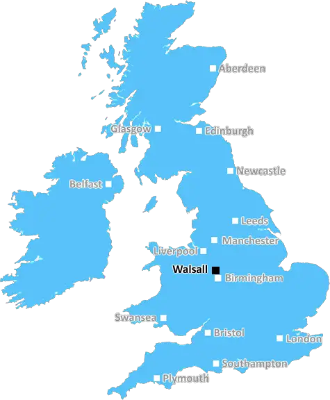
Walsall (WS1)
The WS1 postcode area is located in the Walsall postcode town region, within the county of West Midlands, and contains a total of 1214 individual postcodes.
There are 5 electoral wards in the WS1 postcode area, including Burntwood, Cannock, Lichfield, Rugeley, Walsall, Wednesbury which come under the local authority of the Walsall Council.
Combining the whole postcode region, 16% of people in WS1 are classed as having an AB social grade, (i.e. 'white-collar' middle-upper class), compared to 27% across the UK.
This does not mean that the people of WS1 are poorer than other areas, but it may give an indication that there are areas of deprivation.
The WS1 postcode, situated in the Walsall district of the West Midlands county, is made up of parts of both the town of Walsall as well as Bloxwich and is home to a population of roughly 28,000.
The postcode has been in use since the late 19th century when it was introduced to replace the system of alphabetical codes that had existed previously. It is made up of two main areas: WS1, which covers the town of Walsall; and WS2, which extends to surrounding areas such as Bloxwich and Willenhall.
The WS1 postcode covers a large section of the town, including the town centre, Friar Park, Pleck, Little Bloxwich, Caldmore, Paddock and, further out, venues in Palfrey and Blakenall Heath. Shopping and local amenities can be found at the Saddlers Shopping Centre, the Bentley Mill Shopping Park, Walsall Market and numerous independent shops in the town centre.
For recreational activities, the region is served by a number of parks such as St. Matthew's Park, Ednesbury Park, Highfields Park and Barr Beacon. Further afield, the postcode reaches the Chasewater reservoir and country park which offers something for everyone, from walking and cycling to fishing and kayaking.
When it comes to education, the postcode is served by a large number of schools, from primary schools to further education academies and universities. These include primary schools such as Walsall Wood Primary, St. Thomas Aquinas, St. Peter's and Bilston Primary; secondary schools such as Walsall Academy, St. Matthew's and Queen Mary; and higher education establishments such as the University of Wolverhampton, Birmingham City University and the University College Birmingham.
The transport links to the WS1 postcode are highly impressive, with regular buses providing connections to Walsall and surrounding areas and the M6 providing easy access to Birmingham, Nottingham and further afield. In addition, there are two railway stations located in the postcode area, Bloxwich and Walsall, providing a direct link to Birmingham New Street.
To sum up, the WS1 postcode in the Walsall district is an area of diversity and opportunity with a plenitude of amenities, activities, educational institutions and transport links that makes it an attractive place to both live and visit!

Demographics

West Midlands

WS1 is located in the county of West Midlands, in England.
West Midlands has a total population of 2,864,900, making it the 2nd largest county in the UK.
West Midlands has a total area of 348 square miles, and a population density of 3177 people per square kilometre. For comparison, Greater London has a density of 5,618 people/km2.
| Outward Code | WS1 |
| Postal Town | Walsall |
| MSOA Name | Walsall 030 |
| LSOA Name | Walsall 030A |
| County | West Midlands |
| Region | West Midlands |
| Country | England |
| Local Authority | Walsall |
| Area Classification | Urban with Major Conurbation |
WS1 Electoral Wards
The postal region of WS1, includes the local towns, villages, electoral wards and stations of:
Dig even deeper into the WS1 postcode by clicking on a postcode below:
Click on an outward postal code below for more information about the area. Each 'outward' postcode give you a comprehensive list of all postcodes within the outward code area (WS) and estimated address.
Click on an 'outward' code for more information. For example, the outward postcode page 'EC2M' will give you an alphabetical list covering all postcodes located in the region, from 'EC2M 1BB' through to 'EC2M 7YA'.
Chris H
Saturday, April 6, 2024
We don't have any views of WS1 right now. If you live in WS1 or have visited it, please help us to help others by telling others what you think of this neighbourhood.
Add your view of WS1
People need your local expertise. If you live in WS1 or have first-hand knowledge of the neighbourhood, please consider sharing your views. It's completely anonymous - all we ask is for your initials.
Please tell us what you like about the WS1 postcode area, what you don't like, and what it's like to live or work here.
| LOCAL AMENITIES | |
| FAMILY FRIENDLY | |
| PARKING | |
| GREEN SPACES |
Local News Staffordshire
Free action-packed Easter fun lined up for children from low-income families
Thousands of children from low-income families will be able to enjoy free activities and nutritious meals this Easter as part of Staffordshire's Holiday Activity and Food (HAF) programme.
Staffordshire County CouncilAsthmatic OAP rushed to A&E after 10 days trying to see GP
John Raymond-Adam, 72, said he called his GP practice 'constantly' after experiencing 'breathing problems'
Stoke SentinelMajor road improvement scheme set for completion
A major road improvement scheme to the north of Stafford will be completed on Sunday March 24.
Staffordshire County CouncilFormer Dignity Champion urges others to nominate
A former Staffordshire Dignity in Care award winner is now urging others to nominate for this year's awards.
Staffordshire County CouncilElectric vehicle charging network in Staffordshire set to progress with 4.6million backing
Development and growth of an electric charging network in Staffordshire is set to begin imminently with the release of 4.6million Government funding.
Staffordshire County CouncilBroken hip Betsy, 83, lying on patio for three hours as Royal Stoke delays laid bare
48 ambulances were stuck outside the Royal Stoke University Hospital for more than an hour
Stoke SentinelHoever strike earns Stoke draw with Huddersfield
Ki-Jana Hoever's equaliser helps Stoke City come from behind to draw with fellow Championship strugglers Huddersfield Town.
BBC NewsParking permit increase after price freeze
A 12-month permit for all Staffordshire County Council's country park car parks will rise by 2 to 38, the equivalent of half a penny a day, after being frozen for five years.
Staffordshire County CouncilFrom the Postcode Area blog

Deciphering Crime Rates - a Deep Dive Into UK Postcode Analysis
Ever wondered about the crime rate in your UK postcode? You're not alone. We've dug deep into the data, uncovering trends and patterns that'll make your head spin.

Death of the High Street?
The BBC reports that despite councils' attempts to kurb them, the UK's high streets have seen a huge growth in fast food outlets. Could this mark the death knell for the Great British high street, and what can we do about it to halt its decline?

Discrimination by Postcode
You really couldn't make it up, could you? Some of the country's most vulnerable people are missing out on their weekly £25 Cold Weather Payment, just because the system that's in operation is discriminating against them because payments are based on postcode, rather than geographic location.

The Redesign is Underway
Well, the current website was absolutely in dire need of a good redesign - from the ground up. So I set out to pull it all apart and get it up and running again to become the most comprehensive guide to every postcode in the UK. And it's been a long, tough job from start to finish - and quite possibly the biggest project I've ever undertaken.
SOCIAL GRADES
According to census records, 16% of people here have a social grade of AB (highest), compared to the national average of 27%.