wakefield WF5 Postcodes
Spending a fortune on conveyancing?

Compare instant, low-cost online quotes from trusted conveyancing solicitors.
Backed by experts, our no-obligation service searches through the best conveyancing quotes on the market to save you time and money.
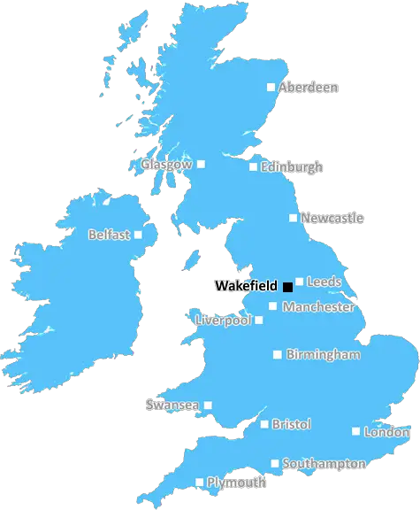
Wakefield (WF5)
The WF5 postcode area is located in the Wakefield postcode town region, within the county of West Yorkshire, and contains a total of 821 individual postcodes.
There are 11 electoral wards in the WF5 postcode area, including Batley, Castleford, Dewsbury, Heckmondwike, Knottingley, Liversedge, Mirfield, Normanton, Ossett, Pontefract, Wakefield which come under the local authority of the Wakefield Council.
Combining the whole postcode region, 17% of people in WF5 are classed as having an AB social grade, (i.e. 'white-collar' middle-upper class), compared to 27% across the UK.
This does not mean that the people of WF5 are poorer than other areas, but it may give an indication that there are areas of deprivation.
The WF5 postcode, which covers the Wakefield district in the UK, is a district postcode and covers the areas of Altofts, Normanton, Streethouse, Stanley and Glasshoughton. It covers an area of 27.20 square miles and has a population of 27,418. It is a predominantly white area with 95.7% of the population being white British.
Altofts is a suburb of Normanton and is situated to the north of Wakefield. It has a population of around 6,200 and this is mainly comprised of families. There is a good mix of shops and amenities in the town, as well as good schools such as Altofts Junior and Infant School, plus a secondary school.
Normanton is a small town in the Wakefield Metropolitan district and is the main settlement in the postcode. It has a population of around 9,800 and also contains a good selection of shops, banks, cafe's and leisure facilities, as well as its own railway station. There are also some industrial premises and, historically, Normanton was an important centre for the production of cutlery and scissors.
Streethouse is a village to the east of Wakefield and has a population of around 1,400. It is an ancient settlement and evidence suggests that it dates back to at least the 13th century. There are some noteworthy buildings here, such as Streethouse Hall and the former chapel.
Stanley is a small residential area to the south of Wakefield. It is mainly a rural area, with some fields and streams providing areas of green space. It also has its own railway station and a population of around 4,700.
Glasshoughton is an area in the district of the Castleford and is located just outside of Wakefield. It has a population of 5,000 and contains a shopping centre, a railway station, a leisure centre, and a park. It is also close to the Xscape Ski and Snowboard Centre, which provides an opportunity for skiing, snowboarding and other outdoor activities.

Demographics
West Yorkshire

WF5 is located in the county of West Yorkshire, in England.
West Yorkshire has a total population of 2,299,700, making it the 4th largest county in the UK.
West Yorkshire has a total area of 783 square miles, and a population density of 1133 people per square kilometre. For comparison, Greater London has a density of 5,618 people/km2.
| Outward Code | WF5 |
| Postal Town | Wakefield |
| MSOA Name | Wakefield 025 |
| LSOA Name | Wakefield 025A |
| County | West Yorkshire |
| Region | West Yorkshire |
| Country | England |
| Local Authority | Wakefield |
| Area Classification | Urban with City and Town |
WF5 Electoral Wards
The postal region of WF5, includes the local towns, villages, electoral wards and stations of:
Dig even deeper into the WF5 postcode by clicking on a postcode below:
Click on an outward postal code below for more information about the area. Each 'outward' postcode give you a comprehensive list of all postcodes within the outward code area (WF) and estimated address.
Click on an 'outward' code for more information. For example, the outward postcode page 'EC2M' will give you an alphabetical list covering all postcodes located in the region, from 'EC2M 1BB' through to 'EC2M 7YA'.
Chris H
Wednesday, April 10, 2024
We don't have any views of WF5 right now. If you live in WF5 or have visited it, please help us to help others by telling others what you think of this neighbourhood.
Add your view of WF5
People need your local expertise. If you live in WF5 or have first-hand knowledge of the neighbourhood, please consider sharing your views. It's completely anonymous - all we ask is for your initials.
Please tell us what you like about the WF5 postcode area, what you don't like, and what it's like to live or work here.
| LOCAL AMENITIES | |
| FAMILY FRIENDLY | |
| PARKING | |
| GREEN SPACES |
Local News West Yorkshire
Leeds United fan injured during FA Cup tie at Chelsea
A Leeds United supporter is "in the hands of the emergency services" after appearing to fall from the stand in their FA Cup tie at Chelsea.
BBC NewsLeeds woman given terminal diagnosis after doctors missed tumour on scan
Leeds NHS trust says it is "deeply sorry" after Anne Shaw's cancer went undiagnosed for two years.
BBC NewsHarry Brook: England batter hits century as Yorkshire draw with Leicestershire in County Championship
England's Harry Brook hits a century to help Yorkshire draw with Leicestershire in their opening County Championship game.
BBC NewsHorbury: Plans to convert WW2 gas site into caf rejected
Objectors say the project would "fail to preserve the special historic interest" of the structure.
BBC NewsDeaf team assistant condemns 'offensive' jibes
Footballers in the Leeds team are regularly mocked for having impaired hearing, Matt Dixon says.
BBC NewsMurder victim told police she feared ex-partner would kill her
Katie Higton warned officers of threats from Marcus Osborne, a timeline obtained by the BBC reveals.
BBC NewsPlans for former Leeds school site put forward
Sports pitches, shops, housing and a special needs school have all been lined up by Leeds Council.
BBC NewsLeeds United 0-0 Sunderland: Hosts into top two but frustrated by Black Cats
Leeds United return to the automatic promotion places but are left frustrated by Sunderland in a goalless stalemate.
BBC NewsFrom the Postcode Area blog

Deciphering Crime Rates - a Deep Dive Into UK Postcode Analysis
Ever wondered about the crime rate in your UK postcode? You're not alone. We've dug deep into the data, uncovering trends and patterns that'll make your head spin.

Death of the High Street?
The BBC reports that despite councils' attempts to kurb them, the UK's high streets have seen a huge growth in fast food outlets. Could this mark the death knell for the Great British high street, and what can we do about it to halt its decline?

Discrimination by Postcode
You really couldn't make it up, could you? Some of the country's most vulnerable people are missing out on their weekly £25 Cold Weather Payment, just because the system that's in operation is discriminating against them because payments are based on postcode, rather than geographic location.

The Redesign is Underway
Well, the current website was absolutely in dire need of a good redesign - from the ground up. So I set out to pull it all apart and get it up and running again to become the most comprehensive guide to every postcode in the UK. And it's been a long, tough job from start to finish - and quite possibly the biggest project I've ever undertaken.
SOCIAL GRADES
According to census records, 17% of people here have a social grade of AB (highest), compared to the national average of 27%.