wakefield WF3 Postcodes
Spending a fortune on conveyancing?

Compare instant, low-cost online quotes from trusted conveyancing solicitors.
Backed by experts, our no-obligation service searches through the best conveyancing quotes on the market to save you time and money.
Wakefield (WF3)
The WF3 postcode area is located in the Wakefield postcode town region, within the county of West Yorkshire, and contains a total of 1089 individual postcodes.
There are 35 electoral wards in the WF3 postcode area, including Batley, Castleford, Dewsbury, Heckmondwike, Knottingley, Liversedge, Mirfield, Normanton, Ossett, Pontefract, Wakefield which come under the local authority of the Leeds Council.
Combining the whole postcode region, 20% of people in WF3 are classed as having an AB social grade, (i.e. 'white-collar' middle-upper class), compared to 27% across the UK.
This does not mean that the people of WF3 are poorer than other areas, but it may give an indication that there are areas of deprivation.
WF3 is a postcode district in the Wakefield metropolitan borough in West Yorkshire, England. It covers parts of Calder Grove, Hall Croft, Lofthouse, Outwood, Stanley, Stanley Ferry, and Thornes, as well as outlying villages including Ackworth Moor Top, Agbrigg, Badsworth, Cumberworth, Fairburn, Hemsworth, Hitchin Hill, Methley, Preistthorpe, Smithies, South Elmsall, and Streethouse.
It is the biggest postcode district in the Wakefield metropolitan borough, with an estimated population of over 35,000 people and an area of 57.73 square kilometres.
WF3 includes five wards: Wakefield East, Wakefield North, Wakefield Rural, Wakefield South, and Wakefield West. It is also bordered by the postcode district of LS25 (Leeds), WF2 (Wakefield), S62 (Barnsley), and WF4 (Wakefield).
WF3 has a diverse range of property, ranging from Victorian terraces and mid-Victorian properties in parts of Outwood and Stanley, to modern housing in new developments at Calder Grove and Hall Croft. It also includes numerous industrial estates, retail parks, business parks, and leisure facilities, making it an attractive district for businesses.
The area is well-connected, with the A1 motorway to the east and the M1 motorway to the south, and there are frequent bus routes heading into Wakefield town centre.
Education facilities in WF3 include Stanley School, Highfield Primary, Wakefield Moor Junior and Infant School, Lofthouse Gates Primary, Outwood Primary Academy, Methley Primary School, as well as St Wilfrid's Catholic High School and the Wakefield City Academy.
Recreational opportunities in the area include Lofthouse Country Park, Agbrigg Country Park, Rollright Stones, Newmillerdam Country Park, and Featherstone Rovers Rugby League Stadium.
There are a number of pubs and restaurants, including the Bay Horse Inn, the Masala Lounge, The Fat Badger, and the Smithies Arms. Shopping is also available at Lofthouse Retail Park, with retailers such as Wilkinson, Holland and Barrett, JD Sports, and TK Maxx.
WF3 is an area with a range of opportunities for businesses, residents, and visitors, making it a popular and vibrant area in the Wakefield area.

Demographics
West Yorkshire

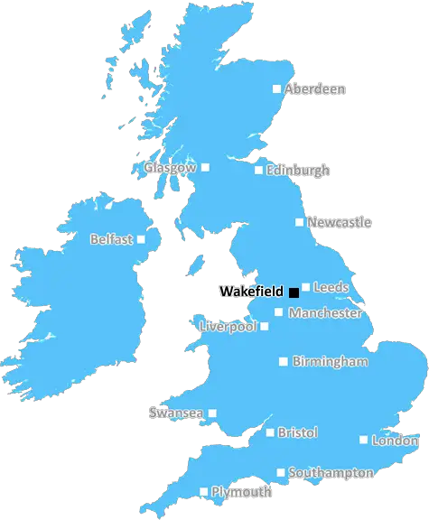
WF3 is located in the county of West Yorkshire, in England.
West Yorkshire has a total population of 2,299,700, making it the 4th largest county in the UK.
West Yorkshire has a total area of 783 square miles, and a population density of 1133 people per square kilometre. For comparison, Greater London has a density of 5,618 people/km2.
| Outward Code | WF3 |
| Postal Town | Wakefield |
| MSOA Name | Leeds 108 |
| LSOA Name | Leeds 108A |
| County | West Yorkshire |
| Region | West Yorkshire |
| Country | England |
| Local Authority | Leeds |
| Area Classification | Urban with Major Conurbation |
WF3 Electoral Wards
The postal region of WF3, includes the local towns, villages, electoral wards and stations of:
Dig even deeper into the WF3 postcode by clicking on a postcode below:
Click on an outward postal code below for more information about the area. Each 'outward' postcode give you a comprehensive list of all postcodes within the outward code area (WF) and estimated address.
Click on an 'outward' code for more information. For example, the outward postcode page 'EC2M' will give you an alphabetical list covering all postcodes located in the region, from 'EC2M 1BB' through to 'EC2M 7YA'.
CB, wakefield
Sunday, August 18, 2019
It is a lovely area and close community. There is all shop's and
Add your view of WF3
People need your local expertise. If you live in WF3 or have first-hand knowledge of the neighbourhood, please consider sharing your views. It's completely anonymous - all we ask is for your initials.
Please tell us what you like about the WF3 postcode area, what you don't like, and what it's like to live or work here.
| LOCAL AMENITIES | |
| FAMILY FRIENDLY | |
| PARKING | |
| GREEN SPACES |
Local News West Yorkshire
Elland waste tip to close for up to two weeks
The waste recycling centre's closure is to allow "essential drainage works" to take place.
BBC NewsCoventry City 2-1 Leeds United: Sky Blues stay in play-off hunt as Leeds miss chance to go top
Coventry City stay in the mix for a Championship play-off spot with victory over Leeds United, who miss the chance to go top.
BBC NewsCounty Championship: Ben Mike helps Leicestershire into good position at Yorkshire
Ben Mike hits a brilliant counter-attacking 90 as Leicestershire's lower order carry their side to 354 on day two against Yorkshire.
BBC NewsRapper Ja Rule denied UK entry ahead of Cardiff gig
The musician says his criminal record was the reason he has to shelve the British leg of his tour.
BBC NewsPrincess Anne praises Rob Burrow for MND fundraising
The Princess Royal meets the ex-rugby league player at an event at Headingley Stadium in Leeds.
BBC NewsCriminals' cash pays to train future plumbers
Cash seized under the Proceeds of Crime Act is funding training for teenagers in West Yorkshire.
BBC NewsFebruary 29: 'Leaplings' finally get to celebrate their birthdays
Three people in Yorkshire born on 29 February can only mark their "real" birthdays every four years.
BBC NewsCoroner raises concern over indefinite jail terms after man's death
John Hobson has urged the Ministry of Justice to consider the impact on offender's mental health.
BBC NewsFrom the Postcode Area blog

Deciphering Crime Rates - a Deep Dive Into UK Postcode Analysis
Ever wondered about the crime rate in your UK postcode? You're not alone. We've dug deep into the data, uncovering trends and patterns that'll make your head spin.

Death of the High Street?
The BBC reports that despite councils' attempts to kurb them, the UK's high streets have seen a huge growth in fast food outlets. Could this mark the death knell for the Great British high street, and what can we do about it to halt its decline?

Discrimination by Postcode
You really couldn't make it up, could you? Some of the country's most vulnerable people are missing out on their weekly £25 Cold Weather Payment, just because the system that's in operation is discriminating against them because payments are based on postcode, rather than geographic location.

The Redesign is Underway
Well, the current website was absolutely in dire need of a good redesign - from the ground up. So I set out to pull it all apart and get it up and running again to become the most comprehensive guide to every postcode in the UK. And it's been a long, tough job from start to finish - and quite possibly the biggest project I've ever undertaken.
SOCIAL GRADES
According to census records, 20% of people here have a social grade of AB (highest), compared to the national average of 27%.