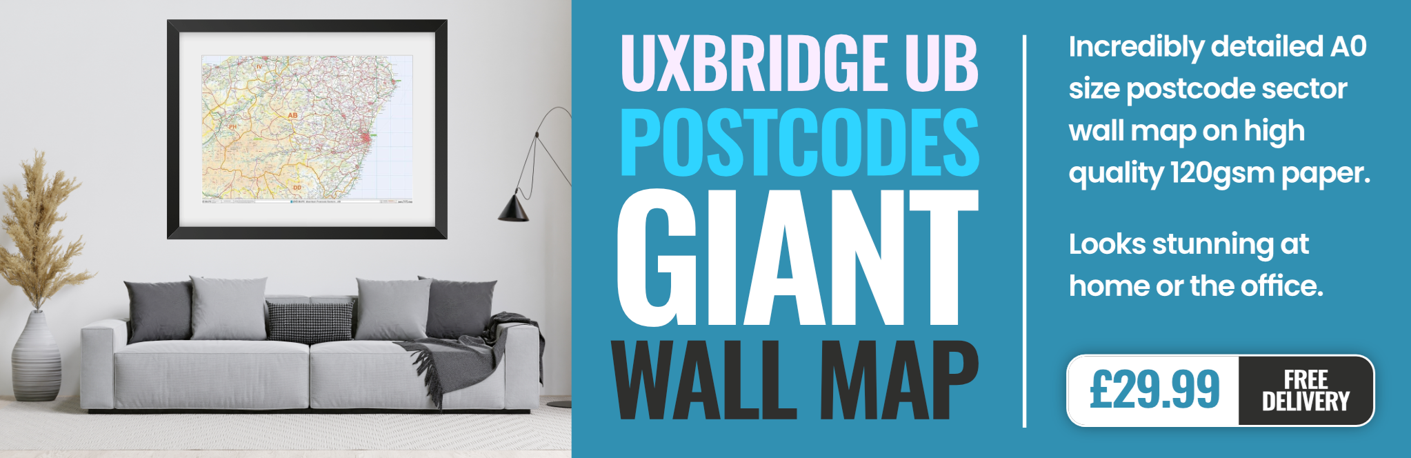
uxbridge UB5 Postcodes
Spending a fortune on conveyancing?

Compare instant, low-cost online quotes from trusted conveyancing solicitors.
Backed by experts, our no-obligation service searches through the best conveyancing quotes on the market to save you time and money.
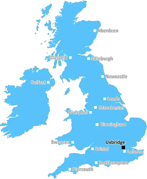
Uxbridge (UB5)
The UB5 postcode area is located in the Uxbridge postcode town region, within the county of , and contains a total of 1319 individual postcodes.
There are 1 electoral wards in the UB5 postcode area, including Greenford, Hayes, Northolt, Southall, Uxbridge, West Drayton which come under the local authority of the Council.
Combining the whole postcode region, 15% of people in UB5 are classed as having an AB social grade, (i.e. 'white-collar' middle-upper class), compared to 27% across the UK.
This does not mean that the people of UB5 are poorer than other areas, but it may give an indication that there are areas of deprivation.
UB5 is a postcode district in southern Middlesex, England. It is located approximately 6 miles (9.5 kilometers) west of Charing Cross, London. The UB5 postcode area is bounded by Harrow and the London Borough of Hillingdon to the west, the London Borough of Ealing to the south, the London Borough of Brent to the north and the London Borough of Hounslow to the east. The UB5 postcode area is covered by the following sixteen Electoral Wards: Northolt West End, Northwood, Northfield, Northolt Mandeville, Northolt Village, Greenford Broadway, Greenford Green, Dormers Wells, Southall Broadway, Northolt Greenwich, Southall Green, Northolt West, Norwood Green, Perivale East, Perivale West and Perivale Central.
The area is an amalgamation of several suburbs and settlements, the most prominent being Southall and Northolt, which are twinned with two towns in west London. It is home to a diverse range of people, including nationalities from East and South Asia, Africa, the Caribbean and the Middle East. Due to its cultural and racial diversity, it has its own unique flavor.
The most prominent feature of the area is the Grand Union Canal which passes through the area from west to east. The canal is known for its environmentally friendly construction, tow paths and wide variety of wildlife. Currently, UB5 is subject to a number of regeneration and redevelopment schemes, such as the redevelopment of Greenford Industrial Estate and the testing of driverless cars on the Grand Union Canal.
The UB5 postcode district is accessible by tube, bus, train and National Rail. It is also served by an extensive bus network and the A40 (western section of the M40) motorway. Furthermore, there are good road links to Heathrow Airport and other parts of London, making it an attractive place to live and work.
The area has a wide range of schools, both state and private, along with libraries, parks and leisure facilities. The postcode district is also home to a number of shopping and leisure facilities, including Southall Market, a range of caf�s, bars and restaurants and, most recently, Southall Waterside which is due to become a major leisure destination in June 2021. The area has excellent transport links and, with the development of new housing estates, is an attractive place to live.

Demographics

UB5 is located in the county of , in .
has a total population of 0, making it the largest county in the UK.
has a total area of square miles, and a population density of people per square kilometre. For comparison, Greater London has a density of 5,618 people/km2.
| Outward Code | UB5 |
| Postal Town | Uxbridge |
| MSOA Name | |
| LSOA Name | |
| County | |
| Region | |
| Country | |
| Local Authority | |
| Area Classification | Unclassified |
UB5 Electoral Wards
The postal region of UB5, includes the local towns, villages, electoral wards and stations of:
Dig even deeper into the UB5 postcode by clicking on a postcode below:
Click on an outward postal code below for more information about the area. Each 'outward' postcode give you a comprehensive list of all postcodes within the outward code area (UB) and estimated address.
Click on an 'outward' code for more information. For example, the outward postcode page 'EC2M' will give you an alphabetical list covering all postcodes located in the region, from 'EC2M 1BB' through to 'EC2M 7YA'.
Chris H
Monday, April 8, 2024
We don't have any views of UB5 right now. If you live in UB5 or have visited it, please help us to help others by telling others what you think of this neighbourhood.
Add your view of UB5
People need your local expertise. If you live in UB5 or have first-hand knowledge of the neighbourhood, please consider sharing your views. It's completely anonymous - all we ask is for your initials.
Please tell us what you like about the UB5 postcode area, what you don't like, and what it's like to live or work here.
| LOCAL AMENITIES | |
| FAMILY FRIENDLY | |
| PARKING | |
| GREEN SPACES |
From the Postcode Area blog

Deciphering Crime Rates - a Deep Dive Into UK Postcode Analysis
Ever wondered about the crime rate in your UK postcode? You're not alone. We've dug deep into the data, uncovering trends and patterns that'll make your head spin.

Death of the High Street?
The BBC reports that despite councils' attempts to kurb them, the UK's high streets have seen a huge growth in fast food outlets. Could this mark the death knell for the Great British high street, and what can we do about it to halt its decline?

Discrimination by Postcode
You really couldn't make it up, could you? Some of the country's most vulnerable people are missing out on their weekly £25 Cold Weather Payment, just because the system that's in operation is discriminating against them because payments are based on postcode, rather than geographic location.

The Redesign is Underway
Well, the current website was absolutely in dire need of a good redesign - from the ground up. So I set out to pull it all apart and get it up and running again to become the most comprehensive guide to every postcode in the UK. And it's been a long, tough job from start to finish - and quite possibly the biggest project I've ever undertaken.
SOCIAL GRADES
According to census records, 15% of people here have a social grade of AB (highest), compared to the national average of 27%.