truro TR18 Postcodes
Spending a fortune on conveyancing?

Compare instant, low-cost online quotes from trusted conveyancing solicitors.
Backed by experts, our no-obligation service searches through the best conveyancing quotes on the market to save you time and money.
Truro (TR18)
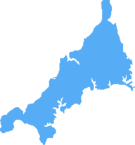
The TR18 postcode area is located in the Truro postcode town region, within the county of Cornwall, and contains a total of 1154 individual postcodes.
There are 7 electoral wards in the TR18 postcode area, including Camborne, Falmouth, Hayle, Helston, Isles Of Scilly, Marazion, Newquay, Penryn, Penzance, Perranporth, Redruth, St Agnes, St Columb, St Ives, Truro which come under the local authority of the Cornwall,Isles of Scilly Council.
Combining the whole postcode region, 16% of people in TR18 are classed as having an AB social grade, (i.e. 'white-collar' middle-upper class), compared to 27% across the UK.
This does not mean that the people of TR18 are poorer than other areas, but it may give an indication that there are areas of deprivation.
The TR18 postcode comprises of the area around Penzance in Cornwall. The TR18 postcode covers most of Penzance town itself and also covers areas such as the nearby villages of Newlyn, Mousehole, Gulval and Madron and the hamlet of Sancreed.
The TR18 postcode is served by Penzance railway station, which connects Penzance to the national rail network. It also has a few bus services which runs to and from nearby towns such as Helston and St Ives.
Penzeance is a popular destination for tourists due to its attractive harbour, art galleries, its many independent shops and restaurants, and its strong connections with the folklore of pirates and shipwrecks. The heart of the town is crowded in the summer with stalls selling regional seafood, souvenirs and gifts.
The area around Penzance also includes some of Cornwall's most renowned tourist attractions including St Michael's Mount, which sits just off the Cornish coast and can be reached by ferry. The nearby Minack Theatre is an iconic open-air theatre built into the cliffs, offering stunning views of the sea and famous plays and musicals during the summer months.
The TR18 postcode is also home to many local businesses, including agricultural farms, food and drink producers, and art galleries, as well as a number of national and international chains.
The town also has a strong history of contributing to the British entertainment industry with several internationally renowned musicals having had their premieres in the town. Camborne School of Mines, a world-renowned mining engineering school, is also located within the TR18 postcode.
Connectivity wise, the TR18 postcode is well connected. It sits roughly 3 miles away from the A30 and the A3076, which links to the A30 and M5 motorways. The local airport is situated 9 miles away and ferries to the Isles of Scilly are available from Penzance harbour.
There is also popular local sailing and windsurfing, beachcombing and also a vibrant music scene which can be found at the local pubs and bars in the area. The TR18 postcode is also home to many notable sculptures, including an ice rink in November and December.

Demographics
Cornwall
TR18 is located in the county of Cornwall, in England.
Cornwall has a total population of 556,000, making it the 40th largest county in the UK.
Cornwall has a total area of 1375 square miles, and a population density of 156 people per square kilometre. For comparison, Greater London has a density of 5,618 people/km2.

| Outward Code | TR18 |
| Postal Town | Truro |
| MSOA Name | Cornwall 068 |
| LSOA Name | Cornwall 068C |
| County | Cornwall |
| Region | Cornwall |
| Country | England |
| Local Authority | Cornwall,Isles of Scilly |
| Area Classification | Mainly Rural (rural including hub towns >=80%) |
TR18 Electoral Wards
The postal region of TR18, includes the local towns, villages, electoral wards and stations of:
Dig even deeper into the TR18 postcode by clicking on a postcode below:
Click on an outward postal code below for more information about the area. Each 'outward' postcode give you a comprehensive list of all postcodes within the outward code area (TR) and estimated address.
Click on an 'outward' code for more information. For example, the outward postcode page 'EC2M' will give you an alphabetical list covering all postcodes located in the region, from 'EC2M 1BB' through to 'EC2M 7YA'.
Chris H
Wednesday, April 17, 2024
We don't have any views of TR18 right now. If you live in TR18 or have visited it, please help us to help others by telling others what you think of this neighbourhood.
Add your view of TR18
People need your local expertise. If you live in TR18 or have first-hand knowledge of the neighbourhood, please consider sharing your views. It's completely anonymous - all we ask is for your initials.
Please tell us what you like about the TR18 postcode area, what you don't like, and what it's like to live or work here.
| LOCAL AMENITIES | |
| FAMILY FRIENDLY | |
| PARKING | |
| GREEN SPACES |
Local News Cornwall
Glover among five golds for GB at World Rowing Cup
Great Britain finish top of the medal table at the World Rowing Cup in Italy.
BBC NewsThird cliff fall near planned flat development
Further cliff falls happened at the site near Newquay in November and December.
BBC NewsTruro roundabout giant hedgehogs to be given facelift
Cecil, Patricia, Denzil and Kizzy first appeared on Trafalgar Roundabout in 2019
Cornwall LiveWeather forces ultra-luxury cruise ship to make surprise visit to Cornwall
The expedition ship carries just 264 guests as well as a 26-strong Expedition Team
Cornwall LiveItems worth hundreds of pounds stolen near Liskeard as police launch CCTV appeal
The reported vehicle interference and thefts took place in Pensilva during the early hours of Thursday, February 22
Cornwall Live'Traffic-free' bridge over A30 in Cornwall opens
The council says the bridge allows pedestrians, cyclists and horse riders to cross the road safely.
BBC NewsBig annual music and drinks festival is coming to Cornwall
Rattler Fest will see the likes of Scouting for Girls, The Zutons and East17 perform over the two-day event
Cornwall LiveGirl seriously hurt in suspected XL Bully attack
The girl was taken to the Royal Cornwall Hospital with serious but not life-threatening injuries.
BBC NewsFrom the Postcode Area blog

Deciphering Crime Rates - a Deep Dive Into UK Postcode Analysis
Ever wondered about the crime rate in your UK postcode? You're not alone. We've dug deep into the data, uncovering trends and patterns that'll make your head spin.

Death of the High Street?
The BBC reports that despite councils' attempts to kurb them, the UK's high streets have seen a huge growth in fast food outlets. Could this mark the death knell for the Great British high street, and what can we do about it to halt its decline?

Discrimination by Postcode
You really couldn't make it up, could you? Some of the country's most vulnerable people are missing out on their weekly £25 Cold Weather Payment, just because the system that's in operation is discriminating against them because payments are based on postcode, rather than geographic location.

The Redesign is Underway
Well, the current website was absolutely in dire need of a good redesign - from the ground up. So I set out to pull it all apart and get it up and running again to become the most comprehensive guide to every postcode in the UK. And it's been a long, tough job from start to finish - and quite possibly the biggest project I've ever undertaken.
SOCIAL GRADES
According to census records, 16% of people here have a social grade of AB (highest), compared to the national average of 27%.