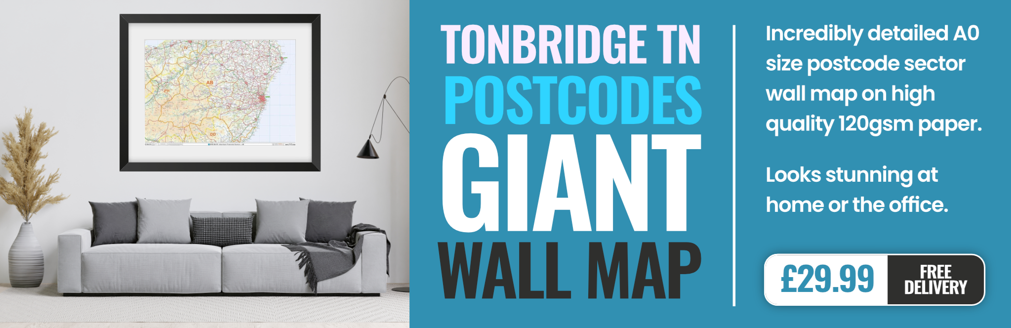
tonbridge TN6 Postcodes
Spending a fortune on conveyancing?

Compare instant, low-cost online quotes from trusted conveyancing solicitors.
Backed by experts, our no-obligation service searches through the best conveyancing quotes on the market to save you time and money.
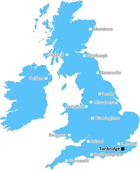
Tonbridge (TN6)
The TN6 postcode area is located in the Tonbridge postcode town region, within the county of East Sussex, and contains a total of 1218 individual postcodes.
There are 33 electoral wards in the TN6 postcode area, including Ashford, Battle, Bexhill-On-Sea, Cranbrook, Crowborough, Edenbridge, Etchingham, Hartfield, Hastings, Heathfield, Mayfield, New Romney, Robertsbridge, Romney Marsh, Rye, Sevenoaks, St Leonards-On-Sea, Tenterden, Tonbridge, Tunbridge Wells, Uckfield, Wadhurst, Westerham, Winchelsea which come under the local authority of the Wealden Council.
Combining the whole postcode region, 33% of people in TN6 are classed as having an AB social grade, (i.e. 'white-collar' middle-upper class), compared to 27% across the UK.
This does not mean that the people of TN6 are wealthier - or higher class - than average, but it can be an indication that the area may be prospering and desirable to live in.
The TN6 postcode area covers parts of East Sussex and Kent, specifically the Tonbridge district. It includes post towns such as Crowborough, Uckfield, Hadlow, Hartfield, and Tunbridge Wells, and covers a total area of 173.13 square miles. TN6 is in the south east of England and borders Surrey and Greater London.
The majority of the TN6 postcode area is situated in East Sussex with Tunbridge Wells accounting for around 90% of the postcode's area. It includes the town of Tonbridge and surrounding villages such as Speldhurst, Groombridge, Southborough, and Leigh. The southeast of the postcode includes the Ashdown Forest, one of the few surviving remnants of ancient woodland in the weald and downland of southeast England.
Other towns in the TN6 area include Edenbridge, where the Kent and East Sussex Railway operates a heritage train service, Crowborough, a flourishing town and arts centre, and Hadlow, which includes a number of historic buildings. TN6 also includes outlying settlements such as Hartfield and High Hurstwood.
The postcode is popular with commuters, with excellent transport links including the A21 and A26 roads, regular trains to London Victoria and Cannon Street, and two international airports nearby - Gatwick Airport and Heathrow Airport. There are also a number of leisure facilities in the region including golf courses, country parks, and National Trust properties. The area is renowned for its picturesque villages and historical market towns, with many attractions such as historical houses, art galleries, and craft centres.
TN6 is a popular residential area, with a range of property types from Georgian townhouses to modern apartments, as well as a number of new developments. As well as modern schools, there are also a number of independent schools in and around the postcode. Education provision also includes two further education colleges, MidKent College and East Sussex College Hastings Campus, making the area well served for higher education.

Demographics
East Sussex

TN6 is located in the county of East Sussex, in England.
East Sussex has a total population of 837,000, making it the 29th largest county in the UK.
East Sussex has a total area of 692 square miles, and a population density of 467 people per square kilometre. For comparison, Greater London has a density of 5,618 people/km2.
| Outward Code | TN6 |
| Postal Town | Tonbridge |
| MSOA Name | Wealden 004 |
| LSOA Name | Wealden 004B |
| County | East Sussex |
| Region | East Sussex |
| Country | England |
| Local Authority | Wealden |
| Area Classification | Mainly Rural (rural including hub towns >=80%) |
TN6 Electoral Wards
The postal region of TN6, includes the local towns, villages, electoral wards and stations of:
Dig even deeper into the TN6 postcode by clicking on a postcode below:
Click on an outward postal code below for more information about the area. Each 'outward' postcode give you a comprehensive list of all postcodes within the outward code area (TN) and estimated address.
Click on an 'outward' code for more information. For example, the outward postcode page 'EC2M' will give you an alphabetical list covering all postcodes located in the region, from 'EC2M 1BB' through to 'EC2M 7YA'.
S, Tonbridge
Friday, May 27, 2022
KENT!! Tonbridge and Tunbridge Wells and many of these places are NOT in East Sussex, they are in Kent!! Get it right!
Add your view of TN6
People need your local expertise. If you live in TN6 or have first-hand knowledge of the neighbourhood, please consider sharing your views. It's completely anonymous - all we ask is for your initials.
Please tell us what you like about the TN6 postcode area, what you don't like, and what it's like to live or work here.
| LOCAL AMENITIES | |
| FAMILY FRIENDLY | |
| PARKING | |
| GREEN SPACES |
Local News Sussex
Muric own goal 'not his fault' as Burnley denied win
A calamitous own goal by goalkeeper Arijanet Muric prevents Burnley from securing a vital Premier League win over Brighton at Turf Moor.
BBC NewsPlans to reopen former household refuse site
Lewes District Council wants to develop the site in Newhaven for the handling of food waste.
BBC NewsResidents prepare to cast votes in local elections
Over 50 seats are up for re-election in four local councils across East and West Sussex in May.
BBC NewsGirl, 13, makes crisp packet blankets for homeless
Savana makes the survival blankets as part of volunteer work for a St Leonards-based project.
BBC NewsMan arrested after suspected arson attack - police
Sussex Police say a 34-year-old man from Hailsham remains in custody following the incident.
BBC NewsNo stopping rules introduced on Brighton roads
London Road, Preston Road and Lewes Road have restrictions implemented seven days a week.
BBC NewsPlans submitted to remove and replace skate park
The new skate park in East Wittering would replace one deemed "no longer fit for purpose".
BBC NewsBogus removals man hid cocaine in piano
Francesco Role was caught when border security officers became suspicious of the piano's weight.
BBC NewsFrom the Postcode Area blog

Deciphering Crime Rates - a Deep Dive Into UK Postcode Analysis
Ever wondered about the crime rate in your UK postcode? You're not alone. We've dug deep into the data, uncovering trends and patterns that'll make your head spin.

Death of the High Street?
The BBC reports that despite councils' attempts to kurb them, the UK's high streets have seen a huge growth in fast food outlets. Could this mark the death knell for the Great British high street, and what can we do about it to halt its decline?

Discrimination by Postcode
You really couldn't make it up, could you? Some of the country's most vulnerable people are missing out on their weekly £25 Cold Weather Payment, just because the system that's in operation is discriminating against them because payments are based on postcode, rather than geographic location.

The Redesign is Underway
Well, the current website was absolutely in dire need of a good redesign - from the ground up. So I set out to pull it all apart and get it up and running again to become the most comprehensive guide to every postcode in the UK. And it's been a long, tough job from start to finish - and quite possibly the biggest project I've ever undertaken.
SOCIAL GRADES
According to census records, 33% of people here have a social grade of AB (highest), compared to the national average of 27%.