tonbridge TN15 Postcodes
Spending a fortune on conveyancing?

Compare instant, low-cost online quotes from trusted conveyancing solicitors.
Backed by experts, our no-obligation service searches through the best conveyancing quotes on the market to save you time and money.
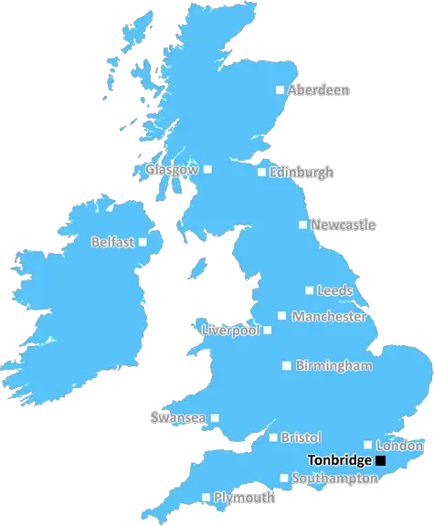
Tonbridge (TN15)
The TN15 postcode area is located in the Tonbridge postcode town region, within the county of Kent, and contains a total of 1192 individual postcodes.
There are 74 electoral wards in the TN15 postcode area, including Ashford, Battle, Bexhill-On-Sea, Cranbrook, Crowborough, Edenbridge, Etchingham, Hartfield, Hastings, Heathfield, Mayfield, New Romney, Robertsbridge, Romney Marsh, Rye, Sevenoaks, St Leonards-On-Sea, Tenterden, Tonbridge, Tunbridge Wells, Uckfield, Wadhurst, Westerham, Winchelsea which come under the local authority of the Sevenoaks Council.
Combining the whole postcode region, 35% of people in TN15 are classed as having an AB social grade, (i.e. 'white-collar' middle-upper class), compared to 27% across the UK.
This does not mean that the people of TN15 are wealthier - or higher class - than average, but it can be an indication that the area may be prospering and desirable to live in.
TN15 is a postcode district in the south-east of England that covers the Tonbridge township. Located within the West Kent and East Sussex ceremonial county, it contains the post towns of Tonbridge, Tonbridge Wells, Sevenoaks, Wrotham, Hildenborough and Hadlow, as well as small parts of East Peckham, Matfield, Wateringbury, East Malling, Borough Green and Laddingford.
TN15 is predominantly rural in character, with the Tonbridge and Hildenborough post towns primarily covered by small suburbs and separated by green belts. There is a wide variety of terrain in TN15, from rolling fields and wooded hills in the west to traditionally urbanised areas in the east. Areas of TN15 to the east and west are separated by a blue line on maps and a line of hills to the east-north.
The Tonbridge post town is TN15's largest population centre, with the town emerging from prehistory, through the Medieval and into the Modern Era. It is home to Tonbridge Castle, dating from the 11th century, Tonbridge School, one of the oldest educational institutions in England and an important hub for business and retail in West Kent.
The post towns of Tonbridge Wells and Sevenoaks are small centres of population, but are both important centres of culture in TN15 and beyond. Tonbridge Wells has an historic theatre, great shopping and restaurants; while Sevenoaks benefits from its close proximity to the affluent Kent commuter belt and London, with large housing estates, very good schools, outdoor activities and golf courses.
TN15 also has several prominent archaeological sites, including Hadlow Castle, Wateringbury and Malling castles and Calverley's Cave, an archaeological site dating back to the Neolithic period. TN15's roads and rail links to London are good, with services from Tonbridge and Tunbridge Wells to London Charing Cross, London Bridge and Cannon Street.

Demographics

Kent

TN15 is located in the county of Kent, in England.
Kent has a total population of 1,820,400, making it the 6th largest county in the UK.
Kent has a total area of 1443 square miles, and a population density of 486 people per square kilometre. For comparison, Greater London has a density of 5,618 people/km2.
| Outward Code | TN15 |
| Postal Town | Tonbridge |
| MSOA Name | Sevenoaks 010 |
| LSOA Name | Sevenoaks 010E |
| County | Kent |
| Region | Kent |
| Country | England |
| Local Authority | Sevenoaks |
| Area Classification | Largely Rural (rural including hub towns 50-79%) |
TN15 Electoral Wards
The postal region of TN15, includes the local towns, villages, electoral wards and stations of:
Dig even deeper into the TN15 postcode by clicking on a postcode below:
Click on an outward postal code below for more information about the area. Each 'outward' postcode give you a comprehensive list of all postcodes within the outward code area (TN) and estimated address.
Click on an 'outward' code for more information. For example, the outward postcode page 'EC2M' will give you an alphabetical list covering all postcodes located in the region, from 'EC2M 1BB' through to 'EC2M 7YA'.
Chris H
Sunday, April 7, 2024
We don't have any views of TN15 right now. If you live in TN15 or have visited it, please help us to help others by telling others what you think of this neighbourhood.
Add your view of TN15
People need your local expertise. If you live in TN15 or have first-hand knowledge of the neighbourhood, please consider sharing your views. It's completely anonymous - all we ask is for your initials.
Please tell us what you like about the TN15 postcode area, what you don't like, and what it's like to live or work here.
| LOCAL AMENITIES | |
| FAMILY FRIENDLY | |
| PARKING | |
| GREEN SPACES |
Local News Kent
Homes England acquires Worthing site to deliver 250 homes
The acquisition forms part of the body's plans to regenerate challenging brownfield areas.
Property WeekKent sign Swanepoel after Bartlett deal called off
South African all-rounder Beyers Swanepoel is to join Kent after Xavier Bartlett's deal falls through.
BBC NewsMirabaud buys Virgin Atlantic HQ in UK debut
Swiss investor snaps up grade-A office scheme let to Virgin Atlantic until 2032.
Property WeekUK Space Agency primed for Harwell Campus landing
The government agency has taken around 10,500 sq ft of space in the Quad Two building.
Property WeekSurrey strikes 32.2m deal to buy offices from cash-strapped Woking Council
Surrey County Council will move staff into Victoria Gate building, formerly let to McLaren, later this year.
Property WeekMan charged over 300 thefts at Co-op and Tesco stores
A man is in court following a spate of thefts from several convenience stores in towns across the county.
Kent OnlineTT Group sells BT's old Southampton offices to consortium
BT's former Friary House office building has permission for residential conversion under permitted development rights.
Property WeekHospital site with permission for 19 homes on market for 2.4m
Land surrounding a former hospital, which has planning permission for 19 townhouses, has hit the market at £2.4 million.
Kent OnlineFrom the Postcode Area blog

Deciphering Crime Rates - a Deep Dive Into UK Postcode Analysis
Ever wondered about the crime rate in your UK postcode? You're not alone. We've dug deep into the data, uncovering trends and patterns that'll make your head spin.

Death of the High Street?
The BBC reports that despite councils' attempts to kurb them, the UK's high streets have seen a huge growth in fast food outlets. Could this mark the death knell for the Great British high street, and what can we do about it to halt its decline?

Discrimination by Postcode
You really couldn't make it up, could you? Some of the country's most vulnerable people are missing out on their weekly £25 Cold Weather Payment, just because the system that's in operation is discriminating against them because payments are based on postcode, rather than geographic location.

The Redesign is Underway
Well, the current website was absolutely in dire need of a good redesign - from the ground up. So I set out to pull it all apart and get it up and running again to become the most comprehensive guide to every postcode in the UK. And it's been a long, tough job from start to finish - and quite possibly the biggest project I've ever undertaken.
SOCIAL GRADES
According to census records, 35% of people here have a social grade of AB (highest), compared to the national average of 27%.