swindon SN6 Postcodes
Spending a fortune on conveyancing?

Compare instant, low-cost online quotes from trusted conveyancing solicitors.
Backed by experts, our no-obligation service searches through the best conveyancing quotes on the market to save you time and money.
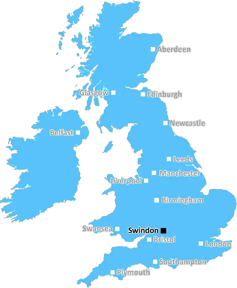
Swindon (SN6)
The SN6 postcode area is located in the Swindon postcode town region, within the county of Wiltshire, and contains a total of 783 individual postcodes.
There are 123 electoral wards in the SN6 postcode area, including Calne, Chippenham, Corsham, Devizes, Faringdon, Malmesbury, Marlborough, Melksham, Pewsey, Swindon which come under the local authority of the Wiltshire Council.
Combining the whole postcode region, 33% of people in SN6 are classed as having an AB social grade, (i.e. 'white-collar' middle-upper class), compared to 27% across the UK.
This does not mean that the people of SN6 are wealthier - or higher class - than average, but it can be an indication that the area may be prospering and desirable to live in.
The SN6 postcode covers a number of areas in the Borough of Swindon, primarily to the east of the town centre. SN6 includes many residential areas, including Haydon Wick, Blagrove, Covingham, Toothill and Eldene.
Haydon Wick is a large residential estate situated on the eastern edge of the town. There are various shops, community facilities and pubs in the area, as well as a variety of playing fields and open green spaces. Blagrove is an older and more traditional calmer residential part of Swindon, which is located on the north side of the A419 and is well served with local amenities such as grocery stores, hairdressers and takeaways, as well as a variety of bus links.
Covingham is a suburb located north of the town centre, bordered by Liden, Eldene and Haydon Wick. It is home to many shops, businesses, pubs, schools, churches, a golf course, parks and two large lakes. Toothill was one of the earliest residential areas in Swindon, developed after the building of the Old Town railway station in 1842. It is a small village, close to the A429 with easy access into the town centre and to Junction 16 of the M4.
Eldene is a residential area located to the south east of Swindon, situated near the boundary between the Borough of Swindon and Wiltshire. It is home to the supermarkets Tesco and Lidl, a number of small businesses, a great variety of local parks, a post office, local schools and a library.
SN6 also includes Rivermead, located in the east of the borough, and Stanton Fitzwarren, situated to the south of the postcode. Rivermead is mainly a residential suburb, served by a selection of amenities including a variety of small shops, a post office, a local library and a leisure centre. Stanton Fitzwarren is a small village situated on the Wiltshire border and is home to a selection of local businesses and services, as well as historic buildings including the church and manor house, and the Swan public house.

Demographics

Wiltshire

SN6 is located in the county of Wiltshire, in England.
Wiltshire has a total population of 706,300, making it the 34th largest county in the UK.
Wiltshire has a total area of 1346 square miles, and a population density of 202 people per square kilometre. For comparison, Greater London has a density of 5,618 people/km2.
| Outward Code | SN6 |
| Postal Town | Swindon |
| MSOA Name | Wiltshire 001 |
| LSOA Name | Wiltshire 001C |
| County | Wiltshire |
| Region | Wiltshire |
| Country | England |
| Local Authority | Wiltshire |
| Area Classification | Largely Rural (rural including hub towns 50-79%) |
SN6 Electoral Wards
The postal region of SN6, includes the local towns, villages, electoral wards and stations of:
Dig even deeper into the SN6 postcode by clicking on a postcode below:
Click on an outward postal code below for more information about the area. Each 'outward' postcode give you a comprehensive list of all postcodes within the outward code area (SN) and estimated address.
Click on an 'outward' code for more information. For example, the outward postcode page 'EC2M' will give you an alphabetical list covering all postcodes located in the region, from 'EC2M 1BB' through to 'EC2M 7YA'.
Chris H
Sunday, April 7, 2024
We don't have any views of SN6 right now. If you live in SN6 or have visited it, please help us to help others by telling others what you think of this neighbourhood.
Add your view of SN6
People need your local expertise. If you live in SN6 or have first-hand knowledge of the neighbourhood, please consider sharing your views. It's completely anonymous - all we ask is for your initials.
Please tell us what you like about the SN6 postcode area, what you don't like, and what it's like to live or work here.
| LOCAL AMENITIES | |
| FAMILY FRIENDLY | |
| PARKING | |
| GREEN SPACES |
Local News Wiltshire
Ukrainians risking air strikes to see a dentist
Natalia Nehriba returned to Ukraine despite the ongoing war after being left in "excruciating" pain.
BBC NewsSwindon Town 2-1 Notts County
Swindon break a four-match winless streak as they beat Notts County thanks to two pieces of comedic defending.
BBC NewsL1 & L2: Wins for Pompey, Derby and Carlisle; Wrexham beat Mansfield; Stockport go top
Follow live text commentary and score updates from League One and League Two.
BBC NewsTitian 16th-century painting set to be auctioned
The painting is expected to fetch between 15m and 25m at auction on 2 July.
BBC NewsRelive Monday's League One & Two action
Aaron Collins scores a hat-trick for Bolton and Carlisle move closer to relegation - relive Monday's games in League One and League Two.
BBC NewsRapist who pretended to be a taxi driver jailed
Fareed Tariq has been given an 18-year sentence for raping a woman he had lured into his car.
BBC NewsMan charged with rape in town centre
Prinse Kessie was remanded in custody until 3 May when he will appear at Swindon Crown Court.
BBC NewsWhy are some people anti-plans for Lime Down Solar Park?
A 2,000 acre solar farm is proposed to stretch across countryside in several Wiltshire villages.
BBC NewsFrom the Postcode Area blog

Deciphering Crime Rates - a Deep Dive Into UK Postcode Analysis
Ever wondered about the crime rate in your UK postcode? You're not alone. We've dug deep into the data, uncovering trends and patterns that'll make your head spin.

Death of the High Street?
The BBC reports that despite councils' attempts to kurb them, the UK's high streets have seen a huge growth in fast food outlets. Could this mark the death knell for the Great British high street, and what can we do about it to halt its decline?

Discrimination by Postcode
You really couldn't make it up, could you? Some of the country's most vulnerable people are missing out on their weekly £25 Cold Weather Payment, just because the system that's in operation is discriminating against them because payments are based on postcode, rather than geographic location.

The Redesign is Underway
Well, the current website was absolutely in dire need of a good redesign - from the ground up. So I set out to pull it all apart and get it up and running again to become the most comprehensive guide to every postcode in the UK. And it's been a long, tough job from start to finish - and quite possibly the biggest project I've ever undertaken.
SOCIAL GRADES
According to census records, 33% of people here have a social grade of AB (highest), compared to the national average of 27%.