swindon SN26 Postcodes
Spending a fortune on conveyancing?

Compare instant, low-cost online quotes from trusted conveyancing solicitors.
Backed by experts, our no-obligation service searches through the best conveyancing quotes on the market to save you time and money.
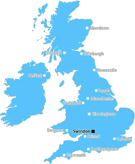
Swindon (SN26)
The SN26 postcode area is located in the Swindon postcode town region, within the county of Wiltshire, and contains a total of 54 individual postcodes.
There are 0 electoral wards in the SN26 postcode area, including Calne, Chippenham, Corsham, Devizes, Faringdon, Malmesbury, Marlborough, Melksham, Pewsey, Swindon which come under the local authority of the Swindon Council.
Combining the whole postcode region, 20% of people in SN26 are classed as having an AB social grade, (i.e. 'white-collar' middle-upper class), compared to 27% across the UK.
This does not mean that the people of SN26 are poorer than other areas, but it may give an indication that there are areas of deprivation.
SN26 is a postcode located in the Swindon district of Wiltshire in the United Kingdom. Swindon is a large town located in the counties of Wiltshire and Gloucestershire, and is well known for its history in manufacturing and engineering. The SN26 postcode district sits to the northeast of Swindon, and contains the villages and hamlets of Blunsdon, Fifield, Purton, Eastcott, Rodbourne Cheney, Even Swindon, Kingston.
SN26 is a generally rural area, and the environment is characterised by open countryside that features agricultural farming, conservation land, and woodland. Blunsdon is the largest village in this postcode area and is located at the foot of a large hill by the same name. This hill was used in stone quarrying during the 19th century, and has since been converted into a nature reserve and golf course. Fifield is a smaller village that has cottages, a village hall, a garage, and a pub, while Purton is a small hamlet with a similar makeup. Eastcott is located close to Upham Brook and is centered around a more urban development than its mainly rural neighbours, while Rodbourne Cheney is a hamlet that offers a few amenities such as a pub, post office, and a village hall.
Even Swindon is a rural hamlet situated within the Chiseldon and Badbury conservation area. Old homes and farmhouses from the 15th century can still be found around this area. Kingston is the smallest settlement in the SN26 postcode, and is located at the southwestern border of the Wroughton parish.
The SN26 postcode district is only a short drive away from the M4 motorway, which makes it a great commuting spot for people travelling to nearby towns such as Cirencester, Cricklade, and Royal Wootton Bassett. The larger towns of Swindon are also easily accessible, as is the city of Gloucester, which is located about 50 miles away.

Demographics

Wiltshire

SN26 is located in the county of Wiltshire, in England.
Wiltshire has a total population of 706,300, making it the 34th largest county in the UK.
Wiltshire has a total area of 1346 square miles, and a population density of 202 people per square kilometre. For comparison, Greater London has a density of 5,618 people/km2.
| Outward Code | SN26 |
| Postal Town | Swindon |
| MSOA Name | Swindon 008 |
| LSOA Name | Swindon 008A |
| County | Wiltshire |
| Region | Wiltshire |
| Country | England |
| Local Authority | Swindon |
| Area Classification | Urban with City and Town |
SN26 Electoral Wards
The postal region of SN26, includes the local towns, villages, electoral wards and stations of:
Dig even deeper into the SN26 postcode by clicking on a postcode below:
Click on an outward postal code below for more information about the area. Each 'outward' postcode give you a comprehensive list of all postcodes within the outward code area (SN) and estimated address.
Click on an 'outward' code for more information. For example, the outward postcode page 'EC2M' will give you an alphabetical list covering all postcodes located in the region, from 'EC2M 1BB' through to 'EC2M 7YA'.
Chris H
Sunday, April 14, 2024
We don't have any views of SN26 right now. If you live in SN26 or have visited it, please help us to help others by telling others what you think of this neighbourhood.
Add your view of SN26
People need your local expertise. If you live in SN26 or have first-hand knowledge of the neighbourhood, please consider sharing your views. It's completely anonymous - all we ask is for your initials.
Please tell us what you like about the SN26 postcode area, what you don't like, and what it's like to live or work here.
| LOCAL AMENITIES | |
| FAMILY FRIENDLY | |
| PARKING | |
| GREEN SPACES |
Local News Wiltshire
Dead lambs and 'decimated crops' on rain-soaked farms
Farmers struggle with crops after continuous rainfall, and new-born lambs perish on the hills
BBC NewsSwindon Town 3-2 AFC Wimbledon
Swindon come from behind to beat AFC Wimbledon 3-2 and dent the visitors' play-off hopes.
BBC NewsBarrow 0-2 Swindon Town
Paul Glatzel continues his fine recent goalscoring form as Swindon stun League Two promotion-chasers Barrow with a 2-0 victory.
BBC NewsSutton United 3-1 Swindon Town
Sutton make it four wins in a row by beating Swindon as they move out of the League Two relegation places.
BBC NewsPublic invited to quiz firm behind station development
An event on 16 April will display plans for developing the front of Salisbury Railway Station.
BBC NewsSwindon Town 2-1 Notts County
Swindon break a four-match winless streak as they beat Notts County thanks to two pieces of comedic defending.
BBC NewsPair sentenced for 'significant' money laundering
Two men are sentenced following their part in a fraud that led to a pensioner paying out 406k.
BBC NewsCancer patients to get gym pass to stay active
Salisbury hospital's charity is granted 88,000 to fund patient fitness and staff counselling.
BBC NewsFrom the Postcode Area blog

Deciphering Crime Rates - a Deep Dive Into UK Postcode Analysis
Ever wondered about the crime rate in your UK postcode? You're not alone. We've dug deep into the data, uncovering trends and patterns that'll make your head spin.

Death of the High Street?
The BBC reports that despite councils' attempts to kurb them, the UK's high streets have seen a huge growth in fast food outlets. Could this mark the death knell for the Great British high street, and what can we do about it to halt its decline?

Discrimination by Postcode
You really couldn't make it up, could you? Some of the country's most vulnerable people are missing out on their weekly £25 Cold Weather Payment, just because the system that's in operation is discriminating against them because payments are based on postcode, rather than geographic location.

The Redesign is Underway
Well, the current website was absolutely in dire need of a good redesign - from the ground up. So I set out to pull it all apart and get it up and running again to become the most comprehensive guide to every postcode in the UK. And it's been a long, tough job from start to finish - and quite possibly the biggest project I've ever undertaken.
SOCIAL GRADES
According to census records, 20% of people here have a social grade of AB (highest), compared to the national average of 27%.