swindon SN11 Postcodes
Spending a fortune on conveyancing?

Compare instant, low-cost online quotes from trusted conveyancing solicitors.
Backed by experts, our no-obligation service searches through the best conveyancing quotes on the market to save you time and money.
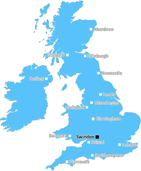
Swindon (SN11)
The SN11 postcode area is located in the Swindon postcode town region, within the county of Wiltshire, and contains a total of 899 individual postcodes.
There are 48 electoral wards in the SN11 postcode area, including Calne, Chippenham, Corsham, Devizes, Faringdon, Malmesbury, Marlborough, Melksham, Pewsey, Swindon which come under the local authority of the Wiltshire Council.
Combining the whole postcode region, 25% of people in SN11 are classed as having an AB social grade, (i.e. 'white-collar' middle-upper class), compared to 27% across the UK.
This does not mean that the people of SN11 are poorer than other areas, but it may give an indication that there are areas of deprivation.
The SN11 postcode is located in the Swindon district of Wiltshire, in the south west of England. It borders the neighbouring SN10 postcode to the northeast; SN3 to the east; SN4 to the south; and SN9 to the west.
SN11 is an urban area, which is mainly residential but also includes some areas of commercial and industrial development. The postcode covers a number of different neighbourhoods including Abbey Mead, Blunsdon, Carfax, Coate, Cheney Manor, Haydon Wick, Haydon End, Lawn, Purton, Rodbourne Cheney and Toothill.
The area is within easy reach of Swindon Town Centre, which has a wide selection of shopping and leisure facilities, including the designer outlet village, the Wyvern Theatre and a number of parks. It is also well connected by public transport, with regular bus services and a main line railway station.
SN11 has a number of primary and secondary schools, including Cheney Manor Primary School, Haydon Wick Primary School, Haydonleigh Primary School, Purton Primary School and others. Swindon College also has a campus in the postcode.
The local environment of the SN11 postcode is generally peaceful, with areas of spacious greenery, such as Cheney Manor Nature Reserve, Coate Water Country Park and Lydiard Park. The nearby village of Purton has a few shops, businesses and pubs, and Haydon Wick has a leisure centre, with a swimming pool, gym and squash courts.
There are some facilities for medical care, such as Cheney Manor Medical Centre and a number of dentists. Swindon has an extensive network of NHS hospitals, providing accident and emergency and other medical services. There are several churches in the area, providing places of worship for local communities, with St John's Church in Purton being the most prominent.

Demographics

Wiltshire

SN11 is located in the county of Wiltshire, in England.
Wiltshire has a total population of 706,300, making it the 34th largest county in the UK.
Wiltshire has a total area of 1346 square miles, and a population density of 202 people per square kilometre. For comparison, Greater London has a density of 5,618 people/km2.
| Outward Code | SN11 |
| Postal Town | Swindon |
| MSOA Name | Wiltshire 016 |
| LSOA Name | Wiltshire 016A |
| County | Wiltshire |
| Region | Wiltshire |
| Country | England |
| Local Authority | Wiltshire |
| Area Classification | Largely Rural (rural including hub towns 50-79%) |
SN11 Electoral Wards
The postal region of SN11, includes the local towns, villages, electoral wards and stations of:
Dig even deeper into the SN11 postcode by clicking on a postcode below:
Click on an outward postal code below for more information about the area. Each 'outward' postcode give you a comprehensive list of all postcodes within the outward code area (SN) and estimated address.
Click on an 'outward' code for more information. For example, the outward postcode page 'EC2M' will give you an alphabetical list covering all postcodes located in the region, from 'EC2M 1BB' through to 'EC2M 7YA'.
Chris H
Sunday, April 14, 2024
We don't have any views of SN11 right now. If you live in SN11 or have visited it, please help us to help others by telling others what you think of this neighbourhood.
Add your view of SN11
People need your local expertise. If you live in SN11 or have first-hand knowledge of the neighbourhood, please consider sharing your views. It's completely anonymous - all we ask is for your initials.
Please tell us what you like about the SN11 postcode area, what you don't like, and what it's like to live or work here.
| LOCAL AMENITIES | |
| FAMILY FRIENDLY | |
| PARKING | |
| GREEN SPACES |
Local News Wiltshire
Energy firm opens its first battery storage site
The site is designed to store energy when output is too high, and release it in line with demand.
BBC NewsBarrow 0-2 Swindon Town
Paul Glatzel continues his fine recent goalscoring form as Swindon stun League Two promotion-chasers Barrow with a 2-0 victory.
BBC NewsPlan for former pork pie factory to be reassessed
Developers of the former Bowyers site are yet to deliver plans to provide things such as affordable housing.
BBC NewsPublic invited to quiz firm behind station development
An event on 16 April will display plans for developing the front of Salisbury Railway Station.
BBC NewsPair sentenced for 'significant' money laundering
Two men are sentenced following their part in a fraud that led to a pensioner paying out 406k.
BBC NewsSwindon Town 3-2 AFC Wimbledon
Swindon come from behind to beat AFC Wimbledon 3-2 and dent the visitors' play-off hopes.
BBC NewsDonelan's libel bills cost taxpayers 34,000
New figures reveal full cost of minister's legal fight with academic she falsely accused of extremism.
BBC NewsRelive Monday's League One & Two action
Aaron Collins scores a hat-trick for Bolton and Carlisle move closer to relegation - relive Monday's games in League One and League Two.
BBC NewsFrom the Postcode Area blog

Deciphering Crime Rates - a Deep Dive Into UK Postcode Analysis
Ever wondered about the crime rate in your UK postcode? You're not alone. We've dug deep into the data, uncovering trends and patterns that'll make your head spin.

Death of the High Street?
The BBC reports that despite councils' attempts to kurb them, the UK's high streets have seen a huge growth in fast food outlets. Could this mark the death knell for the Great British high street, and what can we do about it to halt its decline?

Discrimination by Postcode
You really couldn't make it up, could you? Some of the country's most vulnerable people are missing out on their weekly £25 Cold Weather Payment, just because the system that's in operation is discriminating against them because payments are based on postcode, rather than geographic location.

The Redesign is Underway
Well, the current website was absolutely in dire need of a good redesign - from the ground up. So I set out to pull it all apart and get it up and running again to become the most comprehensive guide to every postcode in the UK. And it's been a long, tough job from start to finish - and quite possibly the biggest project I've ever undertaken.
SOCIAL GRADES
According to census records, 25% of people here have a social grade of AB (highest), compared to the national average of 27%.