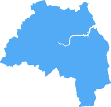
sunderland SR4 Postcodes
Spending a fortune on conveyancing?

Compare instant, low-cost online quotes from trusted conveyancing solicitors.
Backed by experts, our no-obligation service searches through the best conveyancing quotes on the market to save you time and money.
Sunderland (SR4)
The SR4 postcode area is located in the Sunderland postcode town region, within the county of Tyne and Wear, and contains a total of 1186 individual postcodes.
There are 17 electoral wards in the SR4 postcode area, including Peterlee, Seaham, Sunderland which come under the local authority of the Sunderland Council.
Combining the whole postcode region, 11% of people in SR4 are classed as having an AB social grade, (i.e. 'white-collar' middle-upper class), compared to 27% across the UK.
This does not mean that the people of SR4 are poorer than other areas, but it may give an indication that there are areas of deprivation.
The SR4 postcode in the Sunderland district is located in the North East of England. It covers an area of approximately 11 square miles and consists of the suburbs of Ford Estate, Red House, Pallion, Castletown, Grangetown, High Barnes, Plains Farm, South Hetton and Elstob.
SR4 is very diverse, featuring a variety of housing types from modern developments to older terraced houses. It has a mix of older and newer shops, including supermarkets, independent convenience stores, pubs and takeaways. With several bus routes running through the area, it is well-connected to the rest of the city.
The area has a lot of green spaces for leisure activities, with the Sunderland Green Loop cycling and walking route passing nearby. It includes Fulwell Quarry, where people can enjoy tranquil walks, and Castletown Park, with its football and rugby pitches, and its outdoor classrooms and adventure playground.
SR4 primary schools include Ford Primary School, Pallion Primary School, Plains Farm Academy and White Mere Community Primary School. There are several secondary schools in the area, such as St Anthonys Catholic School, Grangetown Primary and Southmoor Community College.
In terms of health facilities, SR4 is served by Barnes Primary Care Centre, Southwick Health Centre and Greenbank Surgery. Qualified medical specialists are located at Sunderland Royal Hospital, Houghton Primary Care Centre and the City Hospitals Sunderland, which is home to the city's eye hospital.
The SR4 postcode is also home to the Sunderland Buddhist Centre, the Community Advice and Law Centre, and the Sunderland Southside Family Support Centre. In addition, there are plenty of churches in the area, including St Luke's Church and St Peter's Church.

Demographics

Tyne and Wear
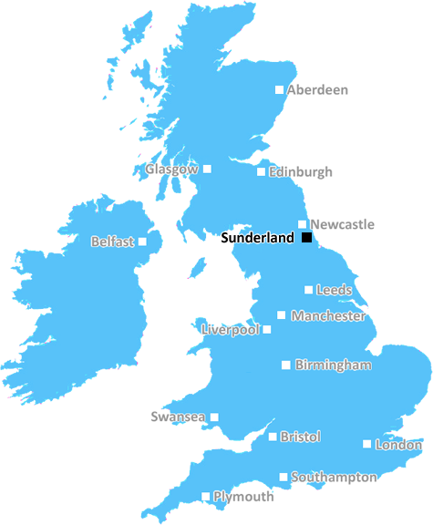
SR4 is located in the county of Tyne and Wear, in England.
Tyne and Wear has a total population of 1,128,800, making it the 16th largest county in the UK.
Tyne and Wear has a total area of 210 square miles, and a population density of 2090 people per square kilometre. For comparison, Greater London has a density of 5,618 people/km2.
| Outward Code | SR4 |
| Postal Town | Sunderland |
| MSOA Name | Sunderland 012 |
| LSOA Name | Sunderland 012B |
| County | Tyne and Wear |
| Region | Tyne and Wear |
| Country | England |
| Local Authority | Sunderland |
| Area Classification | Urban with Major Conurbation |
SR4 Electoral Wards
The postal region of SR4, includes the local towns, villages, electoral wards and stations of:
Dig even deeper into the SR4 postcode by clicking on a postcode below:
Click on an outward postal code below for more information about the area. Each 'outward' postcode give you a comprehensive list of all postcodes within the outward code area (SR) and estimated address.
Click on an 'outward' code for more information. For example, the outward postcode page 'EC2M' will give you an alphabetical list covering all postcodes located in the region, from 'EC2M 1BB' through to 'EC2M 7YA'.
Chris H
Monday, May 6, 2024
We don't have any views of SR4 right now. If you live in SR4 or have visited it, please help us to help others by telling others what you think of this neighbourhood.
Add your view of SR4
People need your local expertise. If you live in SR4 or have first-hand knowledge of the neighbourhood, please consider sharing your views. It's completely anonymous - all we ask is for your initials.
Please tell us what you like about the SR4 postcode area, what you don't like, and what it's like to live or work here.
| LOCAL AMENITIES | |
| FAMILY FRIENDLY | |
| PARKING | |
| GREEN SPACES |
Local News County Durham
Teesport steel erector caught over the drink drive limit
A steel erector who was spotted driving slowly and weaving between lanes in Hartlepool as he made his way to work was found to be over the drink drive limit.
Northern EchoCan you get paid on a UK bank holiday? What happens
This is what can happen if your next payday lands on a bank holiday in the UK - see when you can expect to get paid.
Northern EchoMet Office: Hour-by-hour Darlington weather forecast
This morning will start with overcast skies and scattered light showers moving in.
Northern EchoMarks and Spencer Sunderland to close later this month
Marks and Spencer on High Street West in Sunderland has confirmed it will close for good later this month.
Northern EchoAppeal made to find County Durham firefighters from 1974
This year marks 50 years of County Durham and Darlington Fire and Rescue Service (CDDFRS).
Northern EchoOff-road biker arrested for dangerous driving in Middlesbrough
A teenager was arrested and a bike seized in Corby Avenue, Middlesbrough. as part of a crackdown on nuisance off-road bikers in a North East town.
Northern EchoEcho 3 Darlington Star Wars Day raises 1k for charity
Echo 3 in Clarks Yard, Darlington has raised over 1,000 for charity during their event marking Star Wars Day 2024.
Northern EchoLook inside Darlington's oldest non-religious house up for sale
THE oldest domestic non-religious building in Darlington has this week been put up for sale for the first time in 45 years.
Northern EchoFrom the Postcode Area blog

Deciphering Crime Rates - a Deep Dive Into UK Postcode Analysis
Ever wondered about the crime rate in your UK postcode? You're not alone. We've dug deep into the data, uncovering trends and patterns that'll make your head spin.

Death of the High Street?
The BBC reports that despite councils' attempts to kurb them, the UK's high streets have seen a huge growth in fast food outlets. Could this mark the death knell for the Great British high street, and what can we do about it to halt its decline?

Discrimination by Postcode
You really couldn't make it up, could you? Some of the country's most vulnerable people are missing out on their weekly £25 Cold Weather Payment, just because the system that's in operation is discriminating against them because payments are based on postcode, rather than geographic location.

The Redesign is Underway
Well, the current website was absolutely in dire need of a good redesign - from the ground up. So I set out to pull it all apart and get it up and running again to become the most comprehensive guide to every postcode in the UK. And it's been a long, tough job from start to finish - and quite possibly the biggest project I've ever undertaken.
SOCIAL GRADES
According to census records, 11% of people here have a social grade of AB (highest), compared to the national average of 27%.