stoke-on-trent ST7 Postcodes
Spending a fortune on conveyancing?

Compare instant, low-cost online quotes from trusted conveyancing solicitors.
Backed by experts, our no-obligation service searches through the best conveyancing quotes on the market to save you time and money.
Stoke On Trent (ST7)
The ST7 postcode area is located in the Stoke On Trent postcode town region, within the county of Staffordshire, and contains a total of 1585 individual postcodes.
There are 84 electoral wards in the ST7 postcode area, including Leek, Newcastle, Stafford, Stoke-On-Trent, Stone, Uttoxeter which come under the local authority of the Newcastle-under-Lyme Council.
Combining the whole postcode region, 22% of people in ST7 are classed as having an AB social grade, (i.e. 'white-collar' middle-upper class), compared to 27% across the UK.
This does not mean that the people of ST7 are poorer than other areas, but it may give an indication that there are areas of deprivation.
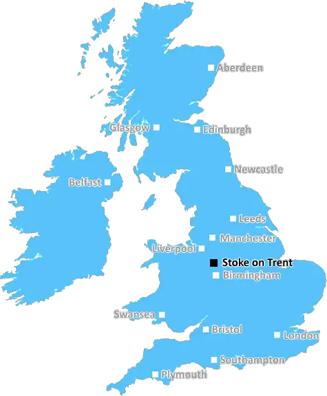
The ST7 postcode covers a large area of the Staffordshire district of Stoke-on-Trent in the UK. It is bordered to the south by the postcode area of ST6, and to the north by that of ST8. The ST7 postcode is primarily centred on the towns of Kidsgrove, Scholar Green, Butt Lane and Loggerheads. The area is home to around 19,000 people, making it one of the larger postcode areas in the district.
Kidsgrove is the largest settlement in the ST7 postcode area and houses the majority of its population. It is a traditional market town which was first recorded on maps as far back as the reign of Elizabeth I. It is now a shopping centre for retail and amenities with good transport links including a train station, making it a great base for commuters to nearby cities such as Manchester, Liverpool and Birmingham.
Scholar Green is a small village in the ST7 postcode district and lies approximately two miles to the south-west of Kidsgrove. The village is home to approximately 1,400 people and provides a rural alternative to more urbanised areas within the district. It is famous for its sixteenth century Saxon church, located in the local park, as well as its historic manor house known as Scholar Grange Hall.
Butt Lane is a hamlet located between the towns of Kidsgrove and Scholar Green and it is home to around 100 people. It is a rural community renowned for its picturesque views across the valleys of the Cheshire Plain that can be admired from its hill top position.
Loggerheads is a small village in the ST7 postcode district. It is a very rural area, and is home to less than 400 people. Its claim to fame lies in the local Loggerheads Country Park, a popular destination for visitors to the area, offering plenty of opportunity to take in the scenery and spot wildlife.
The ST7 postcode district is a great mix of urban and rural areas, offering a great lifestyle for its residents. What's more, its excellent transport links make the available amenities and attractions easily accessible from most of the postcode's settlements.

Demographics

Staffordshire

ST7 is located in the county of Staffordshire, in England.
Staffordshire has a total population of 1,120,300, making it the 17th largest county in the UK.
Staffordshire has a total area of 1047 square miles, and a population density of 412 people per square kilometre. For comparison, Greater London has a density of 5,618 people/km2.
| Outward Code | ST7 |
| Postal Town | Stoke On Trent |
| MSOA Name | Newcastle-under-Lyme 002 |
| LSOA Name | Newcastle-under-Lyme 002D |
| County | Staffordshire |
| Region | Staffordshire |
| Country | England |
| Local Authority | Newcastle-under-Lyme |
| Area Classification | Urban with City and Town |
ST7 Electoral Wards
The postal region of ST7, includes the local towns, villages, electoral wards and stations of:
Dig even deeper into the ST7 postcode by clicking on a postcode below:
Click on an outward postal code below for more information about the area. Each 'outward' postcode give you a comprehensive list of all postcodes within the outward code area (ST) and estimated address.
Click on an 'outward' code for more information. For example, the outward postcode page 'EC2M' will give you an alphabetical list covering all postcodes located in the region, from 'EC2M 1BB' through to 'EC2M 7YA'.
C W, Stoke On Trent
Saturday, October 14, 2023
There's nothing to like or dislike about ST7 but I am confused for my postal address is Stoke-on-Trent which I am not allowed to use the Burslem tip I have been told to use the Newcastle underline Tip which is a 20mile round tip
Add your view of ST7
People need your local expertise. If you live in ST7 or have first-hand knowledge of the neighbourhood, please consider sharing your views. It's completely anonymous - all we ask is for your initials.
Please tell us what you like about the ST7 postcode area, what you don't like, and what it's like to live or work here.
| LOCAL AMENITIES | |
| FAMILY FRIENDLY | |
| PARKING | |
| GREEN SPACES |
Local News Staffordshire
Tesco shoppers furious over TikTok user who claims to make 250 an hour by flipping stock
A man and his friends have been branded 'sad' after they boasted about making a quick profit by clearing out Tesco's stock of calculators and reselling them online
Stoke SentinelBaby among two dead and dozens ill after outbreak at Brit holiday hotspot
Cases of whooping cough has boomed at the start of 2024 with sufferers at the highest in more than a decade and cases reported across Europe
Stoke SentinelNHS trust declares critical incident amid 'extreme pressures'
University Hospitals of North Midlands NHS Trust reports A&Es to be experiencing highest demand.
BBC NewsMajor highways improvement scheme to start in Newcastle
A major highways improvements scheme on the A34 Talke Road in Newcastle is due to start on Monday 11 March.
Staffordshire County CouncilBully boyfriend wielded knife as he threatened to kill his partner's child
Cameron Bennett, 23, was jailed at Stoke-on-Trent Crown Court
Stoke SentinelBob Vylan and Dub Pistols headline North Staffordshire's newest music festival
The music festival will also offer a range of activities such as rock climbing, abseiling and archery
Stoke SentinelFurniture restoration and manufacturing business cuts carbon and costs with backing of county council programme
An established furniture restoration and manufacturing company is making savings in the region of 35,000 annually and reducing its carbon footprint thanks to a county council programme.
Staffordshire County CouncilPlanning approval granted for top grade electric vehicle charging facility at i54
Planning approval has been granted for a GRIDSERVE Electric Forecourt at i54 South Staffordshire.
Staffordshire County CouncilFrom the Postcode Area blog

Deciphering Crime Rates - a Deep Dive Into UK Postcode Analysis
Ever wondered about the crime rate in your UK postcode? You're not alone. We've dug deep into the data, uncovering trends and patterns that'll make your head spin.

Death of the High Street?
The BBC reports that despite councils' attempts to kurb them, the UK's high streets have seen a huge growth in fast food outlets. Could this mark the death knell for the Great British high street, and what can we do about it to halt its decline?

Discrimination by Postcode
You really couldn't make it up, could you? Some of the country's most vulnerable people are missing out on their weekly £25 Cold Weather Payment, just because the system that's in operation is discriminating against them because payments are based on postcode, rather than geographic location.

The Redesign is Underway
Well, the current website was absolutely in dire need of a good redesign - from the ground up. So I set out to pull it all apart and get it up and running again to become the most comprehensive guide to every postcode in the UK. And it's been a long, tough job from start to finish - and quite possibly the biggest project I've ever undertaken.
SOCIAL GRADES
According to census records, 22% of people here have a social grade of AB (highest), compared to the national average of 27%.