stoke-on-trent ST3 Postcodes
Spending a fortune on conveyancing?

Compare instant, low-cost online quotes from trusted conveyancing solicitors.
Backed by experts, our no-obligation service searches through the best conveyancing quotes on the market to save you time and money.
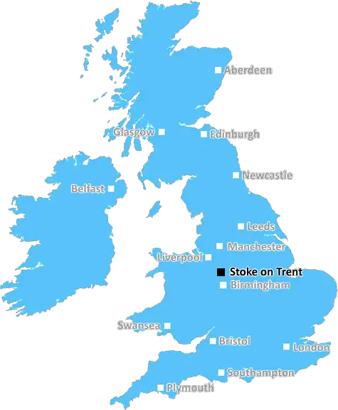
Stoke On Trent (ST3)
The ST3 postcode area is located in the Stoke On Trent postcode town region, within the county of Staffordshire, and contains a total of 2001 individual postcodes.
There are 28 electoral wards in the ST3 postcode area, including Leek, Newcastle, Stafford, Stoke-On-Trent, Stone, Uttoxeter which come under the local authority of the Stoke-on-Trent Council.
Combining the whole postcode region, 12% of people in ST3 are classed as having an AB social grade, (i.e. 'white-collar' middle-upper class), compared to 27% across the UK.
This does not mean that the people of ST3 are poorer than other areas, but it may give an indication that there are areas of deprivation.
ST3 is a postcode district within the UK's Staffordshire postcode area. The postcode area itself covers a large portion of central England, covering a large portion of Staffordshire, including the towns of Stoke-on-Trent, Newcastle-under-Lyme, Stone, and Stafford itself. The postcode district itself covers mainly the north-east of the county, encompassing the various districts of Stoke-on-Trent.
The ST3 area covers such areas of the city such as May Bank, Penkhull, Uttoxeter Road and Burslem, as well as the city centre itself and parts of the wider 'Four towns' area that Stoke-on-Trent is known for.
The area comprises largely residential properties, with areas of light industry and manufacturing. It is a very multicultural area, home to a large Muslim population, as well as people from many different racial backgrounds. There are three separated areas within the ST3 postcode area � Stoke Town Centre, Tunstall and Newcastle-under-Lyme & Stoke-on-Trent.
The infrastructure in the ST3 postcode area is excellent, with more than a dozen primary and secondary schools, plus Colleges and universities. Transport links within the area and into the nearby city of Manchester are excellent, with excellent bus and rail links into the heart of the city. Stoke-on-Trent station is the nearest railway station to the ST3 postcode area, and serves all of the major stops in the region.
There are many parks and leisure centres within the ST3 postcode district, including the popular Hanley Park, Gladstone Pottery Museum, and the Potteries Shopping Centre � all of which are located in Stoke Town Centre. The area also has an excellent range of restaurants, supermarkets, shops, and other businesses, making it a great place to live.
The ST3 postcode district is also the home to many cultural events and festivals, such as the Staffordshire Knights of the Round Table Tour, The Stoke International Film Festival, and the Stoke Fringe Festival. These events attract many locals and visitors alike to the area, giving the local economy an additional boost.
TheST3 postcode district is a wonderful place to live, offering excellent infrastructure, a great range of leisure and cultural activities, plus a great selection of restaurants, shops, and leisure facilities. It is a highly multicultural area, making it an ideal place to live for people from all walks of life.

Demographics

Staffordshire

ST3 is located in the county of Staffordshire, in England.
Staffordshire has a total population of 1,120,300, making it the 17th largest county in the UK.
Staffordshire has a total area of 1047 square miles, and a population density of 412 people per square kilometre. For comparison, Greater London has a density of 5,618 people/km2.
| Outward Code | ST3 |
| Postal Town | Stoke On Trent |
| MSOA Name | Stoke-on-Trent 022 |
| LSOA Name | Stoke-on-Trent 022C |
| County | Staffordshire |
| Region | Staffordshire |
| Country | England |
| Local Authority | Stoke-on-Trent |
| Area Classification | Urban with City and Town |
ST3 Electoral Wards
The postal region of ST3, includes the local towns, villages, electoral wards and stations of:
Dig even deeper into the ST3 postcode by clicking on a postcode below:
Click on an outward postal code below for more information about the area. Each 'outward' postcode give you a comprehensive list of all postcodes within the outward code area (ST) and estimated address.
Click on an 'outward' code for more information. For example, the outward postcode page 'EC2M' will give you an alphabetical list covering all postcodes located in the region, from 'EC2M 1BB' through to 'EC2M 7YA'.
SH, Stoke On Trent
Thursday, August 29, 2019
Melting pot for anti social behaviour.
Add your view of ST3
People need your local expertise. If you live in ST3 or have first-hand knowledge of the neighbourhood, please consider sharing your views. It's completely anonymous - all we ask is for your initials.
Please tell us what you like about the ST3 postcode area, what you don't like, and what it's like to live or work here.
| LOCAL AMENITIES | |
| FAMILY FRIENDLY | |
| PARKING | |
| GREEN SPACES |
Local News Staffordshire
Early intervention scheme makes a difference
Staffordshire County Council is funding schools to step in at the first opportunity to help children with special educational needs progress at their local mainstream school - and the scheme is alread&hellip
Staffordshire County CouncilDrivers over certain age exempt from road fines under new UK scheme
Elderly motorists can dodge tough penalties under a new alternative scheme but can run the risk of being banned indefinitely, it has been warned
Stoke SentinelEarly works continue on main Stafford road ahead of major improvement scheme
Early works taking place ahead of a major improvement scheme on a main Stafford road continue on March 4.
Staffordshire County CouncilRock music returns to town centre boozer as DJ Terri takes on first pub
She's bringing back its rock music heritage that customers loved
Stoke SentinelFive drink-drivers now banned from Stoke-on-Trent's roads
They have all been sentenced at North Staffordshire Justice Centre
Stoke SentinelThe price of feeding deer is dear, warns countryside officers
Feeding deer makes them vulnerable to disease, poaching and overpopulation, so rangers are urging country park users to buck the trend.
Staffordshire County CouncilFurniture restoration and manufacturing business cuts carbon and costs with backing of county council programme
An established furniture restoration and manufacturing company is making savings in the region of 35,000 annually and reducing its carbon footprint thanks to a county council programme.
Staffordshire County CouncilFormer Dignity Champion urges others to nominate
A former Staffordshire Dignity in Care award winner is now urging others to nominate for this year's awards.
Staffordshire County CouncilFrom the Postcode Area blog

Deciphering Crime Rates - a Deep Dive Into UK Postcode Analysis
Ever wondered about the crime rate in your UK postcode? You're not alone. We've dug deep into the data, uncovering trends and patterns that'll make your head spin.

Death of the High Street?
The BBC reports that despite councils' attempts to kurb them, the UK's high streets have seen a huge growth in fast food outlets. Could this mark the death knell for the Great British high street, and what can we do about it to halt its decline?

Discrimination by Postcode
You really couldn't make it up, could you? Some of the country's most vulnerable people are missing out on their weekly £25 Cold Weather Payment, just because the system that's in operation is discriminating against them because payments are based on postcode, rather than geographic location.

The Redesign is Underway
Well, the current website was absolutely in dire need of a good redesign - from the ground up. So I set out to pull it all apart and get it up and running again to become the most comprehensive guide to every postcode in the UK. And it's been a long, tough job from start to finish - and quite possibly the biggest project I've ever undertaken.
SOCIAL GRADES
According to census records, 12% of people here have a social grade of AB (highest), compared to the national average of 27%.