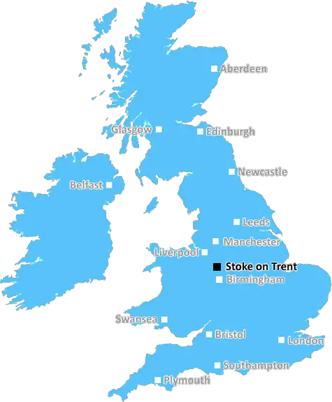
stoke-on-trent ST20 Postcodes
Spending a fortune on conveyancing?

Compare instant, low-cost online quotes from trusted conveyancing solicitors.
Backed by experts, our no-obligation service searches through the best conveyancing quotes on the market to save you time and money.
Stoke On Trent (ST20)
The ST20 postcode area is located in the Stoke On Trent postcode town region, within the county of Staffordshire, and contains a total of 263 individual postcodes.
There are 95 electoral wards in the ST20 postcode area, including Leek, Newcastle, Stafford, Stoke-On-Trent, Stone, Uttoxeter which come under the local authority of the Stafford Council.
Combining the whole postcode region, 33% of people in ST20 are classed as having an AB social grade, (i.e. 'white-collar' middle-upper class), compared to 27% across the UK.
This does not mean that the people of ST20 are wealthier - or higher class - than average, but it can be an indication that the area may be prospering and desirable to live in.
The ST20 postcode area is a group of five postcode districts in England which are part of the ST postcode area. The ST20 postcode area is a group of nine postcode districts in the county of Staffordshire, England. It includes the market town of Stone and the rural areas around Penkridge and Eccleshall. The postcode area covers the Northern part of the county, including the towns of Eccleshall, Penkridge, and Stone. It also covers the small rural villages located north and east of these towns, such as Stretton, Brewood, Gnosall, and High Offley. A small portion of the postcode area lies within Cannock Chase Area of Outstanding Natural Beauty. The area is served by the A41, A519 and A518 roads.

Demographics

Staffordshire

ST20 is located in the county of Staffordshire, in England.
Staffordshire has a total population of 1,120,300, making it the 17th largest county in the UK.
Staffordshire has a total area of 1047 square miles, and a population density of 412 people per square kilometre. For comparison, Greater London has a density of 5,618 people/km2.
| Outward Code | ST20 |
| Postal Town | Stoke On Trent |
| MSOA Name | Stafford 015 |
| LSOA Name | Stafford 015A |
| County | Staffordshire |
| Region | Staffordshire |
| Country | England |
| Local Authority | Stafford |
| Area Classification | Urban with Significant Rural (rural including hub towns 26-49%) |
ST20 Electoral Wards
The postal region of ST20, includes the local towns, villages, electoral wards and stations of:
Dig even deeper into the ST20 postcode by clicking on a postcode below:
Click on an outward postal code below for more information about the area. Each 'outward' postcode give you a comprehensive list of all postcodes within the outward code area (ST) and estimated address.
Click on an 'outward' code for more information. For example, the outward postcode page 'EC2M' will give you an alphabetical list covering all postcodes located in the region, from 'EC2M 1BB' through to 'EC2M 7YA'.
RH, Stoke On Trent
Thursday, June 22, 2023
Overall, it's a nice area to live, although there are few employment opportunities around the village. Most working age people tend to commute to the larger local towns, including Newcastle, Stafford, Newport and Telford. Friendly neighbourhood that's quiet and pleasant.
TJ, Stoke-on-trent
Thursday, October 11, 2018
Apparently The Horns has just closed down, which was probably the best pub in Gnosall. Otherwise, a lovely little (big) village which inevitably is growing as more people move to the area.
CH, Gnosall
Monday, September 24, 2018
There's still a lot of new houses being built in Gnosall, which may one day turn our village into a small town. Mind you, there's plenty of facilities here (5 pubs!), a decent Co-Op, and a modern health centre. Getting an appointment with a GP can be a bit of a pain.
Add your view of ST20
People need your local expertise. If you live in ST20 or have first-hand knowledge of the neighbourhood, please consider sharing your views. It's completely anonymous - all we ask is for your initials.
Please tell us what you like about the ST20 postcode area, what you don't like, and what it's like to live or work here.
| LOCAL AMENITIES | |
| FAMILY FRIENDLY | |
| PARKING | |
| GREEN SPACES |
Local News Staffordshire
Stoke-on-Trent asylum seeker, 31, who sneaked into UK in lorry found dead
Iraqi Gailan Matloob had been living in Normacot under a fake name
Stoke SentinelMother's plea after son killed by speeding driver
"There is no need for anyone else to know what this pain feels like," Jakki Hartland says.
BBC NewsHistoric puppet collection to take centre stage in new history centre
Puppets from a unique collection of over 1,000 historic puppets will be amongst the exhibits in the new Staffordshire History Centre, being funded by The National Lottery Heritage Fund.
Staffordshire County CouncilCouncil sells its stake in development company
Stoke-on-Trent City Council says it is "a sensible time" to sell its shares in a development firm for 5m.
BBC NewsStrategy will help unpaid carers of all ages
A strategy to help unpaid carers of all ages across Staffordshire will be discussed by the county council's cabinet next week.
Staffordshire County CouncilHighways improvements to start in Lichfield next week
A major highways improvements scheme in Lichfield will start on Monday 25 March.
Staffordshire County CouncilSuspended jail sentences for Staffordshire farmers
Three Staffordshire farmers have been given suspended prison sentences for breaching cattle identification and movement rules to stop the spread of Bovine Tuberculosis.
Staffordshire County CouncilThe price of feeding deer is dear, warns countryside officers
Feeding deer makes them vulnerable to disease, poaching and overpopulation, so rangers are urging country park users to buck the trend.
Staffordshire County CouncilFrom the Postcode Area blog

Deciphering Crime Rates - a Deep Dive Into UK Postcode Analysis
Ever wondered about the crime rate in your UK postcode? You're not alone. We've dug deep into the data, uncovering trends and patterns that'll make your head spin.

Death of the High Street?
The BBC reports that despite councils' attempts to kurb them, the UK's high streets have seen a huge growth in fast food outlets. Could this mark the death knell for the Great British high street, and what can we do about it to halt its decline?

Discrimination by Postcode
You really couldn't make it up, could you? Some of the country's most vulnerable people are missing out on their weekly £25 Cold Weather Payment, just because the system that's in operation is discriminating against them because payments are based on postcode, rather than geographic location.

The Redesign is Underway
Well, the current website was absolutely in dire need of a good redesign - from the ground up. So I set out to pull it all apart and get it up and running again to become the most comprehensive guide to every postcode in the UK. And it's been a long, tough job from start to finish - and quite possibly the biggest project I've ever undertaken.
SOCIAL GRADES
According to census records, 33% of people here have a social grade of AB (highest), compared to the national average of 27%.