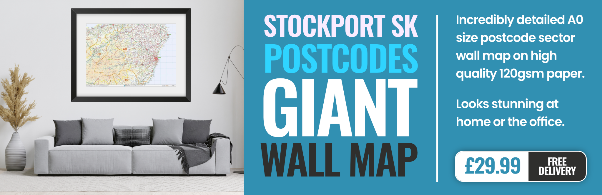
stockport SK9 Postcodes
Spending a fortune on conveyancing?

Compare instant, low-cost online quotes from trusted conveyancing solicitors.
Backed by experts, our no-obligation service searches through the best conveyancing quotes on the market to save you time and money.
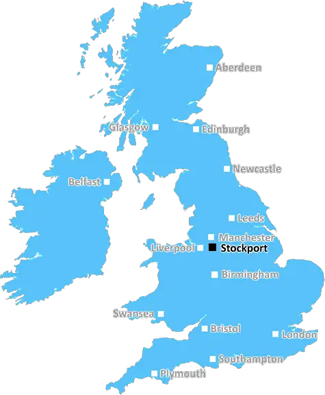
Stockport (SK9)
The SK9 postcode area is located in the Stockport postcode town region, within the county of , and contains a total of 1869 individual postcodes.
There are 27 electoral wards in the SK9 postcode area, including Alderley Edge, Buxton, Cheadle, Dukinfield, Glossop, High Peak, Hyde, Macclesfield, Stalybridge, Stockport, Wilmslow which come under the local authority of the Council.
Combining the whole postcode region, 42% of people in SK9 are classed as having an AB social grade, (i.e. 'white-collar' middle-upper class), compared to 27% across the UK.
This does not mean that the people of SK9 are wealthier - or higher class - than average, but it can be an indication that the area may be prospering and desirable to live in.
The SK9 postcode is located in Stockport, Greater Manchester, England. It is situated to the south of Manchester city centre and is home to several suburban areas such as Towns Moor, Poynton, Bramhall, Handforth, Adswood, Wilmslow, Hazel Grove, Alderley Edge, Macclesfield, Stockport, Woodford, and Buxton.
This postcode covers both urban and rural areas, with Poynton and Towns Moor being the most rural areas. There are a number of different neighbourhoods including mainly detached and semi-detached properties, purpose-built flats, small terraced houses and apartments.
The SK9 postcode is conveniently located and surrounded by many amenities. Shopping areas are plentiful and include Poynton Shopping Centre, Bramhall Shopping Park, Handforth Dean Retail Park, Hazel Grove Shopping Village, Alderley Edge Shopping Centre and Brook Street Mews Shopping Centre. There are various supermarkets, such as Tesco, Sainsbury's, Asda, Morrisons, Aldi and Lidl.
Transportation links are good, with excellent road connections to nearby cities, towns and villages, including Manchester, which can be easily accessed via the A6 road and the M60 motorway. Public transportation can also be accessed from Cheadle Hulme, Poynton, Hazel Grove, Adswood and Wilmslow stations, which are located within the SK9 postcode.
The area is well served in terms of leisure and recreational activities, with Hazel Grove Golf Course, Ash Grove Park, Hilly Fields Nature Reserve, Cypress Park, and Romiley Pool, all popular attractions. Education is also excellent in the area, with many reputable primary and secondary schools located within the SK9 postcode area.
In general, SK9 is a desirable postcode and a great place to live. It is known for its green landscapes, multitude of shopping options and excellent transportation connections. The area provides a high standard of living with a range of amenities, education provision, recreational activities and its convenient location close to Manchester city centre.

Demographics

SK9 is located in the county of , in .
has a total population of 0, making it the largest county in the UK.
has a total area of square miles, and a population density of people per square kilometre. For comparison, Greater London has a density of 5,618 people/km2.
| Outward Code | SK9 |
| Postal Town | Stockport |
| MSOA Name | |
| LSOA Name | |
| County | |
| Region | |
| Country | |
| Local Authority | |
| Area Classification | Unclassified |
SK9 Electoral Wards
The postal region of SK9, includes the local towns, villages, electoral wards and stations of:
Dig even deeper into the SK9 postcode by clicking on a postcode below:
Click on an outward postal code below for more information about the area. Each 'outward' postcode give you a comprehensive list of all postcodes within the outward code area (SK) and estimated address.
Click on an 'outward' code for more information. For example, the outward postcode page 'EC2M' will give you an alphabetical list covering all postcodes located in the region, from 'EC2M 1BB' through to 'EC2M 7YA'.
Chris H
Saturday, April 6, 2024
We don't have any views of SK9 right now. If you live in SK9 or have visited it, please help us to help others by telling others what you think of this neighbourhood.
Add your view of SK9
People need your local expertise. If you live in SK9 or have first-hand knowledge of the neighbourhood, please consider sharing your views. It's completely anonymous - all we ask is for your initials.
Please tell us what you like about the SK9 postcode area, what you don't like, and what it's like to live or work here.
| LOCAL AMENITIES | |
| FAMILY FRIENDLY | |
| PARKING | |
| GREEN SPACES |
From the Postcode Area blog

Deciphering Crime Rates - a Deep Dive Into UK Postcode Analysis
Ever wondered about the crime rate in your UK postcode? You're not alone. We've dug deep into the data, uncovering trends and patterns that'll make your head spin.

Death of the High Street?
The BBC reports that despite councils' attempts to kurb them, the UK's high streets have seen a huge growth in fast food outlets. Could this mark the death knell for the Great British high street, and what can we do about it to halt its decline?

Discrimination by Postcode
You really couldn't make it up, could you? Some of the country's most vulnerable people are missing out on their weekly £25 Cold Weather Payment, just because the system that's in operation is discriminating against them because payments are based on postcode, rather than geographic location.

The Redesign is Underway
Well, the current website was absolutely in dire need of a good redesign - from the ground up. So I set out to pull it all apart and get it up and running again to become the most comprehensive guide to every postcode in the UK. And it's been a long, tough job from start to finish - and quite possibly the biggest project I've ever undertaken.
SOCIAL GRADES
According to census records, 42% of people here have a social grade of AB (highest), compared to the national average of 27%.