stevenage SG3 Postcodes
Spending a fortune on conveyancing?

Compare instant, low-cost online quotes from trusted conveyancing solicitors.
Backed by experts, our no-obligation service searches through the best conveyancing quotes on the market to save you time and money.
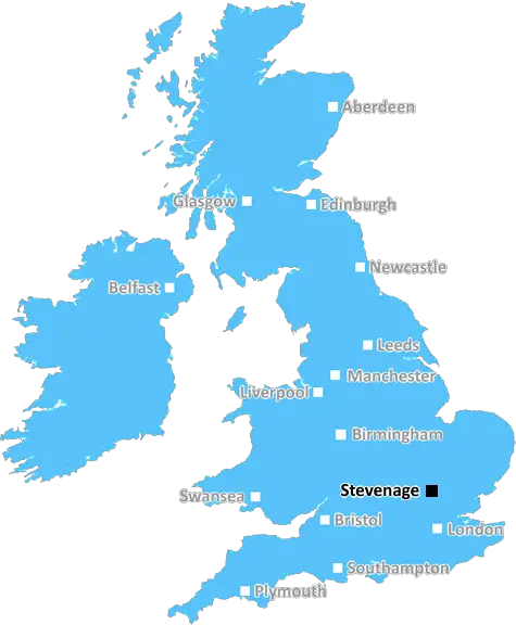
Stevenage (SG3)
The SG3 postcode area is located in the Stevenage postcode town region, within the county of Hertfordshire, and contains a total of 303 individual postcodes.
There are 15 electoral wards in the SG3 postcode area, including Arlesey, Baldock, Biggleswade, Buntingford, Henlow, Hertford, Hitchin, Knebworth, Letchworth Garden City, Much Hadham, Royston, Sandy, Shefford, Stevenage, Ware which come under the local authority of the North Hertfordshire Council.
Combining the whole postcode region, 41% of people in SG3 are classed as having an AB social grade, (i.e. 'white-collar' middle-upper class), compared to 27% across the UK.
This does not mean that the people of SG3 are wealthier - or higher class - than average, but it can be an indication that the area may be prospering and desirable to live in.
The SG3 postcode covers the majority of the localities in and around the borough of Stevenage in the county of Hertfordshire, England, and includes many residential areas as well as business districts.
It consists of the areas surrounding the town centre such as Stevenage Old Town, which is the original settlement of around 400 homes and shops; and Stevenage New Town, which is a post-war expansion of the town centre and includes the two main shopping areas. It also encompasses a number of other residential districts such as Broadwater, Shephall, Bedwell, Manor, and Symonds Green.
SG3 provides many transport links to the surrounding towns and cities in Hertfordshire and the Greater London area including, rail, bus, and road links. The town centre also houses Stevenage railway station, providing direct services to and from London King's Cross Station.
In terms of amenities, SG3 is home to a wide range of leisure and recreational activities, such as golf courses, public parks, sports complexes, museums, art galleries, and libraries. Furthermore, there are many shopping centres and entertainment venues located in and around the town centre.
In terms of education, SG3 is home to a range of educational institutions and awards-winning schools. Stevenage boasts four primary and three secondary schools, as well as two further education colleges and two university campuses.
The postcode also has a range of health care services with two General Practitioner Practices providing medical services throughout the area.
Additionally, SG3 is home to many churches such as Church of St. Nicholas, Church of St. Hugh of Lincoln, and Christ Church Stevenage. It provides local services such as neighbourhood policing, waste disposal, and recycling.
In terms of entertainment, the town centre features many nightclubs, a leisure centre, and a modern cinema complex. There are also a large number of restaurants, pubs, bars, and cafes located in the area offering a variety of cuisines for dining.
TheSG3 postcode is a vibrant and cosmopolitan area with excellent transportation links making it ideal for living, working, and playing.

Demographics

Hertfordshire

SG3 is located in the county of Hertfordshire, in England.
Hertfordshire has a total population of 1,176,700, making it the 12th largest county in the UK.
Hertfordshire has a total area of 634 square miles, and a population density of 716 people per square kilometre. For comparison, Greater London has a density of 5,618 people/km2.
| Outward Code | SG3 |
| Postal Town | Stevenage |
| MSOA Name | North Hertfordshire 015 |
| LSOA Name | North Hertfordshire 015E |
| County | Hertfordshire |
| Region | Hertfordshire |
| Country | England |
| Local Authority | North Hertfordshire |
| Area Classification | Urban with Significant Rural (rural including hub towns 26-49%) |
SG3 Electoral Wards
The postal region of SG3, includes the local towns, villages, electoral wards and stations of:
Dig even deeper into the SG3 postcode by clicking on a postcode below:
Click on an outward postal code below for more information about the area. Each 'outward' postcode give you a comprehensive list of all postcodes within the outward code area (SG) and estimated address.
Click on an 'outward' code for more information. For example, the outward postcode page 'EC2M' will give you an alphabetical list covering all postcodes located in the region, from 'EC2M 1BB' through to 'EC2M 7YA'.
Chris H
Wednesday, April 17, 2024
We don't have any views of SG3 right now. If you live in SG3 or have visited it, please help us to help others by telling others what you think of this neighbourhood.
Add your view of SG3
People need your local expertise. If you live in SG3 or have first-hand knowledge of the neighbourhood, please consider sharing your views. It's completely anonymous - all we ask is for your initials.
Please tell us what you like about the SG3 postcode area, what you don't like, and what it's like to live or work here.
| LOCAL AMENITIES | |
| FAMILY FRIENDLY | |
| PARKING | |
| GREEN SPACES |
Local News Hertfordshire
The reading rabbit who calms children
Winter the rabbit helps children to read at Animal Edge Farm in Millbrook.
BBC NewsSouthampton score late winner to beat Watford
Flynn Downes' goal in the final seconds gives Southampton victory over Watford and keeps them in with a chance of automatic promotion.
BBC NewsThe man who painted the Millennium Falcon
Alf Hunter from Borehamwood, Hertfordshire, was the set decorator on many classic films.
BBC NewsWoman charged with murder after two-year-old dies
Shilyrand Charigwati appears in court after a two-year-old is taken to hospital and dies on Sunday.
BBC NewsHouse blast accused 'complacent' with explosives
A man tells a court he caused a blast at his home when he was "complacent" with explosive substances.
BBC NewsHooked at 14: Man gambled away 250,000
Taylor Hart from Dunstable was soon addicted after placing his first bet as a child.
BBC NewsChurch abuser forgiven by Christian singer
Singer Matt Redman says forgiveness is a part of the Christian faith
BBC NewsPet cat 'on a mission to keep Britain clean'
Stevenage cat Tofu brings home rubbish he finds elsewhere as "gifts" for his owner.
BBC NewsFrom the Postcode Area blog

Deciphering Crime Rates - a Deep Dive Into UK Postcode Analysis
Ever wondered about the crime rate in your UK postcode? You're not alone. We've dug deep into the data, uncovering trends and patterns that'll make your head spin.

Death of the High Street?
The BBC reports that despite councils' attempts to kurb them, the UK's high streets have seen a huge growth in fast food outlets. Could this mark the death knell for the Great British high street, and what can we do about it to halt its decline?

Discrimination by Postcode
You really couldn't make it up, could you? Some of the country's most vulnerable people are missing out on their weekly £25 Cold Weather Payment, just because the system that's in operation is discriminating against them because payments are based on postcode, rather than geographic location.

The Redesign is Underway
Well, the current website was absolutely in dire need of a good redesign - from the ground up. So I set out to pull it all apart and get it up and running again to become the most comprehensive guide to every postcode in the UK. And it's been a long, tough job from start to finish - and quite possibly the biggest project I've ever undertaken.
SOCIAL GRADES
According to census records, 41% of people here have a social grade of AB (highest), compared to the national average of 27%.