southend-on-sea SS1 Postcodes
Spending a fortune on conveyancing?

Compare instant, low-cost online quotes from trusted conveyancing solicitors.
Backed by experts, our no-obligation service searches through the best conveyancing quotes on the market to save you time and money.
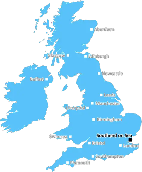
Southend On Sea (SS1)
The SS1 postcode area is located in the Southend On Sea postcode town region, within the county of Essex, and contains a total of 1204 individual postcodes.
There are 4 electoral wards in the SS1 postcode area, including Basildon, Benfleet, Canvey Island, Hockley, Leigh-On-Sea, Rayleigh, Rochford, Southend-On-Sea, Stanford-Le-Hope, Westcliff-On-Sea, Wickford which come under the local authority of the Southend-on-Sea Council.
Combining the whole postcode region, 22% of people in SS1 are classed as having an AB social grade, (i.e. 'white-collar' middle-upper class), compared to 27% across the UK.
This does not mean that the people of SS1 are poorer than other areas, but it may give an indication that there are areas of deprivation.
The SS1 postcode is part of the Southend On Sea district which is located in the county of Essex in England. It comprises the town of Southend-On-Sea and some of its suburbs. The postcode district itself is in the north part of the district. The SS1 postcode covers Westborough and Prittlewell wards, the south side of Victoria Avenue and much of Southchurch.
The postcode district has a population of around 27,305, and its local authority is the Southend-on-Sea Borough Council. Different parts of the postcode district mostly comprise council housing estates and some privately owned properties.
Southend-On-Sea is a popular seaside resort and one of the largest towns in Essex. This postcode is close to Southend's amenities, such as the Taylor Park, Southend Pier, Adventure Island, Southend Leisure & Tennis Centre, Sainsbury's Opticians, the two beaches, and the train stations, which provide easy access to London.
In terms of transport, the SS1 postcode is served by bus routes from Southend Central Station, Southend Airport, Prittlewell, and Westborough. The nearby Southend East railway station on the South Eastern Main Lineis also close to many parts of the postcode.
The local primary schools in the area include St. Saviour's Church of England Primary School, St. Michael's Catholic Primary School, Southchurch Junior School, Prittlewell Primary School and Westborough Community Primary School.
Westcliff High School for Boys and Girls is one of the most notable secondary education providers in the area, along with Southend High School for Boys, Southend High School for Girls, Eastwood Academy, The Royal Liberty School and Kingswood School.
The SS1 postcode has a number of post offices, libraries, large supermarkets, department stores, a gastro-pub, cafes, bars and some of the best restaurants in the area.
TheSS1 postcode is a desirable area to live and it provides all of the amenities one can find in a small but vibrant place like Southend-On-Sea. Its close proximity to a number of exciting attractions and top educational institutions make it an attractive prospect for families and individuals looking for a good home.

Demographics

Essex

SS1 is located in the county of Essex, in England.
Essex has a total population of 1,802,200, making it the 7th largest county in the UK.
Essex has a total area of 1417 square miles, and a population density of 491 people per square kilometre. For comparison, Greater London has a density of 5,618 people/km2.
| Outward Code | SS1 |
| Postal Town | Southend On Sea |
| MSOA Name | Southend-on-Sea 010 |
| LSOA Name | Southend-on-Sea 010D |
| County | Essex |
| Region | Essex |
| Country | England |
| Local Authority | Southend-on-Sea |
| Area Classification | Urban with City and Town |
SS1 Electoral Wards
The postal region of SS1, includes the local towns, villages, electoral wards and stations of:
Dig even deeper into the SS1 postcode by clicking on a postcode below:
Click on an outward postal code below for more information about the area. Each 'outward' postcode give you a comprehensive list of all postcodes within the outward code area (SS) and estimated address.
Click on an 'outward' code for more information. For example, the outward postcode page 'EC2M' will give you an alphabetical list covering all postcodes located in the region, from 'EC2M 1BB' through to 'EC2M 7YA'.
GOD, Southend On Sea
Saturday, February 17, 2024
shithole
Add your view of SS1
People need your local expertise. If you live in SS1 or have first-hand knowledge of the neighbourhood, please consider sharing your views. It's completely anonymous - all we ask is for your initials.
Please tell us what you like about the SS1 postcode area, what you don't like, and what it's like to live or work here.
| LOCAL AMENITIES | |
| FAMILY FRIENDLY | |
| PARKING | |
| GREEN SPACES |
Local News Essex
Morrisons warning over bacteria which can cause meningitis
The bacteria can survive and even grow under refrigeration and can cause Listeriosis which can last up to several weeks
Daily GazetteSellar gets green light for Hertfordshire media facility
The developer has designed the scheme to appeal to the media sector, as well as being appropriate for logistics, warehousing and data centre uses.
Property WeekPolice confirm missing Colchester woman, 38, has been found
Helen May, 38, from Colchester, is currently missing and was last seen yesterday, April 4
Daily GazetteAbri and Vistry partner to develop 1,500 homes in West Sussex
The 50/50 joint venture will develop the scheme on a former airfield site in Arundel.
Property WeekColchester Cemetery denies claims made over cross removal
COUNCIL bosses have denied claims they removed a decades-old cemetery cross because it was deemed offensive - instead revealing they just no longer have the money to maintain it.
Daily GazetteThe Essex areas forecast to be warmer than Los Angeles in Hollywood this weekend
The Met Office is predicting temperatures between 17 and 20 across Essex this Saturday
Essex LiveWhat questions do you ask a mortgage adviser? The top 10
These are the 10 most important questions to ask about your mortgage adviser to the different types of mortgages available.
Daily GazetteMixed-use London freehold to lead Allsop's March residential auction
Thefreeholdbuilding in Hampstead is guided at 2.5m-plus.
Property WeekFrom the Postcode Area blog

Deciphering Crime Rates - a Deep Dive Into UK Postcode Analysis
Ever wondered about the crime rate in your UK postcode? You're not alone. We've dug deep into the data, uncovering trends and patterns that'll make your head spin.

Death of the High Street?
The BBC reports that despite councils' attempts to kurb them, the UK's high streets have seen a huge growth in fast food outlets. Could this mark the death knell for the Great British high street, and what can we do about it to halt its decline?

Discrimination by Postcode
You really couldn't make it up, could you? Some of the country's most vulnerable people are missing out on their weekly £25 Cold Weather Payment, just because the system that's in operation is discriminating against them because payments are based on postcode, rather than geographic location.

The Redesign is Underway
Well, the current website was absolutely in dire need of a good redesign - from the ground up. So I set out to pull it all apart and get it up and running again to become the most comprehensive guide to every postcode in the UK. And it's been a long, tough job from start to finish - and quite possibly the biggest project I've ever undertaken.
SOCIAL GRADES
According to census records, 22% of people here have a social grade of AB (highest), compared to the national average of 27%.