southampton SO43 Postcodes
Spending a fortune on conveyancing?

Compare instant, low-cost online quotes from trusted conveyancing solicitors.
Backed by experts, our no-obligation service searches through the best conveyancing quotes on the market to save you time and money.
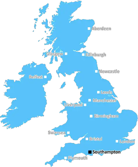
Southampton (SO43)
The SO43 postcode area is located in the Southampton postcode town region, within the county of Hampshire, and contains a total of 178 individual postcodes.
There are 36 electoral wards in the SO43 postcode area, including Alresford, Brockenhurst, Eastleigh, Lymington, Lyndhurst, Romsey, Southampton, Stockbridge, Winchester which come under the local authority of the New Forest Council.
Combining the whole postcode region, 32% of people in SO43 are classed as having an AB social grade, (i.e. 'white-collar' middle-upper class), compared to 27% across the UK.
This does not mean that the people of SO43 are wealthier - or higher class - than average, but it can be an indication that the area may be prospering and desirable to live in.
The SO43 postcode covers a wide area of Southampton district in the South of England. This area includes parts of Eastleigh, Hedge End, North Baddesley, Romsey, and even parts of Winchester. It is located close to the M27 motorway, and is within easy access of both Southampton and Portsmouth.
Most residential areas in the SO43 area are made up of medium-priced housing, including many suburban semi-detached homes and houses in established estates. It is home to several popular villages, such as Shedfield, Twyford, Botley and West End. These villages are relatively rural compared to the rest of the postcode, and are well sought after for their great quality of life.
The SO43 postcode also encompasses several vibrant towns and villages, including Eastleigh, Romsey, Bishopstoke, Fair Oak, Kings Worthy, Chilworth, and North Baddesley. These places offer a variety of amenities, including pubs, cafes, restaurants, shops, and a range of leisure activities.
The SO43 postcode also has strong transport links, with both Southampton Airport and Southampton Parkway railway station being easily accessible. From Eastleigh, commuters can access London in under an hour on the direct train to Waterloo.
There are a variety of educational institutions in the area, from primary schools, such as Chandlers Ford Infant School and Test Valley School, to high schools such as Kings' School in Romsey.
This postcode is known for its natural beauty, with many areas being covered by woodland and open green spaces, such as the Test Valley Countryside Park. The hills of the South Downs are also visible from areas of the postcode, and offer stunning views.
TheSO43 postcode offers something for everyone, with its great variety of amenities, easy access to central locations, and natural beauty. Its rural villages and nearby towns offer the perfect combination of a peaceful lifestyle with plenty of activities to enjoy.

Demographics

Hampshire

SO43 is located in the county of Hampshire, in England.
Hampshire has a total population of 1,829,500, making it the 5th largest county in the UK.
Hampshire has a total area of 1455 square miles, and a population density of 485 people per square kilometre. For comparison, Greater London has a density of 5,618 people/km2.
| Outward Code | SO43 |
| Postal Town | Southampton |
| MSOA Name | New Forest 007 |
| LSOA Name | New Forest 007D |
| County | Hampshire |
| Region | Hampshire |
| Country | England |
| Local Authority | New Forest |
| Area Classification | Urban with Significant Rural (rural including hub towns 26-49%) |
SO43 Electoral Wards
The postal region of SO43, includes the local towns, villages, electoral wards and stations of:
Dig even deeper into the SO43 postcode by clicking on a postcode below:
Click on an outward postal code below for more information about the area. Each 'outward' postcode give you a comprehensive list of all postcodes within the outward code area (SO) and estimated address.
Click on an 'outward' code for more information. For example, the outward postcode page 'EC2M' will give you an alphabetical list covering all postcodes located in the region, from 'EC2M 1BB' through to 'EC2M 7YA'.
Chris H
Tuesday, April 9, 2024
We don't have any views of SO43 right now. If you live in SO43 or have visited it, please help us to help others by telling others what you think of this neighbourhood.
Add your view of SO43
People need your local expertise. If you live in SO43 or have first-hand knowledge of the neighbourhood, please consider sharing your views. It's completely anonymous - all we ask is for your initials.
Please tell us what you like about the SO43 postcode area, what you don't like, and what it's like to live or work here.
| LOCAL AMENITIES | |
| FAMILY FRIENDLY | |
| PARKING | |
| GREEN SPACES |
Local News Hampshire
Hampshire & Isle of Wight: Friday's Big Picture
Showcasing the best images sent to us from around Hampshire & Isle of Wight.
BBC NewsWoman's five-day canoe challenge in mum's memory
A Southsea woman will try to canoe a 62-mile trail to raise money for a charity in her mum's memory.
BBC NewsThousands of runners take part in city marathon
Road closures were in place in Southampton for the annual event, which started in Guildhall Square.
BBC NewsAnti-racism groups condemn Webber 'jail' comments
Anti-racism campaign groups condemn "disgraceful" comments made by ex-Norwich sporting director Stuart Webber about five black footballers.
BBC NewsTheatre Royal Winchester's rendition of Singing Mermaid
The Theatre Royal Winchester is set to entertain children and adults with a puppet packed rendition of The Singing Mermaid this weekend from April 13.
Hampshire ChronicleIllegal River Itchen fisherman fined after catching salmon and trout
A man has been fined after he was caught illegally fishing for Salmon and Trout in the River Itchen.
Hampshire ChronicleDog owners warned of potentially fatal blue-green algae
Blue green algae, or cyanobacteria, are a group of bacteria that can contain dangerous toxins which can be harmful and potentially fatal to pets
Hampshire ChronicleCall for support to form new group focused on nature in Teg Down
MORE than 50 people turned up to hear more about setting up a community group in Teg Down.
Hampshire ChronicleFrom the Postcode Area blog

Deciphering Crime Rates - a Deep Dive Into UK Postcode Analysis
Ever wondered about the crime rate in your UK postcode? You're not alone. We've dug deep into the data, uncovering trends and patterns that'll make your head spin.

Death of the High Street?
The BBC reports that despite councils' attempts to kurb them, the UK's high streets have seen a huge growth in fast food outlets. Could this mark the death knell for the Great British high street, and what can we do about it to halt its decline?

Discrimination by Postcode
You really couldn't make it up, could you? Some of the country's most vulnerable people are missing out on their weekly £25 Cold Weather Payment, just because the system that's in operation is discriminating against them because payments are based on postcode, rather than geographic location.

The Redesign is Underway
Well, the current website was absolutely in dire need of a good redesign - from the ground up. So I set out to pull it all apart and get it up and running again to become the most comprehensive guide to every postcode in the UK. And it's been a long, tough job from start to finish - and quite possibly the biggest project I've ever undertaken.
SOCIAL GRADES
According to census records, 32% of people here have a social grade of AB (highest), compared to the national average of 27%.