southampton SO40 Postcodes
Spending a fortune on conveyancing?

Compare instant, low-cost online quotes from trusted conveyancing solicitors.
Backed by experts, our no-obligation service searches through the best conveyancing quotes on the market to save you time and money.
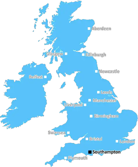
Southampton (SO40)
The SO40 postcode area is located in the Southampton postcode town region, within the county of Hampshire, and contains a total of 1399 individual postcodes.
There are 52 electoral wards in the SO40 postcode area, including Alresford, Brockenhurst, Eastleigh, Lymington, Lyndhurst, Romsey, Southampton, Stockbridge, Winchester which come under the local authority of the New Forest Council.
Combining the whole postcode region, 23% of people in SO40 are classed as having an AB social grade, (i.e. 'white-collar' middle-upper class), compared to 27% across the UK.
This does not mean that the people of SO40 are poorer than other areas, but it may give an indication that there are areas of deprivation.
SO40 is a postcode used in the Southampton district of Hampshire, England. It covers Lyndhurst and parts of the neighbouring villages of Bramshaw, Cadnam, Emery Down, Exbury, and East Boldre. The postcode district was created in 1996.
The SO40 postcode district lies between the SO20 (Romsey), SO42 (Brockenhurst) and SO51 (Eastleigh) postcode districts, and is almost entirely surrounded by the New Forest National Park. It is situated at the edge of the picturesque New Forest National Park and is home to some of the most beautiful and peaceful scenery in England.
SO40 covers a large area, stretching right from Hordle on the west side to Essoholme on the east, with Cadnam to the south and parts of Emery Down and Bramshaw in the north. It contains a range of amenities included in its large network of rural villages, such as local shops, secondary schools, post offices, pubs, banks, car dealerships, and a national park visitor centre.
The area also has a variety of different properties, both detached and semi-detached. There are also a number of green spaces and outdoor recreation areas scattered throughout the district, such as the popular Beaulieu heath and forest, as well as public parks. The beautiful Hampshire countryside provides a peaceful and scenic location for a number of popular walking and cycling trails.
The SO40 postcode district is well connected by both road and rail links, meaning it has easy access to Southampton, Bournemouth, Salisbury and London. Lyndhurst station is situated in the district and provides direct train services to a range of locations. At the same time, the A31 and M27 motorways run in an east-west direction along the length of the SO40 postcode district, linking the area to the rest of Hampshire and further afield.

Demographics

Hampshire

SO40 is located in the county of Hampshire, in England.
Hampshire has a total population of 1,829,500, making it the 5th largest county in the UK.
Hampshire has a total area of 1455 square miles, and a population density of 485 people per square kilometre. For comparison, Greater London has a density of 5,618 people/km2.
| Outward Code | SO40 |
| Postal Town | Southampton |
| MSOA Name | New Forest 003 |
| LSOA Name | New Forest 003B |
| County | Hampshire |
| Region | Hampshire |
| Country | England |
| Local Authority | New Forest |
| Area Classification | Urban with Significant Rural (rural including hub towns 26-49%) |
SO40 Electoral Wards
The postal region of SO40, includes the local towns, villages, electoral wards and stations of:
Dig even deeper into the SO40 postcode by clicking on a postcode below:
Click on an outward postal code below for more information about the area. Each 'outward' postcode give you a comprehensive list of all postcodes within the outward code area (SO) and estimated address.
Click on an 'outward' code for more information. For example, the outward postcode page 'EC2M' will give you an alphabetical list covering all postcodes located in the region, from 'EC2M 1BB' through to 'EC2M 7YA'.
Chris H
Sunday, April 7, 2024
We don't have any views of SO40 right now. If you live in SO40 or have visited it, please help us to help others by telling others what you think of this neighbourhood.
Add your view of SO40
People need your local expertise. If you live in SO40 or have first-hand knowledge of the neighbourhood, please consider sharing your views. It's completely anonymous - all we ask is for your initials.
Please tell us what you like about the SO40 postcode area, what you don't like, and what it's like to live or work here.
| LOCAL AMENITIES | |
| FAMILY FRIENDLY | |
| PARKING | |
| GREEN SPACES |
Local News Hampshire
Watch: Dinosaurs invade BBC South studio
During a live segment about a Megalosaurus presenter Anjana Gadgil found herself surrounded.
BBC NewsRelive Portsmouth's draw with Derby and Doncaster's win over Wrexham
Relive live EFL text commentary of Portsmouth's draw with Derby and Doncaster's win over Wrexham.
BBC NewsSparsholt, The Worthys, Easton, Littleton Community nibs
Hamphire Chronicle nibs
Hampshire ChronicleHampshire country hotel to host fundraising race night
To celebrate the partnership, the hotel and charity are hosting a Night at the Races' fundraiser, with a guest appearance from top classic-winning jockey, Sean Levey.
Hampshire ChronicleMore trains to stop at suburban railway station
Southern is adding stops at Woolston for its Southampton-Brighton route from June.
BBC NewsHampshire and Isle of Wight Fire and Rescue's animal rescues
April 2024 will mark the 20th anniversary of the Hampshire and Isle of Wight Fire and Rescue Service's (HIWFRS) animal rescue unit.
Hampshire ChronicleLetter: 'Councillors need to adjust their misguided understanding'
So we now have a date forecast for the closure of Andover Road of early 2026 in favour of all the main road traffic entering Winchester from the north passing through the Kings Barton housing estate.
Hampshire ChronicleBishop's Waltham Charity Garden Fair in Hampshire cancelled
A HAMPSHIRE garden fair has been cancelled one month before it was due to be held.
Hampshire ChronicleFrom the Postcode Area blog

Deciphering Crime Rates - a Deep Dive Into UK Postcode Analysis
Ever wondered about the crime rate in your UK postcode? You're not alone. We've dug deep into the data, uncovering trends and patterns that'll make your head spin.

Death of the High Street?
The BBC reports that despite councils' attempts to kurb them, the UK's high streets have seen a huge growth in fast food outlets. Could this mark the death knell for the Great British high street, and what can we do about it to halt its decline?

Discrimination by Postcode
You really couldn't make it up, could you? Some of the country's most vulnerable people are missing out on their weekly £25 Cold Weather Payment, just because the system that's in operation is discriminating against them because payments are based on postcode, rather than geographic location.

The Redesign is Underway
Well, the current website was absolutely in dire need of a good redesign - from the ground up. So I set out to pull it all apart and get it up and running again to become the most comprehensive guide to every postcode in the UK. And it's been a long, tough job from start to finish - and quite possibly the biggest project I've ever undertaken.
SOCIAL GRADES
According to census records, 23% of people here have a social grade of AB (highest), compared to the national average of 27%.