sheffield S18 Postcodes
Spending a fortune on conveyancing?

Compare instant, low-cost online quotes from trusted conveyancing solicitors.
Backed by experts, our no-obligation service searches through the best conveyancing quotes on the market to save you time and money.
Sheffield (S18)
The S18 postcode area is located in the Sheffield postcode town region, within the county of Derbyshire, and contains a total of 1352 individual postcodes.
There are 50 electoral wards in the S18 postcode area, including Barnsley, Chesterfield, Dronfield, Hope Valley, Mexborough, Rotherham, Sheffield, Worksop which come under the local authority of the North East Derbyshire Council.
Combining the whole postcode region, 27% of people in S18 are classed as having an AB social grade, (i.e. 'white-collar' middle-upper class), compared to 27% across the UK.
This does not mean that the people of S18 are wealthier - or higher class - than average, but it can be an indication that the area may be prospering and desirable to live in.
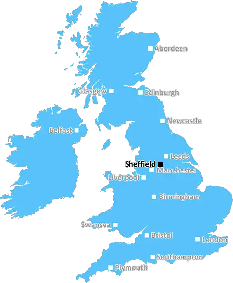
The S18 postcode is located within the boundaries of the Sheffield district of South Yorkshire, England. It covers the area of Derbyshire Dales, including Dronfield, Unstone, Old Whittington, Barlow, Coal Aston, and part of Dronfield Woodhouse.
S18 is a popular postcode area with a mix of housing types in a rural setting, mostly detached properties or small terraced houses. It is a semi-rural area known for its bustling market towns and villages which attract many visitors and locals alike.
There is a wealth of activities to be enjoyed in the S18 postcode. There are many nearby attractions, including historic sites, wildlife parks, country pubs and traditional craft markets. Numerous parks and gardens are also within reach, such as the Grade-I listed Chatsworth House and gardens, and the National Park.
The area also has excellent educational opportunities with a number of primary and secondary schools, as well as Sheffield College and the University of Sheffield's International Centre.
Transport links around S18 are also excellent, with the M1 motorway running through the area. Sheffield's railway links provide direct services to Manchester, Leeds and London, while buses and trams run regularly from the nearby Sheaf Valley interchange.
Residents of S18 also have access to a variety of shopping outlets, a farmers market, and numerous pubs and restaurants. There are also several large supermarkets, retail parks and specialty shops in the area.
In addition, S18 is home to multiple sports and leisure facilities, such as local golf courses, rugby and football teams, many of which are based around Dronfield. There are several sports centres, a ski centre and an ice rink located nearby, as well as a wide variety of clubs to choose from.
S18 is a vibrant and lively area with much to offer. It has the perfect balance of rural life and city amenities, making it an attractive place to live or visit.

Demographics

Derbyshire

S18 is located in the county of Derbyshire, in England.
Derbyshire has a total population of 1,042,000, making it the 20th largest county in the UK.
Derbyshire has a total area of 1013 square miles, and a population density of 396 people per square kilometre. For comparison, Greater London has a density of 5,618 people/km2.
| Outward Code | S18 |
| Postal Town | Sheffield |
| MSOA Name | North East Derbyshire 004 |
| LSOA Name | North East Derbyshire 004C |
| County | Derbyshire |
| Region | Derbyshire |
| Country | England |
| Local Authority | North East Derbyshire |
| Area Classification | Urban with City and Town |
S18 Electoral Wards
The postal region of S18, includes the local towns, villages, electoral wards and stations of:
Dig even deeper into the S18 postcode by clicking on a postcode below:
Click on an outward postal code below for more information about the area. Each 'outward' postcode give you a comprehensive list of all postcodes within the outward code area (S) and estimated address.
Click on an 'outward' code for more information. For example, the outward postcode page 'EC2M' will give you an alphabetical list covering all postcodes located in the region, from 'EC2M 1BB' through to 'EC2M 7YA'.
Chris H
Sunday, April 7, 2024
We don't have any views of S18 right now. If you live in S18 or have visited it, please help us to help others by telling others what you think of this neighbourhood.
Add your view of S18
People need your local expertise. If you live in S18 or have first-hand knowledge of the neighbourhood, please consider sharing your views. It's completely anonymous - all we ask is for your initials.
Please tell us what you like about the S18 postcode area, what you don't like, and what it's like to live or work here.
| LOCAL AMENITIES | |
| FAMILY FRIENDLY | |
| PARKING | |
| GREEN SPACES |
Local News Derbyshire
Lara Croft voted most iconic video game character
Lara Croft beat old favourites Mario, Sonic and Pac-Man to claim the title, voted for by gamers.
BBC NewsDerby's Guildhall in line for 24m restoration
The Grade II listed building was at risk of falling into disrepair, the council said.
BBC NewsNo play possible at Durham & Derbyshire on day two
No play is possible at Durham against Hampshire and Derbyshire against Gloucestershire for a second straight day.
BBC NewsTeen injured in Ilkeston street fight, police make 4 arrests
A teenager suffered a swollen lip, cut to the head and grazes and was taken to hospital
Derby TelegraphHuge manor house with formal gardens close to Derby city centre up for sale
Parts of the Old Rectory date back to the 1750s
Derby TelegraphBurton Albion 0-4 Oxford United
Mark Harris' double helps push Oxford back into the League One play-off places as they ruthlessly beat Burton.
BBC News'Beautiful' Chellaston mum in Derby Telegraph funeral notices this weekend
Our thoughts are with the friends and family of those who have died recently
Derby TelegraphCosy cottage near Derbyshire town with 'UK's best high street' up for sale
The quaint house looks like it belongs in a fairytale
Derby TelegraphFrom the Postcode Area blog

Deciphering Crime Rates - a Deep Dive Into UK Postcode Analysis
Ever wondered about the crime rate in your UK postcode? You're not alone. We've dug deep into the data, uncovering trends and patterns that'll make your head spin.

Death of the High Street?
The BBC reports that despite councils' attempts to kurb them, the UK's high streets have seen a huge growth in fast food outlets. Could this mark the death knell for the Great British high street, and what can we do about it to halt its decline?

Discrimination by Postcode
You really couldn't make it up, could you? Some of the country's most vulnerable people are missing out on their weekly £25 Cold Weather Payment, just because the system that's in operation is discriminating against them because payments are based on postcode, rather than geographic location.

The Redesign is Underway
Well, the current website was absolutely in dire need of a good redesign - from the ground up. So I set out to pull it all apart and get it up and running again to become the most comprehensive guide to every postcode in the UK. And it's been a long, tough job from start to finish - and quite possibly the biggest project I've ever undertaken.
SOCIAL GRADES
According to census records, 27% of people here have a social grade of AB (highest), compared to the national average of 27%.