romford RM9 Postcodes
Spending a fortune on conveyancing?

Compare instant, low-cost online quotes from trusted conveyancing solicitors.
Backed by experts, our no-obligation service searches through the best conveyancing quotes on the market to save you time and money.
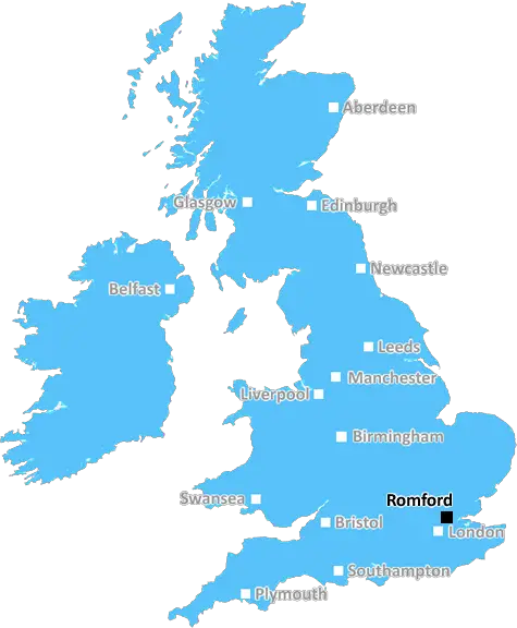
Romford (RM9)
The RM9 postcode area is located in the Romford postcode town region, within the county of Greater London, and contains a total of 866 individual postcodes.
There are 4 electoral wards in the RM9 postcode area, including Dagenham, Grays, Hornchurch, Purfleet, Rainham, Romford, South Ockendon, Tilbury, Upminster which come under the local authority of the Barking and Dagenham Council.
Combining the whole postcode region, 9% of people in RM9 are classed as having an AB social grade, (i.e. 'white-collar' middle-upper class), compared to 27% across the UK.
This does not mean that the people of RM9 are poorer than other areas, but it may give an indication that there are areas of deprivation.
The RM9 postcode is located in the borough of Havering and includes Bridge, Rainham, South Hornchurch, St. Andrew's, and Upminster Bridge in London, England.
Bridge is an urban, mostly residential area with a few small businesses. Rainham is mostly residential, but contains a number of industrial parks and warehouses. South Hornchurch is a mainly residential area with some light industry. It contains a few primary and secondary schools, as well as a supermarket. St. Andrews is a small hamlet in the middle of the RM9 postcode. Upminster Bridge is a residential area, with a few shops and pubs.
The area is served mainly by public transport, including Train services provided by London Overground and London's Metropolitan Line. London Buses and Romford's taxi service also operate in and around the area.
The area is largely residential, though a few small businesses and industrial and commercial sites are located here. It is a popular area with young professionals due to its good transport links and proximity to London. The area is home to several nice parks and recreational facilities, as well as some smaller shops, restaurants, cafes and a post office.
The area is served by two primary schools - St. Andrews Primary School and Rainham Hall Primary School. There are also two secondary schools - Marshalls Park Academy and an adult education centre at St. Andrews. Havering College is also located nearby.
The area has seen some regeneration in recent years with the development of Upminster Bridge Shopping Centre and a new leisure centre in the form of the Upminster Bridge Recreation Centre. The area is also home to some of the best golf courses in London, including Hawkwells Golf Centre and The London Golf Club. The Upminster Windmill and Tithe Farm Nature Reserve are a popular destination for locals and visitors alike.

Demographics

Greater London

RM9 is located in the county of Greater London, in England.
Greater London has a total population of 8,778,500, making it the 1st largest county in the UK.
Greater London has a total area of 606 square miles, and a population density of 5594 people per square kilometre. For comparison, Greater London has a density of 5,618 people/km2.
| Outward Code | RM9 |
| Postal Town | Romford |
| MSOA Name | Barking and Dagenham 012 |
| LSOA Name | Barking and Dagenham 012D |
| County | Greater London |
| Region | Greater London |
| Country | England |
| Local Authority | Barking and Dagenham |
| Area Classification | Urban with Major Conurbation |
RM9 Electoral Wards
The postal region of RM9, includes the local towns, villages, electoral wards and stations of:
Dig even deeper into the RM9 postcode by clicking on a postcode below:
Click on an outward postal code below for more information about the area. Each 'outward' postcode give you a comprehensive list of all postcodes within the outward code area (RM) and estimated address.
Click on an 'outward' code for more information. For example, the outward postcode page 'EC2M' will give you an alphabetical list covering all postcodes located in the region, from 'EC2M 1BB' through to 'EC2M 7YA'.
Chris H
Monday, April 8, 2024
We don't have any views of RM9 right now. If you live in RM9 or have visited it, please help us to help others by telling others what you think of this neighbourhood.
Add your view of RM9
People need your local expertise. If you live in RM9 or have first-hand knowledge of the neighbourhood, please consider sharing your views. It's completely anonymous - all we ask is for your initials.
Please tell us what you like about the RM9 postcode area, what you don't like, and what it's like to live or work here.
| LOCAL AMENITIES | |
| FAMILY FRIENDLY | |
| PARKING | |
| GREEN SPACES |
Local News Essex
Family plans Home Alone trip after lottery win
Leyla Eaton, who bagged 411,000, says she can fulfil her children's holiday dreams.
BBC NewsMandatory first aid training called for UK drivers by experts
LeaseCar.uk is calling for mandatory first aid training for motorists when getting their driving licence so they know what to do during an accident.
The EchoWhat age a child can stay at home alone in the UK? NSPCC advises
From the cost of living to childcare, there are many challenges to being a parent. Here's the NSPCC advice if you're considering leaving them alone at home for the first time.
The EchoMorrisons, Asda, Magnum recalls and 'do not eat' warnings
Food recalls have been issued at Asda and Morrisons after products were found to contain a disease-causing bacteria linked to meningitis
Daily GazettePlaces for People acquires Rosewood Housing
The affordable homes provider was previously owned by housing developer Inland Homes.
Property WeekHow to shop at Aldi for cheaper from a deals expert
Aldi might be Which's cheapest UK supermarket for three years running but this is how you can save even more on your supermarket shop.
The EchoSouthend United 4-2 Boreham Wood
Southend United beat relegation-battling Boreham Wood to keep alive their slim National League promotion hopes..
BBC NewsLittle Heroes: Girl's sponsored silence for Southend charity
A FOUR-YEAR-OLD girl whose little brother is severely disabled is raising hundreds of pounds to help a Southend charity open its new home
The EchoFrom the Postcode Area blog

Deciphering Crime Rates - a Deep Dive Into UK Postcode Analysis
Ever wondered about the crime rate in your UK postcode? You're not alone. We've dug deep into the data, uncovering trends and patterns that'll make your head spin.

Death of the High Street?
The BBC reports that despite councils' attempts to kurb them, the UK's high streets have seen a huge growth in fast food outlets. Could this mark the death knell for the Great British high street, and what can we do about it to halt its decline?

Discrimination by Postcode
You really couldn't make it up, could you? Some of the country's most vulnerable people are missing out on their weekly £25 Cold Weather Payment, just because the system that's in operation is discriminating against them because payments are based on postcode, rather than geographic location.

The Redesign is Underway
Well, the current website was absolutely in dire need of a good redesign - from the ground up. So I set out to pull it all apart and get it up and running again to become the most comprehensive guide to every postcode in the UK. And it's been a long, tough job from start to finish - and quite possibly the biggest project I've ever undertaken.
SOCIAL GRADES
According to census records, 9% of people here have a social grade of AB (highest), compared to the national average of 27%.