romford RM4 Postcodes
Spending a fortune on conveyancing?

Compare instant, low-cost online quotes from trusted conveyancing solicitors.
Backed by experts, our no-obligation service searches through the best conveyancing quotes on the market to save you time and money.
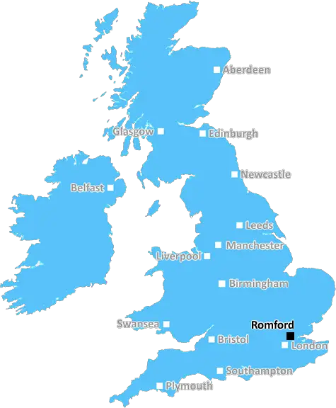
Romford (RM4)
The RM4 postcode area is located in the Romford postcode town region, within the county of Essex, and contains a total of 215 individual postcodes.
There are 24 electoral wards in the RM4 postcode area, including Dagenham, Grays, Hornchurch, Purfleet, Rainham, Romford, South Ockendon, Tilbury, Upminster which come under the local authority of the Epping Forest Council.
Combining the whole postcode region, 20% of people in RM4 are classed as having an AB social grade, (i.e. 'white-collar' middle-upper class), compared to 27% across the UK.
This does not mean that the people of RM4 are poorer than other areas, but it may give an indication that there are areas of deprivation.
The RM4 postcode is a postcode district in the Romford borough of Greater London. It is situated to the south of Chadwell Heath, to the west of Collier Row, and to the east of Dagenham. The postcode is comprised of the neighbourhoods of Havering Park, Chase Cross, and Noak Hill.
Havering Park is an area of mostly residential housing, though there is also a local leisure centre, primary school and church. Located at the centre of the postcode, Havering Park is within easy reach of local amenities and public transportation.
Chase Cross is a leafy neighbourhood located at the southern edge of the RM4 postcode. It is home to a railway station, providing direct access to the centre of London.
Noak Hill is a less populous neighbourhood, located at the north of the postcode. Its streets are lined with trees, making it a pleasant and relatively quiet area.
Residents of the RM4 postcode are serviced by several GPs, dentists, opticians, local pharmacies and health centres. The postcode is located within the London Borough of Havering authority, providing access to local council services.
The area is home to a number of local businesses, as well as thematic retail outlets, supermarkets and restaurants. For green-seekers, there are a few large parks within the RM4 postcode, including Havering Country Park and Pyrgo Park. The area is well-connected, offering convenient bus services, as well as rail services between Romford and East London.
This is an ideal postcode for people who would like to experience a mix of both rural and urban living. It's the perfect area for young professionals, families and those looking for an active and engaged lifestyle.

Demographics

Essex

RM4 is located in the county of Essex, in England.
Essex has a total population of 1,802,200, making it the 7th largest county in the UK.
Essex has a total area of 1417 square miles, and a population density of 491 people per square kilometre. For comparison, Greater London has a density of 5,618 people/km2.
| Outward Code | RM4 |
| Postal Town | Romford |
| MSOA Name | Epping Forest 010 |
| LSOA Name | Epping Forest 010A |
| County | Essex |
| Region | Essex |
| Country | England |
| Local Authority | Epping Forest |
| Area Classification | Urban with Significant Rural (rural including hub towns 26-49%) |
RM4 Electoral Wards
The postal region of RM4, includes the local towns, villages, electoral wards and stations of:
Dig even deeper into the RM4 postcode by clicking on a postcode below:
Click on an outward postal code below for more information about the area. Each 'outward' postcode give you a comprehensive list of all postcodes within the outward code area (RM) and estimated address.
Click on an 'outward' code for more information. For example, the outward postcode page 'EC2M' will give you an alphabetical list covering all postcodes located in the region, from 'EC2M 1BB' through to 'EC2M 7YA'.
Chris H
Monday, April 8, 2024
We don't have any views of RM4 right now. If you live in RM4 or have visited it, please help us to help others by telling others what you think of this neighbourhood.
Add your view of RM4
People need your local expertise. If you live in RM4 or have first-hand knowledge of the neighbourhood, please consider sharing your views. It's completely anonymous - all we ask is for your initials.
Please tell us what you like about the RM4 postcode area, what you don't like, and what it's like to live or work here.
| LOCAL AMENITIES | |
| FAMILY FRIENDLY | |
| PARKING | |
| GREEN SPACES |
Local News Essex
Ford Fiesta 'may be involved' as man found injured in Essex
A MANfound seriously injured after reports he had been hit by a car has sparked a police appeal for witnesses
The EchoNHS: number of south Essex patients unable to contact GP
It showed 4.5 per cent of people registered to a GP practice in the NHS Mid and South Essex Integrated Care Board were unable to contact their doctor
The EchoPlaces for People acquires Rosewood Housing
The affordable homes provider was previously owned by housing developer Inland Homes.
Property WeekWhat items are not allowed to be packed in hand luggage?
Many items are not allowed in hand luggage but are you allowed to pack make up, razors, aerosols or medication? Here are the rules.
The EchoA13 Bread and Cheese Hill traffic amid emergency works
Cadent has put the lights in place as it carries out emergency gas works in that stretch of the road
The EchoPolice officer attacked in 'aggression' at Essex pub
Police were called to the pub after receiving reports of a man being aggressive and threatening customers and door staff
Essex LivePolice find man seriously inured after suspected hit-and-run crash
Police said they believed a white Ford Fiesta may have been involved in the incident
Essex LiveRegal London signs Epson UK for 30,000 sq ft pre-let at Watford scheme
The grade-A The Clarendon Works office scheme will open in Q3.
Property WeekFrom the Postcode Area blog

Deciphering Crime Rates - a Deep Dive Into UK Postcode Analysis
Ever wondered about the crime rate in your UK postcode? You're not alone. We've dug deep into the data, uncovering trends and patterns that'll make your head spin.

Death of the High Street?
The BBC reports that despite councils' attempts to kurb them, the UK's high streets have seen a huge growth in fast food outlets. Could this mark the death knell for the Great British high street, and what can we do about it to halt its decline?

Discrimination by Postcode
You really couldn't make it up, could you? Some of the country's most vulnerable people are missing out on their weekly £25 Cold Weather Payment, just because the system that's in operation is discriminating against them because payments are based on postcode, rather than geographic location.

The Redesign is Underway
Well, the current website was absolutely in dire need of a good redesign - from the ground up. So I set out to pull it all apart and get it up and running again to become the most comprehensive guide to every postcode in the UK. And it's been a long, tough job from start to finish - and quite possibly the biggest project I've ever undertaken.
SOCIAL GRADES
According to census records, 20% of people here have a social grade of AB (highest), compared to the national average of 27%.