romford RM2 Postcodes
Spending a fortune on conveyancing?

Compare instant, low-cost online quotes from trusted conveyancing solicitors.
Backed by experts, our no-obligation service searches through the best conveyancing quotes on the market to save you time and money.
Romford (RM2)
The RM2 postcode area is located in the Romford postcode town region, within the county of Greater London, and contains a total of 405 individual postcodes.
There are 2 electoral wards in the RM2 postcode area, including Dagenham, Grays, Hornchurch, Purfleet, Rainham, Romford, South Ockendon, Tilbury, Upminster which come under the local authority of the Havering Council.
Combining the whole postcode region, 26% of people in RM2 are classed as having an AB social grade, (i.e. 'white-collar' middle-upper class), compared to 27% across the UK.
This does not mean that the people of RM2 are poorer than other areas, but it may give an indication that there are areas of deprivation.
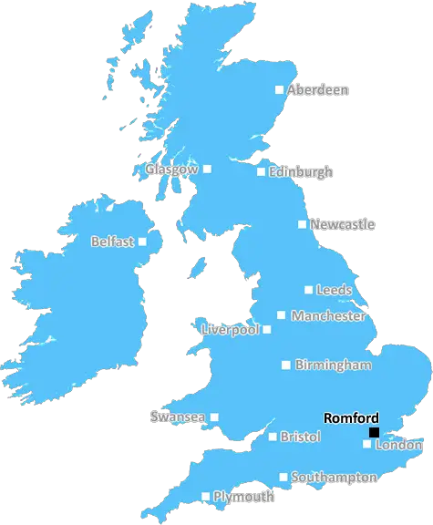
The Romford RM2 postcode serves Romford, a town in the London Borough of Havering, East London, England. It forms part of the Hornchurch and Upminster constituency.
The postcode district is centered on South Street in Romford, with an approximate population of 20,000. It is made up of the areas of Heath Park, South Street, Lower Church Road, Gidea Park, Waterloo Road and parts of Rush Green. The area measures just over 0.5 square miles, is relatively densely populated and has predominantly white British and Asian ethnic populations.
Public transport is readily available in the form of bus routes connecting the area to Havering and other neighbouring towns. Romford Railway Station provides access to central London in around 30 minutes. The area is served by several primary schools, including Parkside Primary, Hilldene Primary, St Andrews Primary and Scargill Primary. Additional schools include Scala Theatre Arts, Courtyard Dance Studios, and Romford Piano Academy.
The area is rich in parks and open spaces, providing good recreational activities for all. The historic Raphael Park is renowned for its green spaces, Grade II listed manor house and boating lake, while Squirrels Heath Park plays host to a children's playground and BMX track. Additionally, Gidea Park Garden is a large Edwardian garden that is open to the public year-round.
In terms of entertainment, the area boasts many pubs and restaurants, as well as Kelly's Nightclub, Collier Row Bowls Club, and Collier Row Golf Club. Romford Town F.C, Corringham Cosmos F.C and Whitehall F.C all play in the area, providing plenty of sport-related activity.
RM2 is also home to lots of shopping options and independent stores, with The Galleria shopping centre, The Brewery and a range of other retail outlets situated in the area. Along with plenty of other local amenities, it is easy to see why RM2 has become a much sought-after postcode.

Demographics

Greater London

RM2 is located in the county of Greater London, in England.
Greater London has a total population of 8,778,500, making it the 1st largest county in the UK.
Greater London has a total area of 606 square miles, and a population density of 5594 people per square kilometre. For comparison, Greater London has a density of 5,618 people/km2.
| Outward Code | RM2 |
| Postal Town | Romford |
| MSOA Name | Havering 013 |
| LSOA Name | Havering 013F |
| County | Greater London |
| Region | Greater London |
| Country | England |
| Local Authority | Havering |
| Area Classification | Urban with Major Conurbation |
RM2 Electoral Wards
The postal region of RM2, includes the local towns, villages, electoral wards and stations of:
Dig even deeper into the RM2 postcode by clicking on a postcode below:
Click on an outward postal code below for more information about the area. Each 'outward' postcode give you a comprehensive list of all postcodes within the outward code area (RM) and estimated address.
Click on an 'outward' code for more information. For example, the outward postcode page 'EC2M' will give you an alphabetical list covering all postcodes located in the region, from 'EC2M 1BB' through to 'EC2M 7YA'.
Chris H
Tuesday, April 9, 2024
We don't have any views of RM2 right now. If you live in RM2 or have visited it, please help us to help others by telling others what you think of this neighbourhood.
Add your view of RM2
People need your local expertise. If you live in RM2 or have first-hand knowledge of the neighbourhood, please consider sharing your views. It's completely anonymous - all we ask is for your initials.
Please tell us what you like about the RM2 postcode area, what you don't like, and what it's like to live or work here.
| LOCAL AMENITIES | |
| FAMILY FRIENDLY | |
| PARKING | |
| GREEN SPACES |
Local News Essex
Harlow woman shrinks from size 26 to size 14 after scare
A 50-year-old woman dropped 10 stone after nearly dying from septic shock, having survived a womb perforation.
Daily GazetteThe stunning pub that's one of Essex's oldest named the best in the county
The village pub beat dozens of other pubs to grab the top spot for the county
Essex LiveHarry Potter Essex links: cast and filming locations
Mystic and wonder are not just limited to the Shire or Hogwarts - south Essex has its own magical links thanks to Harry Potter
The EchoWhat is the route and course of the 2024 London Marathon?
Watching the London Marathon or running it? Find out the full route runners will be taking on in 2024.
The EchoWhat items are not allowed to be packed in hand luggage?
Many items are not allowed in hand luggage but are you allowed to pack make up, razors, aerosols or medication? Here are the rules.
The EchoThe Essex coastal areas where flood alerts are issued for Shoeburyness, Southend, Burnham-on-Crouch, Clacton and Brightlingsea
The government has said flooding of coastal paths and roads are likely today (April 8)
Essex LiveHatton Jewellers launches 'flagship' new store in Chelmsford replacing previous Bathstore
The firm sells and manufactures men's and women's fine jewellery, including gold chains and diamond necklaces
Essex LiveWestcliff London Road new jazz bar and restaurant could open
A NEW Jazz bar and restaurant could open just doors away from the Cricketers pub in Westcliff under fresh plans submitted to Southend Council
The EchoFrom the Postcode Area blog

Deciphering Crime Rates - a Deep Dive Into UK Postcode Analysis
Ever wondered about the crime rate in your UK postcode? You're not alone. We've dug deep into the data, uncovering trends and patterns that'll make your head spin.

Death of the High Street?
The BBC reports that despite councils' attempts to kurb them, the UK's high streets have seen a huge growth in fast food outlets. Could this mark the death knell for the Great British high street, and what can we do about it to halt its decline?

Discrimination by Postcode
You really couldn't make it up, could you? Some of the country's most vulnerable people are missing out on their weekly £25 Cold Weather Payment, just because the system that's in operation is discriminating against them because payments are based on postcode, rather than geographic location.

The Redesign is Underway
Well, the current website was absolutely in dire need of a good redesign - from the ground up. So I set out to pull it all apart and get it up and running again to become the most comprehensive guide to every postcode in the UK. And it's been a long, tough job from start to finish - and quite possibly the biggest project I've ever undertaken.
SOCIAL GRADES
According to census records, 26% of people here have a social grade of AB (highest), compared to the national average of 27%.