romford RM15 Postcodes
Spending a fortune on conveyancing?

Compare instant, low-cost online quotes from trusted conveyancing solicitors.
Backed by experts, our no-obligation service searches through the best conveyancing quotes on the market to save you time and money.
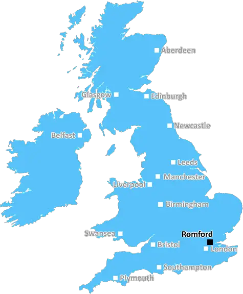
Romford (RM15)
The RM15 postcode area is located in the Romford postcode town region, within the county of Essex, and contains a total of 736 individual postcodes.
There are 3 electoral wards in the RM15 postcode area, including Dagenham, Grays, Hornchurch, Purfleet, Rainham, Romford, South Ockendon, Tilbury, Upminster which come under the local authority of the Thurrock Council.
Combining the whole postcode region, 12% of people in RM15 are classed as having an AB social grade, (i.e. 'white-collar' middle-upper class), compared to 27% across the UK.
This does not mean that the people of RM15 are poorer than other areas, but it may give an indication that there are areas of deprivation.
RM15 is a postcode in the Romford district of the London Borough of Havering, in the East of England. It covers part of Emerson Park, a popular residential area with a mix of Edwardian, Victorian and modern homes, as well as the industrial and business parks of the nearby Gidea Park.
RM15 is a predominantly affluent area with each of its bespoke residential roads lined with large houses and features a number of private and popular schools, such as Marshalls Park School and Royal Liberty School.
Emerson Park Station is the local train station and provides access to public transport links in the area, including the Central line connecting it to London and other parts of East London. It's also a major transport hub with direct links to various parts of Essex and London.
The area is home to bustling Gidea Park shopping centre which is filled with interesting shops and eateries, as well as a handful of amenities and community facilities in the immediate area such as a library, health services and leisure centres. The centre also hosts various events throughout the year such as farmers markets, fairs and street parties.
The nearby area of Upminster is home to Upminster Windmill, considered to be one of the best preserved traditional windmills in the UK, and is listed on the National Heritage List.
RM15 is a popular area for outdoor executive team-building activities and is host to some of the region's largest golf clubs. The Bushwood Golf Club and the Gidea Park Golf Club offer world-class golf courses, which often host international tournaments.
The area's natural environment is equally remarkable and includes some of the region's most luscious green spaces, including the well-manicured grounds in Belfairs Wood Nature Reserve, and the expansive grounds of Rightwood Hill Nature Reserve.
RM15 also has a vibrant cultural scene with a wealth of local pubs, clubs, theatres, opera houses, galleries and art venues that showcase the best of British and international talents. The area is also home to numerous cultural and heritage sites, including the Historic England listed 12th century Romford War Memorial.

Demographics

Essex

RM15 is located in the county of Essex, in England.
Essex has a total population of 1,802,200, making it the 7th largest county in the UK.
Essex has a total area of 1417 square miles, and a population density of 491 people per square kilometre. For comparison, Greater London has a density of 5,618 people/km2.
| Outward Code | RM15 |
| Postal Town | Romford |
| MSOA Name | Thurrock 008 |
| LSOA Name | Thurrock 008E |
| County | Essex |
| Region | Essex |
| Country | England |
| Local Authority | Thurrock |
| Area Classification | Urban with Major Conurbation |
RM15 Electoral Wards
The postal region of RM15, includes the local towns, villages, electoral wards and stations of:
Dig even deeper into the RM15 postcode by clicking on a postcode below:
Click on an outward postal code below for more information about the area. Each 'outward' postcode give you a comprehensive list of all postcodes within the outward code area (RM) and estimated address.
Click on an 'outward' code for more information. For example, the outward postcode page 'EC2M' will give you an alphabetical list covering all postcodes located in the region, from 'EC2M 1BB' through to 'EC2M 7YA'.
Chris H
Sunday, April 7, 2024
We don't have any views of RM15 right now. If you live in RM15 or have visited it, please help us to help others by telling others what you think of this neighbourhood.
Add your view of RM15
People need your local expertise. If you live in RM15 or have first-hand knowledge of the neighbourhood, please consider sharing your views. It's completely anonymous - all we ask is for your initials.
Please tell us what you like about the RM15 postcode area, what you don't like, and what it's like to live or work here.
| LOCAL AMENITIES | |
| FAMILY FRIENDLY | |
| PARKING | |
| GREEN SPACES |
Local News Essex
TT Group sells BT's old Southampton offices to consortium
BT's former Friary House office building has permission for residential conversion under permitted development rights.
Property WeekEssex woman Diane Jones murder to be explored in Channel 5 show
A Channel 5 show, Prime Suspect: Murder in Suburbia, will examine the murder of Diane Jones
Daily GazetteLeigh Grove Restaurant opened after extensive refurbishment
A TRENDY Leigh restaurant which boasts sweeping views of the idyllic Thames Estuary has opened its doors following an "extensive" renovation
The EchoChaiiwala could be coming to Colchester High Street
A popular Indian street food chain is looking to open a new branch in Colchester High Street.
Daily GazetteEssex Police appeal to find boy, 15, last seen six days ago
Essex Police officers are searching for Marley Stapleton, 15, who is missing from the Great Dunmow area
Daily GazetteRegal London signs Epson UK for 30,000 sq ft pre-let at Watford scheme
The grade-A The Clarendon Works office scheme will open in Q3.
Property WeekA12 police stop: Two charged with human trafficking offences
Two people are charged with Class A drugs and human trafficking offences in Essex
The EchoA12 police stop: Two charged with human trafficking offences
Two people are charged with Class A drugs and human trafficking offences in Essex
Daily GazetteFrom the Postcode Area blog

Deciphering Crime Rates - a Deep Dive Into UK Postcode Analysis
Ever wondered about the crime rate in your UK postcode? You're not alone. We've dug deep into the data, uncovering trends and patterns that'll make your head spin.

Death of the High Street?
The BBC reports that despite councils' attempts to kurb them, the UK's high streets have seen a huge growth in fast food outlets. Could this mark the death knell for the Great British high street, and what can we do about it to halt its decline?

Discrimination by Postcode
You really couldn't make it up, could you? Some of the country's most vulnerable people are missing out on their weekly £25 Cold Weather Payment, just because the system that's in operation is discriminating against them because payments are based on postcode, rather than geographic location.

The Redesign is Underway
Well, the current website was absolutely in dire need of a good redesign - from the ground up. So I set out to pull it all apart and get it up and running again to become the most comprehensive guide to every postcode in the UK. And it's been a long, tough job from start to finish - and quite possibly the biggest project I've ever undertaken.
SOCIAL GRADES
According to census records, 12% of people here have a social grade of AB (highest), compared to the national average of 27%.