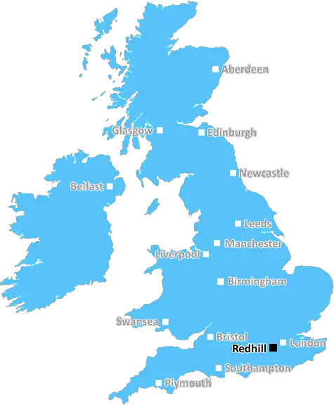
redhill RH3 Postcodes
Spending a fortune on conveyancing?

Compare instant, low-cost online quotes from trusted conveyancing solicitors.
Backed by experts, our no-obligation service searches through the best conveyancing quotes on the market to save you time and money.
Redhill (RH3)
The RH3 postcode area is located in the Redhill postcode town region, within the county of Surrey, and contains a total of 179 individual postcodes.
There are 10 electoral wards in the RH3 postcode area, including Betchworth, Billingshurst, Burgess Hill, Crawley, Dorking, East Grinstead, Forest Row, Gatwick, Godstone, Haywards Heath, Horley, Horsham, Lingfield, Oxted, Pulborough, Redhill, Reigate which come under the local authority of the Mole Valley Council.
Combining the whole postcode region, 39% of people in RH3 are classed as having an AB social grade, (i.e. 'white-collar' middle-upper class), compared to 27% across the UK.
This does not mean that the people of RH3 are wealthier - or higher class - than average, but it can be an indication that the area may be prospering and desirable to live in.
The RH3 postcode is an area of Surrey, England covering the towns of Dorking, Beare Green, Betchworth, Brockham, Leigh, Pixham and parts of North Holmwood. This densely populated area is largely residential, containing a variety of housing types from traditional family homes to modern apartment blocks.
In terms of education, RH3 includes a number of primary and secondary schools, including St. Martin's Primary School, St. Paul's Roman Catholic Primary School, and Holmwood House School. The area also has two Further Education (FE) Colleges, Dorking College and the National School of Theatre, based in Brockham.
Transport connections in RH3 are excellent, with a regular train service to London from stations at Dorking and Box Hill & Westhumble; and regular buses connecting to the towns in the area.
There are some great facilities available in the RH3 area, including an 18-hole golf course at Denbies, outdoor tennis courts in Brockham and Pixham, and cricket grounds at Box Hill & Westhumble. For those who prefer the great outdoors, there are beautiful countryside walks and cycling routes to be found in the Holmwood Common and Box Hill Nature Reserve.
The area is known for its thriving art and cultural scene, with numerous art galleries, theatres and independent cinemas such as the Dorking Halls. There's plenty of fantastic local restaurants, pubs and independent caf�s to discover too.
Despite its largely residential characteristics, RH3 is also home to small to medium sized businesses, some of which have been established in the area for many years. There is even the opportunity for start-ups to take advantage of the inexpensive commercial property within the postcode.
In terms of health services, RH3 is served by two GP practices, two dental surgeries, and a hospital based in Dorking. Shopping opportunities are plentiful, with three major supermarkets within the postcode and a retail park on Dorking's Westhumble Street. The area also boasts its own farmers' market and farmers' shops.
All in all, RH3 is a great place to live, offering plenty of options for working, playing and entertaining. With its vibrant culture and great transport links, it's no wonder that the RH3 postcode is so popular.

Demographics

Surrey

RH3 is located in the county of Surrey, in England.
Surrey has a total population of 1,176,500, making it the 13th largest county in the UK.
Surrey has a total area of 642 square miles, and a population density of 707 people per square kilometre. For comparison, Greater London has a density of 5,618 people/km2.
| Outward Code | RH3 |
| Postal Town | Redhill |
| MSOA Name | Mole Valley 008 |
| LSOA Name | Mole Valley 008D |
| County | Surrey |
| Region | Surrey |
| Country | England |
| Local Authority | Mole Valley |
| Area Classification | Urban with Significant Rural (rural including hub towns 26-49%) |
RH3 Electoral Wards
The postal region of RH3, includes the local towns, villages, electoral wards and stations of:
Dig even deeper into the RH3 postcode by clicking on a postcode below:
Click on an outward postal code below for more information about the area. Each 'outward' postcode give you a comprehensive list of all postcodes within the outward code area (RH) and estimated address.
Click on an 'outward' code for more information. For example, the outward postcode page 'EC2M' will give you an alphabetical list covering all postcodes located in the region, from 'EC2M 1BB' through to 'EC2M 7YA'.
Chris H
Wednesday, April 10, 2024
We don't have any views of RH3 right now. If you live in RH3 or have visited it, please help us to help others by telling others what you think of this neighbourhood.
Add your view of RH3
People need your local expertise. If you live in RH3 or have first-hand knowledge of the neighbourhood, please consider sharing your views. It's completely anonymous - all we ask is for your initials.
Please tell us what you like about the RH3 postcode area, what you don't like, and what it's like to live or work here.
| LOCAL AMENITIES | |
| FAMILY FRIENDLY | |
| PARKING | |
| GREEN SPACES |
Local News Surrey
Motorcyclist seriously injured in Milford crash with van
A 45-year-old man was arrested at the scene
Get SurreyInside the stunning 1.5m Dorking barn with garden that looks like tropical resort
The property is nestled within the countryside
Get SurreyPotential new lower speed limits coming to four Surrey areas
Molesey, Guildford, Camberley and Tandridge could all see new speed limits
Get SurreyFormer Surrey pub to become Sainsbury's but residents' claim it's 'unwanted'
Residents expressed concerns the new store would put pressure on street parking, increase traffic and air pollution, encourage anti-social behaviour
Get SurreyMansfield Town 1-4 Crawley Town
Crawley coast to a powerful statement 4-1 victory at promotion rivals Mansfield.
BBC NewsDangerous Surrey motorcyclist who hit speeds of '80mph in a 30mph zone' hid reg plate to avoid getting caught
The 24-year-old from Surrey wore a distinctive helmet and concealed his reg plates
Get SurreyPlans for 13 new industrial warehouses on outskirts of Leatherhead
Tired buildings will be torn down and new modern units built in their place
Get Surrey'Biggest housing opportunity' for Guildford as new flooding scheme to 'take pressure off green belt villages'
The Environment Agency is looking into an expanded flood prevention scheme that would save homes and businesses from rising waters
Get SurreyFrom the Postcode Area blog

Deciphering Crime Rates - a Deep Dive Into UK Postcode Analysis
Ever wondered about the crime rate in your UK postcode? You're not alone. We've dug deep into the data, uncovering trends and patterns that'll make your head spin.

Death of the High Street?
The BBC reports that despite councils' attempts to kurb them, the UK's high streets have seen a huge growth in fast food outlets. Could this mark the death knell for the Great British high street, and what can we do about it to halt its decline?

Discrimination by Postcode
You really couldn't make it up, could you? Some of the country's most vulnerable people are missing out on their weekly £25 Cold Weather Payment, just because the system that's in operation is discriminating against them because payments are based on postcode, rather than geographic location.

The Redesign is Underway
Well, the current website was absolutely in dire need of a good redesign - from the ground up. So I set out to pull it all apart and get it up and running again to become the most comprehensive guide to every postcode in the UK. And it's been a long, tough job from start to finish - and quite possibly the biggest project I've ever undertaken.
SOCIAL GRADES
According to census records, 39% of people here have a social grade of AB (highest), compared to the national average of 27%.