redhill RH20 Postcodes
Spending a fortune on conveyancing?

Compare instant, low-cost online quotes from trusted conveyancing solicitors.
Backed by experts, our no-obligation service searches through the best conveyancing quotes on the market to save you time and money.
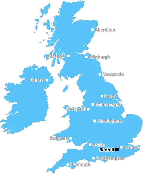
Redhill (RH20)
The RH20 postcode area is located in the Redhill postcode town region, within the county of West Sussex, and contains a total of 1187 individual postcodes.
There are 71 electoral wards in the RH20 postcode area, including Betchworth, Billingshurst, Burgess Hill, Crawley, Dorking, East Grinstead, Forest Row, Gatwick, Godstone, Haywards Heath, Horley, Horsham, Lingfield, Oxted, Pulborough, Redhill, Reigate which come under the local authority of the Horsham Council.
Combining the whole postcode region, 34% of people in RH20 are classed as having an AB social grade, (i.e. 'white-collar' middle-upper class), compared to 27% across the UK.
This does not mean that the people of RH20 are wealthier - or higher class - than average, but it can be an indication that the area may be prospering and desirable to live in.
The RH20 postcode is located in an area known as 'The Weald' in West Sussex, England. It is made up of two sub-divisions; the northern sub-division (RH20 1) is found in the parish of Slindon, with the southern sub-division (RH20 2) in a large area stretching from Cocking to Midhurst.
The RH20 postcode is a desirable place to live due to its attractive villages and excellent access to the South Downs National Park. This rural area offers a variety of activities such as leisurely country walks, horse riding, cycling, and many other outdoor pursuits.
The area is home to a range of schools, including Junior and Secondary levels, as well as local colleges, independent schools and nurseries.
The local economy is based mainly on small businesses, franchises and tourism. Slindon is a quaint village that has many small businesses including a wholefood cafe, a bakery, a farm shop, plant nursery and clothing boutiques. For visitors, Slindon also hosts a popular country fair and is home to an award-winning vineyard.
In terms of transport, the RH20 postcode is conveniently located near the A272, which provides easy access to many other towns and cities in Sussex and further afield. There are three railway stations nearby which provide services to the surrounding areas, with the nearest being at Lodsworth.
The RH20 area is also home to several sites of historic interest, with the most notable being Slindon Castle, originally dating back to the 11th Century, and Cocking Dean, an Anglo-Saxon burial chamber.
The area offers a wide variety of amenities including leisure centres, back gardens, farms and golf clubs. There are also retail parks, supermarkets, garden centres, pubs, restaurants and cinemas which provide entertainment for the whole family.
The RH20 postcode is an ideal area for people looking for a rural lifestyle while still retaining easy access to nearby cities and towns. It is popular with families who want to raise their children in a relaxed and scenic environment.

Demographics

West Sussex

RH20 is located in the county of West Sussex, in England.
West Sussex has a total population of 843,800, making it the 28th largest county in the UK.
West Sussex has a total area of 770 square miles, and a population density of 423 people per square kilometre. For comparison, Greater London has a density of 5,618 people/km2.
| Outward Code | RH20 |
| Postal Town | Redhill |
| MSOA Name | Horsham 013 |
| LSOA Name | Horsham 013D |
| County | West Sussex |
| Region | West Sussex |
| Country | England |
| Local Authority | Horsham |
| Area Classification | Largely Rural (rural including hub towns 50-79%) |
RH20 Electoral Wards
The postal region of RH20, includes the local towns, villages, electoral wards and stations of:
Dig even deeper into the RH20 postcode by clicking on a postcode below:
Click on an outward postal code below for more information about the area. Each 'outward' postcode give you a comprehensive list of all postcodes within the outward code area (RH) and estimated address.
Click on an 'outward' code for more information. For example, the outward postcode page 'EC2M' will give you an alphabetical list covering all postcodes located in the region, from 'EC2M 1BB' through to 'EC2M 7YA'.
Chris H
Wednesday, April 10, 2024
We don't have any views of RH20 right now. If you live in RH20 or have visited it, please help us to help others by telling others what you think of this neighbourhood.
Add your view of RH20
People need your local expertise. If you live in RH20 or have first-hand knowledge of the neighbourhood, please consider sharing your views. It's completely anonymous - all we ask is for your initials.
Please tell us what you like about the RH20 postcode area, what you don't like, and what it's like to live or work here.
| LOCAL AMENITIES | |
| FAMILY FRIENDLY | |
| PARKING | |
| GREEN SPACES |
Local News Sussex
New 1m football pitch to get community funding
Funds collected from developers will complete the financing for a new 3G pitch at Three Bridges FC.
BBC NewsWindmill Entertainment Centre to reopen after fire
A date is announced for the reopening of the Windmill Entertainment Centre.
BBC NewsNorthants hang on to deny Sussex an opening win
Northamptonshire, and bad light, deny Sussex an opening County Championship Division Two victory at Hove.
BBC NewsCharity making memories for sick children on stage
Forward Facing organises an event at Brighton Dome for children with life-limiting conditions.
BBC NewsChalk cliff collapses on to beach in East Sussex
The cliff fall between Saltdean and Telscombe comes after the authorities warned people to stay safe.
BBC NewsHardest Geezer eyes next challenge after Africa run
Russ Cook says it is "hard to contemplate the whole thing" after completing the mammoth challenge.
BBC NewsFormer Brighton player Kinnear dies aged 77
Former Wimbledon and Newcastle United manager Joe Kinnear dies at the age of 77, his family announces.
BBC NewsFlood warnings and travel delays as high tides hit
Exceptionally high tides combined with strong winds cause problems in parts of the UK.
BBC NewsFrom the Postcode Area blog

Deciphering Crime Rates - a Deep Dive Into UK Postcode Analysis
Ever wondered about the crime rate in your UK postcode? You're not alone. We've dug deep into the data, uncovering trends and patterns that'll make your head spin.

Death of the High Street?
The BBC reports that despite councils' attempts to kurb them, the UK's high streets have seen a huge growth in fast food outlets. Could this mark the death knell for the Great British high street, and what can we do about it to halt its decline?

Discrimination by Postcode
You really couldn't make it up, could you? Some of the country's most vulnerable people are missing out on their weekly £25 Cold Weather Payment, just because the system that's in operation is discriminating against them because payments are based on postcode, rather than geographic location.

The Redesign is Underway
Well, the current website was absolutely in dire need of a good redesign - from the ground up. So I set out to pull it all apart and get it up and running again to become the most comprehensive guide to every postcode in the UK. And it's been a long, tough job from start to finish - and quite possibly the biggest project I've ever undertaken.
SOCIAL GRADES
According to census records, 34% of people here have a social grade of AB (highest), compared to the national average of 27%.