redhill RH15 Postcodes
Spending a fortune on conveyancing?

Compare instant, low-cost online quotes from trusted conveyancing solicitors.
Backed by experts, our no-obligation service searches through the best conveyancing quotes on the market to save you time and money.
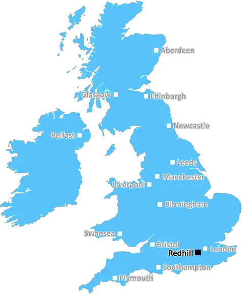
Redhill (RH15)
The RH15 postcode area is located in the Redhill postcode town region, within the county of West Sussex, and contains a total of 1138 individual postcodes.
There are 4 electoral wards in the RH15 postcode area, including Betchworth, Billingshurst, Burgess Hill, Crawley, Dorking, East Grinstead, Forest Row, Gatwick, Godstone, Haywards Heath, Horley, Horsham, Lingfield, Oxted, Pulborough, Redhill, Reigate which come under the local authority of the Mid Sussex Council.
Combining the whole postcode region, 30% of people in RH15 are classed as having an AB social grade, (i.e. 'white-collar' middle-upper class), compared to 27% across the UK.
This does not mean that the people of RH15 are wealthier - or higher class - than average, but it can be an indication that the area may be prospering and desirable to live in.
RH15 is a postcode district located in East Sussex, England. It covers parts of Burgess Hill, Haywards Heath and Imberhorne, rural areas outside Horsham and Five Ash Down.
Situated 24 miles south of London, RH15 is split between the East and West Sussex regions and is in the local government area of Mid Sussex. The area includes local towns such as Chailey, Hurstpierpoint, Ansty and Cuckfield, plus the villages of Keymer, Twineham, Slaugham and Wivelsfield Green.
The postcode district includes parts of the A272 road and includes areas alongside the main railway line between London and Brighton. The area provides excellent transport connections to both London and Brighton; Burgess Hill railway station is served by Southern and Thameslink trains, whilst there are also regular bus services to both towns.
RH15 covers an area of almost 40 square miles, of which 20% is classed as open spaces or green belt, for example, the South Downs National Park and surrounding countryside. The residential area is home to 22,000 people, of which the majority are families living in semi-detached or terraced houses, often with their own gardens. The area also consists of a large number of retirement homes, as well as new housing estates which are a popular alternative to living closer to the bigger towns.
Nearby schools range from nursery facilities up to secondary education, whilst the area is also home to a number of independent and Catholic schools, along with the local further education college at Haywards Heath. The RH15 area includes several large supermarkets, smaller convenience stores, and local services such as banks, post offices and petrol stations.
There are a number of attractions in RH15, including the unique Bluebell Railway and Standen House and Garden. The area is also close to Wakehurst Place, a large estate featuring Tudor and Jacobean styled gardens and is a famous National Trust property. Other local attractions include rural walks, horse riding and mountain biking, fishing and golf courses.

Demographics

West Sussex

RH15 is located in the county of West Sussex, in England.
West Sussex has a total population of 843,800, making it the 28th largest county in the UK.
West Sussex has a total area of 770 square miles, and a population density of 423 people per square kilometre. For comparison, Greater London has a density of 5,618 people/km2.
| Outward Code | RH15 |
| Postal Town | Redhill |
| MSOA Name | Mid Sussex 014 |
| LSOA Name | Mid Sussex 014C |
| County | West Sussex |
| Region | West Sussex |
| Country | England |
| Local Authority | Mid Sussex |
| Area Classification | Urban with City and Town |
RH15 Electoral Wards
The postal region of RH15, includes the local towns, villages, electoral wards and stations of:
Dig even deeper into the RH15 postcode by clicking on a postcode below:
Click on an outward postal code below for more information about the area. Each 'outward' postcode give you a comprehensive list of all postcodes within the outward code area (RH) and estimated address.
Click on an 'outward' code for more information. For example, the outward postcode page 'EC2M' will give you an alphabetical list covering all postcodes located in the region, from 'EC2M 1BB' through to 'EC2M 7YA'.
Chris H
Saturday, April 13, 2024
We don't have any views of RH15 right now. If you live in RH15 or have visited it, please help us to help others by telling others what you think of this neighbourhood.
Add your view of RH15
People need your local expertise. If you live in RH15 or have first-hand knowledge of the neighbourhood, please consider sharing your views. It's completely anonymous - all we ask is for your initials.
Please tell us what you like about the RH15 postcode area, what you don't like, and what it's like to live or work here.
| LOCAL AMENITIES | |
| FAMILY FRIENDLY | |
| PARKING | |
| GREEN SPACES |
Local News Sussex
Sussex PC cleared of three sex attack charges
PC Daniel Julian was cleared of three charges after a five-day trial at Lewes Crown Court.
BBC NewsTwo men jailed after cannabis farm discovery
Police discovered more than 1,000 cannabis plants at an industrial unit on 12 January.
BBC NewsPatel & Trevaskis help Foxes start well against Sussex
Rishi Patel, Liam Trevaskis and Peter Handscomb hit half-centuries as Leicestershire make 326-8 on day one against Sussex.
BBC NewsTributes paid to motorcyclist following collision
Heidi Visser, 29, died following a four-vehicle collision near Eastbourne.
BBC NewsBusy stretch of A27 is closed for entire weekend
It is the first of four weekend closures in Lancing to continue with work on a new roundabout.
BBC NewsResidents prepare to cast votes in local elections
Over 50 seats are up for re-election in four local councils across East and West Sussex in May.
BBC NewsTeenager died because of care failures, jury says
An inquest has heard how several chances to prevent Jason Pulman taking his own life were missed.
BBC NewsNorthants hang on to deny Sussex an opening win
Northamptonshire, and bad light, deny Sussex an opening County Championship Division Two victory at Hove.
BBC NewsFrom the Postcode Area blog

Deciphering Crime Rates - a Deep Dive Into UK Postcode Analysis
Ever wondered about the crime rate in your UK postcode? You're not alone. We've dug deep into the data, uncovering trends and patterns that'll make your head spin.

Death of the High Street?
The BBC reports that despite councils' attempts to kurb them, the UK's high streets have seen a huge growth in fast food outlets. Could this mark the death knell for the Great British high street, and what can we do about it to halt its decline?

Discrimination by Postcode
You really couldn't make it up, could you? Some of the country's most vulnerable people are missing out on their weekly £25 Cold Weather Payment, just because the system that's in operation is discriminating against them because payments are based on postcode, rather than geographic location.

The Redesign is Underway
Well, the current website was absolutely in dire need of a good redesign - from the ground up. So I set out to pull it all apart and get it up and running again to become the most comprehensive guide to every postcode in the UK. And it's been a long, tough job from start to finish - and quite possibly the biggest project I've ever undertaken.
SOCIAL GRADES
According to census records, 30% of people here have a social grade of AB (highest), compared to the national average of 27%.