redhill RH1 Postcodes
Spending a fortune on conveyancing?

Compare instant, low-cost online quotes from trusted conveyancing solicitors.
Backed by experts, our no-obligation service searches through the best conveyancing quotes on the market to save you time and money.
Redhill (RH1)
The RH1 postcode area is located in the Redhill postcode town region, within the county of Surrey, and contains a total of 1890 individual postcodes.
There are 22 electoral wards in the RH1 postcode area, including Betchworth, Billingshurst, Burgess Hill, Crawley, Dorking, East Grinstead, Forest Row, Gatwick, Godstone, Haywards Heath, Horley, Horsham, Lingfield, Oxted, Pulborough, Redhill, Reigate which come under the local authority of the Reigate and Banstead Council.
Combining the whole postcode region, 35% of people in RH1 are classed as having an AB social grade, (i.e. 'white-collar' middle-upper class), compared to 27% across the UK.
This does not mean that the people of RH1 are wealthier - or higher class - than average, but it can be an indication that the area may be prospering and desirable to live in.
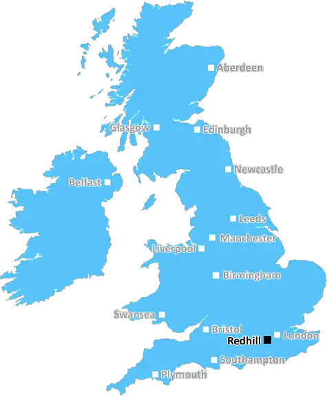
RH1 postcode in the Redhill district is located approximately 16 miles south of London and half way between Gatwick Airport and the City of Brighton. It covers the areas of Redhill, Earlswood, Nutfield, Godstone, South Nutfield, Brownhill and some smaller areas.
Redhill itself is a market town with a long established history, boasting a range of shops, restaurants, bars and leisure activities. Redhill is home to the renowned Belfry Shopping Centre, as well as its traditional high street. There are also several popular parks and green spaces dotted around, all of which make it an ideal destination for a day out in Surrey.
Earlswood, Nutfield, Godstone and South Nutfield are all small villages nestled in the countryside, offering a peaceful backdrop and a slower pace of life. These villages host regular events, including fetes and exhibitions, to provide a cultural injection for the local community. Small businesses flourish in some of these villages, providing a unique shopping experience for visitors.
Brownhill is a residential area made up of semi-detached and terraced houses, most of which were built in the 1960s. The area is well connected with the London transport network and easy access to the M25.
The RH1 postcode is home to a variety of attractions, from the neighbouring towns and villages to open countryside and wildlife along the River Mole and Earlswood Lakes. There are also a number of archaeological monuments and historic sites dotted around, providing glimpses into the area's past.
The RH1 postcode offers a variety of amenities for locals and visitors alike. There are several schools, both primary and secondary, located within the area, as well as a range of restaurants, pubs and other services. Redhill train station provides direct links to London, as well as Brighton, Gatwick Airport and a number of other nearby towns. The area is also served by several bus routes and has excellent access to a number of major motorways.

Demographics

Surrey

RH1 is located in the county of Surrey, in England.
Surrey has a total population of 1,176,500, making it the 13th largest county in the UK.
Surrey has a total area of 642 square miles, and a population density of 707 people per square kilometre. For comparison, Greater London has a density of 5,618 people/km2.
| Outward Code | RH1 |
| Postal Town | Redhill |
| MSOA Name | Reigate and Banstead 011 |
| LSOA Name | Reigate and Banstead 011C |
| County | Surrey |
| Region | Surrey |
| Country | England |
| Local Authority | Reigate and Banstead |
| Area Classification | Urban with City and Town |
RH1 Electoral Wards
The postal region of RH1, includes the local towns, villages, electoral wards and stations of:
Dig even deeper into the RH1 postcode by clicking on a postcode below:
Click on an outward postal code below for more information about the area. Each 'outward' postcode give you a comprehensive list of all postcodes within the outward code area (RH) and estimated address.
Click on an 'outward' code for more information. For example, the outward postcode page 'EC2M' will give you an alphabetical list covering all postcodes located in the region, from 'EC2M 1BB' through to 'EC2M 7YA'.
AF, redhill
Saturday, February 23, 2019
I like this area because it is very tranquil and safe, lovely woods, parks and lakes for families and animal lovers. The area has schools and a train station, it is very clean and people are very friendly and helpful. It has many shops and businesses that can satisfy personal daily necessities and offers many restaurants and pubs for enjoyment of young and old and I found the love of a lifetime.
Add your view of RH1
People need your local expertise. If you live in RH1 or have first-hand knowledge of the neighbourhood, please consider sharing your views. It's completely anonymous - all we ask is for your initials.
Please tell us what you like about the RH1 postcode area, what you don't like, and what it's like to live or work here.
| LOCAL AMENITIES | |
| FAMILY FRIENDLY | |
| PARKING | |
| GREEN SPACES |
Local News Surrey
County council's former headquarters up for sale
The site has planning permission for homes in the former county hall building and new blocks.
BBC NewsCroydon hospital goes into partial lockdown after woman swallows poison
A woman was reported to have ingested a hazardous substance
Get SurreyBarber apologies for charging 2 extra for kids with special needs
The barber near Surrey labelled the pricing strategy as a 'misunderstanding'
Get SurreyWarning to NHS after Surrey man's death could have been prevented if hospital bed free
A man tragically took his own life after a mental health relapse, prompting a coroner to warn of a shortage of psychiatric beds in hospitals
Get SurreySurrey weather latest as 'mini heatwave' forecast this weekend with temperature of 19C
Guildford, Dorking and Staines to see temperatures in the high teens
Get SurreyLeisure centre awarded 86k from swimming pool fund
Guildford Borough Council says the funds will be used to improve the pool's energy efficiency.
BBC NewsM25 traffic blocked after driver crashed into barrier and tumbled down embankment - as it happened
An M25 driver was rushed to hospital after their car crashed into a barrier
Get Surrey'Possible human remains' discovered in park on Surrey border
Police said the possible remains will be sent away for a full analysis
Get SurreyFrom the Postcode Area blog

Deciphering Crime Rates - a Deep Dive Into UK Postcode Analysis
Ever wondered about the crime rate in your UK postcode? You're not alone. We've dug deep into the data, uncovering trends and patterns that'll make your head spin.

Death of the High Street?
The BBC reports that despite councils' attempts to kurb them, the UK's high streets have seen a huge growth in fast food outlets. Could this mark the death knell for the Great British high street, and what can we do about it to halt its decline?

Discrimination by Postcode
You really couldn't make it up, could you? Some of the country's most vulnerable people are missing out on their weekly £25 Cold Weather Payment, just because the system that's in operation is discriminating against them because payments are based on postcode, rather than geographic location.

The Redesign is Underway
Well, the current website was absolutely in dire need of a good redesign - from the ground up. So I set out to pull it all apart and get it up and running again to become the most comprehensive guide to every postcode in the UK. And it's been a long, tough job from start to finish - and quite possibly the biggest project I've ever undertaken.
SOCIAL GRADES
According to census records, 35% of people here have a social grade of AB (highest), compared to the national average of 27%.