portsmouth PO10 Postcodes
Spending a fortune on conveyancing?

Compare instant, low-cost online quotes from trusted conveyancing solicitors.
Backed by experts, our no-obligation service searches through the best conveyancing quotes on the market to save you time and money.
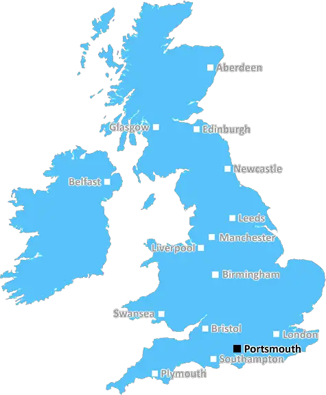
Portsmouth (PO10)
The PO10 postcode area is located in the Portsmouth postcode town region, within the county of Hampshire, and contains a total of 714 individual postcodes.
There are 19 electoral wards in the PO10 postcode area, including Bembridge, Bognor Regis, Chichester, Cowes, East Cowes, Emsworth, Fareham, Freshwater, Gosport, Havant, Hayling Island, Lee-On-The-Solent, Newport, Portsmouth, Rowland's Castle, Ryde, Sandown, Seaview, Shanklin, Southsea, Totland Bay, Ventnor, Waterlooville, Yarmouth which come under the local authority of the Havant Council.
Combining the whole postcode region, 34% of people in PO10 are classed as having an AB social grade, (i.e. 'white-collar' middle-upper class), compared to 27% across the UK.
This does not mean that the people of PO10 are wealthier - or higher class - than average, but it can be an indication that the area may be prospering and desirable to live in.
The PO10 postcode is in the north of the county of West Sussex, in the south-east of England. It covers the area around the town of Emsworth, located south of the city of Chichester.
The area is mostly rural in nature, with a scattering of small deciduous woodland, and a mix of sand, chalk and clay resulting in a predominance of heathland, grassland and arable land. However, the coastline along the area is popular with sailors, with a number of sailing clubs in the area. The Emsworth Marina is a well known spot, and offers moorings, boat hire, and other boating facilities.
The PO10 postcode is split into three parts, with the local council area of Havant stretching along the coastline. The council area of Chichester is located to the north of PO10, with many villages located throughout the area. The local secondary school is Warblington School, which is fed by several primary schools.
In terms of culture, Emsworth is home to many interesting traditional pubs, as well as a number of independent cafes, restaurants, and retail outlets. The area is also home to the House in the Clouds, a wooden-framed house that was built on the top of a water tower during the Second World War in an attempt to confuse German bombers.
In terms of transport links, the area is well served by a number of local buses, and has a railway station with direct connections to Portsmouth and other neighbouring locations. The A27 runs through the centre of the postcode, connecting Emsworth to other locations in the South East.
For leisure, the Harbour Park in Emsworth is a popular spot, and offers a range of activities, such as a Putting Green, Archery range, Adventure Play area and Crazy Golf. There are also a number of cycling paths in the surrounding countryside, and many walking routes, including along the coastline and through the South Downs National Park.

Demographics

Hampshire

PO10 is located in the county of Hampshire, in England.
Hampshire has a total population of 1,829,500, making it the 5th largest county in the UK.
Hampshire has a total area of 1455 square miles, and a population density of 485 people per square kilometre. For comparison, Greater London has a density of 5,618 people/km2.
| Outward Code | PO10 |
| Postal Town | Portsmouth |
| MSOA Name | Havant 013 |
| LSOA Name | Havant 013F |
| County | Hampshire |
| Region | Hampshire |
| Country | England |
| Local Authority | Havant |
| Area Classification | Urban with City and Town |
PO10 Electoral Wards
The postal region of PO10, includes the local towns, villages, electoral wards and stations of:
Dig even deeper into the PO10 postcode by clicking on a postcode below:
Click on an outward postal code below for more information about the area. Each 'outward' postcode give you a comprehensive list of all postcodes within the outward code area (PO) and estimated address.
Click on an 'outward' code for more information. For example, the outward postcode page 'EC2M' will give you an alphabetical list covering all postcodes located in the region, from 'EC2M 1BB' through to 'EC2M 7YA'.
Chris H
Sunday, April 7, 2024
We don't have any views of PO10 right now. If you live in PO10 or have visited it, please help us to help others by telling others what you think of this neighbourhood.
Add your view of PO10
People need your local expertise. If you live in PO10 or have first-hand knowledge of the neighbourhood, please consider sharing your views. It's completely anonymous - all we ask is for your initials.
Please tell us what you like about the PO10 postcode area, what you don't like, and what it's like to live or work here.
| LOCAL AMENITIES | |
| FAMILY FRIENDLY | |
| PARKING | |
| GREEN SPACES |
Local News Hampshire
Scoop on Netflix - full cast list, how to watch and plot
This is all you need to know about Scoop on Netflix starring Gillian Anderson and Billie Piper including full cast list, what it's about and how to watch on TV.
Hampshire ChronicleServicemen silhouettes en route to Normandy
The figures will depart from the Standing with Giants workshop in Oxfordshire in four lorries.
BBC NewsMP champions greener holidays after re-visit to Two Hoots'
Owners Shaun and Michele have created a wildlife-enriched sanctuary, which Shaun told Steve Brine he believes is integral for couples and families to achieve a more healthy work-life balance.
Hampshire ChronicleChance Perdomo: Peter Symonds pays tribute to former student
He attended Peter Symondsfrom 2012 until 2014 and was elected Student Union President during his time at the college, which posted on its Facebook page to pay tribute to Chance.
Hampshire ChronicleLetter: 'Councillors need to adjust their misguided understanding'
So we now have a date forecast for the closure of Andover Road of early 2026 in favour of all the main road traffic entering Winchester from the north passing through the Kings Barton housing estate.
Hampshire ChronicleThe Cycle Company coming to Romsey after plans submitted
AN electric bicycle shop is coming to the centre of Romsey.
Hampshire ChronicleCommunity news: Alresford, Cheriton and Avington areas
AVINGTON Park Golf Club is holding its annual charity quiz in aid of Cancer Research at the Winchester Club at 7pm on Friday April 19. Teams of four most welcome to attend.NEW Alresford Town Counci&hellip
Hampshire ChronicleDrone video shows bus on road metres from collapse
Isle of Wight MP Bob Seely said he is looking into getting government money to fix Military Road.
BBC NewsFrom the Postcode Area blog

Deciphering Crime Rates - a Deep Dive Into UK Postcode Analysis
Ever wondered about the crime rate in your UK postcode? You're not alone. We've dug deep into the data, uncovering trends and patterns that'll make your head spin.

Death of the High Street?
The BBC reports that despite councils' attempts to kurb them, the UK's high streets have seen a huge growth in fast food outlets. Could this mark the death knell for the Great British high street, and what can we do about it to halt its decline?

Discrimination by Postcode
You really couldn't make it up, could you? Some of the country's most vulnerable people are missing out on their weekly £25 Cold Weather Payment, just because the system that's in operation is discriminating against them because payments are based on postcode, rather than geographic location.

The Redesign is Underway
Well, the current website was absolutely in dire need of a good redesign - from the ground up. So I set out to pull it all apart and get it up and running again to become the most comprehensive guide to every postcode in the UK. And it's been a long, tough job from start to finish - and quite possibly the biggest project I've ever undertaken.
SOCIAL GRADES
According to census records, 34% of people here have a social grade of AB (highest), compared to the national average of 27%.